
Country United States County Kent Time zone Eastern (EST) (UTC-5) Zip code 02893 Population 29,191 (2010) | Elevation 151 ft (46 m) FIPS code 44-78440 Local time Saturday 12:48 AM Area code 401 | |
 | ||
Weather 2°C, Wind E at 23 km/h, 93% Humidity | ||
Nexus property management 9 pine hollow road west warwick rhode island 02839
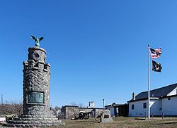
West Warwick is a town in Kent County, Rhode Island, United States. The population was 29,191 at the 2010 census.
Contents
- Nexus property management 9 pine hollow road west warwick rhode island 02839
- Map of West Warwick RI 02893 USA
- History
- Geography
- Demographics
- Tourism
- Government
- Notable people
- References
Map of West Warwick, RI 02893, USA
West Warwick was incorporated in 1913, making it the youngest town in the state. Prior to 1913, the town, situated on the western bank of the Pawtuxet River, was the population and industrial center of the larger town of Warwick. The town split because local Democratic politicians wanted to consolidate their power and isolate their section of town from the Republican-dominated farmland in the east.
History
The area that is now the town of West Warwick was the site of some of the earliest textile mills in the United States situated along the banks of the north and south branches of the Pawtuxet River. These small mill villages would play an important role in the early development of the textile industry in North America. Lippitt Mill founded in 1809 by Revolutionary War hero, Christopher Lippitt, was one of the first mills in the area.
On February 20, 2003, The Station nightclub fire was caused by pyrotechnics used indoors during a Great White concert. The fire killed 100 patrons. The fire occurred in a single-story wooden building that was more than 70 years old. It had previously served as an Italian restaurant, and during World War II was a popular hangout for sailors from nearby Quonset Point Naval Air Station.
In 2010, a massive rainfall caused the Pawtuxet River to rise to 21 feet, which is 12 feet above flood stage which caused flooding through much of the town.
Geography
According to the United States Census Bureau, the CDP has a total area of 8.1 square miles (21.0 km²), of which, 7.9 square miles (20.5 km²) of it is land and 0.2 square miles (0.5 km²) of it (2.22%) is water. Geographical location: 41.698 North, 71.518 West.
The following villages are located in West Warwick:
Demographics
As of the census of 2000, there were 29,581 people, 12,498 households, and 7,698 families residing in the town. The population density was 3,728.7 people per square mile (1,440.3/km²). There were 13,186 housing units at an average density of 1,662.1 per square mile (642.0/km²). The racial makeup of the town was 93.78% White, 1.11% African American, 0.35% Native American, 1.42% Asian, 0.02% Pacific Islander, 1.44% from other races, and 1.88% from two or more races. Hispanic or Latino of any race were 3.10% of the population.
There were 12,498 households out of which 28.0% had children under the age of 18 living with them, 44.4% were married couples living together, 13.1% had a female householder with no husband present, and 38.4% were non-families. 31.2% of all households were made up of individuals and 10.7% had someone living alone who was 65 years of age or older. The average household size was 2.35 and the average family size was 2.97.
In the town, the population was spread out with 22.4% under the age of 18, 9.5% from 18 to 24, 32.0% from 25 to 44, 22.0% from 45 to 64, and 14.1% who were 65 years of age or older. The median age was 36 years. For every 10 females there were 9.97 males. For every 10 females age 18 and over, there were 9.93 males.
The median income for a household in the town was $39,505, and the median income for a family was $47,674. Males had a median income of $35,128 versus $26,720 for females. The per capita income for the town was $20,250. About 9.2% of families and 11.2% of the population were below the poverty line, including 17.9% of those under age 18 and 11.0% of those age 65 or over.
Tourism
The 1810 Lippitt Mill is on the National Register of Historic Places, and is one of the earliest textile mills in Rhode Island. It was founded in 1809 and the current dam was constructed in 1889. The Mill is one of the earliest textile mills in Rhode Island and is one of the oldest American textile mills still used for manufacturing. Another mill in the area, The Original Bradford Soap Works, dates back to the 1800s and is still in use today. West Warwick was recently named the "Mattress Capital of Rhode Island."
Government
West Warwick has a council-manager form of government. There are five town councilors, one for each of the town's wards. Each is elected to a two-year term.