
Website www.rensco.com Founded 1791 | Area 1,722 km² Population 159,918 (2013) | |
 | ||
Points of interest Burden Iron Works, Children's Museum of Science a, Oakwood Cemetery, Fort Crailo, Bennington Battlefield State Hist Colleges and Universities Rensselaer Polytechnic Institute, Hudson Valley Communi, Russell Sage College, Sage Graduate Schools, Samaritan Hospital School of | ||
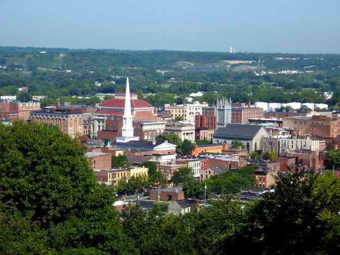
Rensselaer County /rɛnsəˈlɪər/ is a county in the state of New York, in the United States of America. As of the 2010 census, the population was 159,429. Its county seat is Troy. The county is named in honor of the family of Kiliaen van Rensselaer, the original Dutch owner of the land in the area.
Contents
- Map of Rensselaer County NY USA
- History
- Geography
- Adjacent counties
- Demographics
- Government and politics
- Education
- Cities
- Villages
- Census designated places
- References
Map of Rensselaer County, NY, USA
Rensselaer County is part of the Albany-Schenectady-Troy, NY Metropolitan Statistical Area.
History
The area that is now Rensselaer County was inhabited by the Algonquian-speaking Mohican Indian tribe at the time of European encounter. Kiliaen van Rensselaer, a Dutch jeweler and merchant, purchased the area in 1630 and incorporated it in his patroonship Rensselaerswyck. (It was part of the Dutch colony New Netherland).
The land passed into English rule in 1664; the Dutch regained control in 1673, but the English took it back in 1674. Until 1776, the year of American independence, the county was under English or British control. The county was not organized as a legal entity until after the Revolution in 1791, when it was created from an area that was originally part of the very large Albany County.
In 1807, in a county re-organization, the rural sections of Troy were set off as Towns, and the city was incorporated. The two towns created were Brunswick (named for Duke Friedrich Wilhelm of Braunschweig-Lüneburg) and Grafton (named for Henry FitzRoy, 5th Duke of Grafton). A third town, Philipstown, was set off in 1806. In 1808 it was renamed Nassau after the duke of that area.
Geography
According to the U.S. Census Bureau, the county has a total area of 665 square miles (1,720 km2), of which 652 square miles (1,690 km2) is land and 13 square miles (34 km2) (1.9%) is water.
Rensselaer County is in the eastern part of New York State. The eastern boundary of Rensselaer County runs along the New York–Vermont and New York–Massachusetts borders.
The terrain runs from level and flat near the Hudson and then rises into the Rensselaer Plateau around Poestenkill and Sand Lake, then to the Taconic Mountains along the Massachusetts state line.
The highest point is Berlin Mountain, 2,818 feet (859 m) above sea level, in the town of Berlin. The lowest point is sea level at the Hudson.
The Hoosic River, a tributary of the Hudson River, is in the north part of the county.
Depending on precise location within the county, road travel distance to New York City ranges between 132 miles (212 km) and 178 miles (286 km).
Adjacent counties
Demographics
As of the census of 2010, there were 161,129 people, 62,694 households, and 39,989 families residing in the county. The population density was 233 people per square mile (90/km²). There were 69,120 housing units at an average density of 109 per square mile (39/km²). The racial makeup of the county was 88.73% White, 7.14% Black or African American, 0.23% Native American, 1.71% Asian, 0.02% Pacific Islander, 0.89% from other races, and 1.34% from two or more races. 5.01% of the population were Hispanic or Latino of any race. 22.3% were of Irish, 14.7% Italian, 12.8% German, 7.5% English, 6.2% French, 5.3% American and 2.3% Puerto Rican ancestry according to Census 2010. 95.4% spoke English and 2.7% Spanish as their first language.
There were 61,094 households out of which 33.30% had children under the age of 18 living with them, 46.80% were married couples living together, 12.00% had a female householder with no husband present, and 34.80% were non-families. 27.90% of all households were made up of individuals and 10.30% had someone living alone who was 65 years of age or older. The average household size was 2.46 and the average family size was 3.02.
In the county, the population was spread out with 24.20% under the age of 18, 10.10% from 18 to 24, 29.10% from 25 to 44, 23.00% from 45 to 64, and 13.60% who were 65 years of age or older. The median age was 37 years. For every 100 females there were 95.90 males. For every 100 females age 18 and over, there were 93.70 males.
The median income for a household in the county was $42,905, and the median income for a family was $52,864. Males had a median income of $36,666 versus $28,153 for females. The per capita income for the county was $21,095. About 6.70% of families and 9.50% of the population were below the poverty line, including 11.90% of those under age 18 and 6.60% of those age 65 or over.
Government and politics
Beginning in 1791, Rensselaer County was governed by a Board of Supervisors, which acted as the Legislature, with the chairman of the board serving as a de facto Executive.
In 1970, the Rensselaer County Legislature was created, which elected Edward J. "Ned" Quinn as Chairman. The Chairman served as the equivalent to an executive until the office of County Executive was created in 1972. Since its creation, Democrats have never won the office, although they controlled the Legislature until 1994. One notable candidate for Executive was Edward Pattison who was later elected to Congress, and whose son Mark served two terms as Mayor of Troy. The current county executive is Kathleen M. Jimino. Legislative authority is vested in the County Legislature, which consists of 20 members representing 17 different communities, separated into six districts. The current composition of the Legislature is as follows (11 Republicans, 5 Democrats and 4 Conservatives that caucus with the Republicans):
District 1 – Troy:
District 2 – North Greenbush, East Greenbush, and Poestenkill:
District 3 – Brunswick, Schaghticoke, and Pittstown:
District 4 – Schodack, Sand Lake, and Nassau:
District 5 – Hoosick Falls, Hoosick, Grafton, Berlin, Stephentown, & Petersburgh:
District 6 – Rensselaer:
Education
The county is serviced by 16 school districts. Some are completely contained in the county while some cross county lines into other counties. No school districts cross either the Vermont or Massachusetts state borders. Below is a table that shows the districts within the county, which BOCES they belong to, and which other counties they may serve.