
Founded March 12, 1772 Area 2,191 km² | Population 63,093 (2013) Unemployment rate 5.1% (Apr 2015) | |
 | ||
Website www.washingtoncountyny.gov Destinations Points of interest Adirondack Mountains, Batten Kill, Champlain Canal, Salem Tavern, Shelving Rock Falls | ||
Pole valley player s club golf course in washington county new york
Washington County is a county in the U.S. state of New York. As of the 2010 census, the population was 63,216. The county seat is Fort Edward. The county was named for President George Washington.
Contents
- Pole valley player s club golf course in washington county new york
- Map of Washington County NY USA
- History
- Historic sites
- Geography
- Adjacent counties
- Demographics
- Airports
- Hamlets
- Notable people
- References
Map of Washington County, NY, USA
Washington County is part of the Glens Falls, NY Metropolitan Statistical Area, which is also included in the Albany-Schenectady, NY Combined Statistical Area.
History
When counties were established in New York State in 1683, the present Washington County was part of Albany County. This was an enormous county, including the northern part of New York State as well as all of the present state of Vermont and, in theory, extending westward to the Pacific Ocean. This county was reduced in size on July 3, 1766 by the creation of Cumberland County, and further on March 16, 1770 by the creation of Gloucester County, both containing territory now in Vermont.
On March 12, 1772, what was left of Albany County was split into three parts, one remaining under the name Albany County. The other two were called Tryon County (later renamed Montgomery County) and Charlotte County.
In 1784, Charlotte County was renamed Washington County in honor of George Washington, the American Revolutionary War general and later President of the United States of America.
In 1788, Clinton County was split off from Washington County. This was a much larger area than the present Clinton County, including several other counties or county parts of the present New York State.
In 1791, the Town of Cambridge was transferred from Albany County to Washington County.
In 1813, Warren County was split off from Washington County.
In 1994, with the completion of the new municipal center, the county seat was moved from Hudson Falls to Fort Edward.
In 2006, Cambridge Town Supervisor Jo Ann Trinkle made history by becoming the first Chairwoman of the Board of Supervisors.
Historic sites
Washington County has four historic covered bridges, each listed on the National Register of Historic Places:
Including those, it has a total of 35 sites listed on the National Register. The Lemuel Haynes House is further designated to be a National Historic Landmark.
Geography
According to the U.S. Census Bureau, the county has a total area of 846 square miles (2,190 km2), of which 831 square miles (2,150 km2) is land and 15 square miles (39 km2) (1.7%) is water.
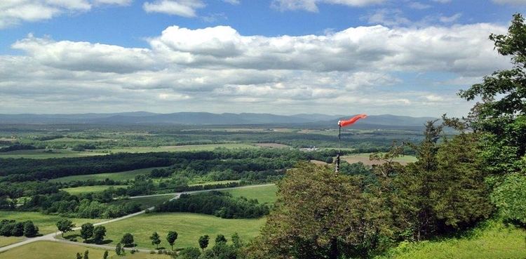
Washington County is a long narrow county located in the northeastern section of the State. It is known for its rich valley farm land and is part of the Great Appalachian Valley (also known simply as the 'Great Valley') which is a long narrow valley strip often between tall mountain ranges. The county transitions from the Taconic Mountains to the Adirondack Mountains, and from the Lake Champlain Valley to Hudson River Valley.
Much of the county is part of the slate valley of the Upper Taconic Mountains (Taghkanic, meaning 'in the trees'). The eastern boundary of Washington County is the New York–Vermont border, part of which is Lake Champlain. This is also the border with New England proper. The northern end of the county is part of the Adirondack Mountains. Western boundaries include primarily the Hudson River and Lake George.
Washington County belongs to the following valleys and watersheds: Champlain Valley / Lake George Watershed—02010001 Hudson River Valley / Hudson-Hoosic Watershed—02020003 Waters in the northern part drain into Lake Champlain via Lake George (Horican) or the Mettawee River, and then flow into the Saint Lawrence River (Kaniatarowanenneh). These waters mingle in the Saint Lawrence with waters of all the Great Lakes as they flow northeast into the Gulf of Saint Lawrence, and ultimately join the Atlantic Ocean. Meanwhile, the remainder of waters drain south via the Hudson River (Muh-he-kun-ne-tuk or Muhheakantuck), and ultimately flow south into the Atlantic Ocean below New York City. See the approximation of the watershed divide mapped in context of mountains [1] and valleys [2].
Nearly half of its borders are by long bodies of water. Winding across the bottom of the county is the legendary Batten Kill (Dionondehowa), famous for its worldclass flyfishing, and its marvelous falls (near the Washington County fairgrounds).
Black Mountain, part of the Adirondacks, is the tallest peak in Washington County, and has beautiful views of Lake George, Lake Champlain, the surrounding countryside, and the Adirondacks, Taconic Mountains and Green Mountains. Willard Mountain is a ski slope in southern part of the county.
Adjacent counties
Demographics
As of the census of 2000, there were 61,042 people, 22,458 households, and 15,787 families residing in the county. The population density was 73 people per square mile (28/km²). There were 26,794 housing units at an average density of 32 per square mile (12/km²). The racial makeup of the county was 94.97% White, 2.92% Black or African American, 0.20% Native American, 0.28% Asian, 0.01% Pacific Islander, 0.84% from other races, and 0.77% from two or more races. 2.02% of the population were Hispanic or Latino of any race. 17.5% were of Irish, 14.1% French, 12.1% English, 11.1% American, 9.0% Italian and 7.7% German ancestry according to Census 2000. 96.9% spoke English and 1.4% Spanish as their first language.
There were 22,458 households out of which 33.20% had children under the age of 18 living with them, 55.20% were married couples living together, 10.40% had a female householder with no husband present, and 29.70% were non-families. 24.00% of all households were made up of individuals and 10.80% had someone living alone who was 65 years of age or older. The average household size was 2.55 and the average family size was 3.01.
In the county, the population was spread out with 24.60% under the age of 18, 8.30% from 18 to 24, 29.40% from 25 to 44, 23.70% from 45 to 64, and 14.00% who were 65 years of age or older. The median age was 38 years. For every 100 females there were 105.20 males. For every 100 females age 18 and over, there were 104.50 males.
The median income for a household in the county was $37,668, and the median income for a family was $43,500. Males had a median income of $31,537 versus $22,160 for females. The per capita income for the county was $17,958. About 6.80% of families and 9.40% of the population were below the poverty line, including 12.30% of those under age 18 and 7.30% of those age 65 or over.
Airports
The following public use airports are located in the county: