
Country United States County Rensselaer FIPS code 36-58398 Elevation 207 m Local time Monday 8:33 PM | State New York Time zone Eastern (EST) (UTC-5) GNIS feature ID 0979373 Population 5,735 (2010) | |
 | ||
Weather 4°C, Wind SW at 3 km/h, 53% Humidity Area 167.8 km² (159.8 km² Land / 8.029 km² Water) | ||
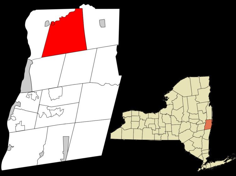
Pittstown is a town in Rensselaer County, New York, United States. The population was 5,735 at the 2010 census. It is in the northern part of the county.
Contents
- Map of Pittstown NY 12094 USA
- History
- Geography
- Demographics
- Communities and locations in Pittstown
- References
Map of Pittstown, NY 12094, USA
A small part of the north town line is Rensselaer County's border with Washington County, New York. Moving west, the Hoosic River defines the town's northwestern line to the crux of its border with the town of Schaghticoke, which juts south to form the western town line. The towns of Brunswick and Grafton border to the southwest and southeast, respectively, with the town of Hoosick to the east.
The majority of the town is serviced by the Hoosic Valley Central School District while the southern part of the town is serviced by Brunswick (Brittonkill) Central School District, with a portion of the eastern part of the town serviced by the Hoosick Falls Central School District.
History
The town is one of the original towns in the county and was created in 1788 from a patent dated 1761.
The Coletti–Rowland–Agan Farmstead, Howard–Odmin–Sherman Farmstead, and Tomhannock Methodist Episcopal Church are listed on the National Register of Historic Places.
Geography
New York State Route 67 runs along the Hoosic River, which defines the northeast town line.
In western Pittstown, a manmade body of water, the Tomhannock Reservoir, provides water to the residents of the city of Troy.
The Pittstown State Forest is in the southeast corner of the town, where New York State Route 7 runs along the northern edge of the Rensselaer Plateau.
According to the United States Census Bureau, the town has a total area of 64.8 square miles (168 km2), of which, 61.7 square miles (160 km2) of it is land (95.2%) and 3.1 square miles (8.0 km2) of it is water (4.8%).
Demographics
As of the census of 2000, there were 5,644 people, 1,993 households, and 1,548 families residing in the town. The population density was 91.4 people per square mile (35.3/km²). There were 2,142 housing units at an average density of 34.7 per square mile (13.4/km²). The racial makeup of the town was 97.84% White, 0.48% African American, 0.44% Native American, 0.30% Asian, 0.16% from other races, and 0.78% from two or more races. Hispanic or Latino of any race were 0.66% of the population.
There were 1,993 households out of which 39.6% had children under the age of 18 living with them, 63.4% were married couples living together, 9.0% had a female householder with no husband present, and 22.3% were non-families. 17.1% of all households were made up of individuals and 6.4% had someone living alone who was 65 years of age or older. The average household size was 2.83 and the average family size was 3.20.
In the town, the population was spread out with 28.8% under the age of 18, 7.3% from 18 to 24, 30.5% from 25 to 44, 23.8% from 45 to 64, and 9.5% who were 65 years of age or older. The median age was 36 years. For every 100 females there were 100.4 males. For every 100 females age 18 and over, there were 100.4 males.
The median income for a household in the town was $49,968, and the median income for a family was $52,194. Males had a median income of $35,173 versus $28,720 for females. The per capita income for the town was $18,578. About 4.3% of families and 6.0% of the population were below the poverty line, including 7.7% of those under age 18 and 9.2% of those age 65 or over.