
 | ||
Restaurants Red Hook Lobster Pound, Brooklyn Crab, Fort Defiance, The Good Fork, Defonte's Sandwich Shop | ||
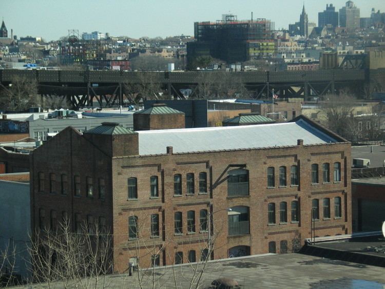
Streets of red hook brooklyn drive through hamilton lorraine dwight clinton van dyke
Red Hook is a neighborhood in the New York City borough of Brooklyn, New York. The neighborhood is part of Brooklyn Community Board 6.
Contents
- Streets of red hook brooklyn drive through hamilton lorraine dwight clinton van dyke
- Map of Red Hook Brooklyn NY USA
- Colonization
- American Revolution
- Later years and recent history
- Location
- IKEA
- Park
- Water
- Public transport
- Planned streetcars
- Vehicular
- Events
- References
Map of Red Hook, Brooklyn, NY, USA
Colonization
Red Hook has been part of the Town of Brooklyn since it was organized in the 1600s. It is named for the red clay soil and the point of land projecting into the Upper New York Bay. The village was settled by Dutch colonists of New Amsterdam in 1636, and named Roode Hoek. In Dutch "Hoek" means "point" or "corner" and not the English hook (i.e., not something curved or bent). The actual "hoek" of Red Hook was a point on an island that stuck out into Upper New York Bay at today's Dikeman Street west of Ferris Street. From the 1880s to the present time, people who live in the eastern area of Red Hook have referred to their neighborhood as "The Point". Today, the area is home to about 11,000 people.
Rapelye Street in Red Hook commemorates the beginnings of one of New Amsterdam's earliest families, the Rapelje clan, descended from the first European child born in the new Dutch settlement in the New World, Sarah Rapelje. She was born near Wallabout Bay, which later became the site of the New York (Brooklyn) Naval Shipyard. A couple of decades after the birth of his daughter Sarah, Joris Jansen Rapelje removed to Brooklyn, where he was one of the Council of twelve men, and where he was soon joined by son-in-law Hans Hansen Bergen. Rapelye Street in Red Hook is named for Rapelje and his descendants, who lived in Brooklyn for centuries.
American Revolution
During the Battle of Brooklyn (also known as the Battle of Long Island), a fort was constructed on the "hoek" called "Fort Defiance". It is shown on a map called "a Map of the Environs of Brooklyn" drawn in 1780 by a loyalist engineer named George S. Sproule. The Sproule map shows that Fort Defiance complex actually consisted of three redoubts on a small island connected by trenches, with an earthwork on the island’s south side to defend against a landing. The entire earthwork was about 1,600 feet long and covered the entire island. The three redoubts covered an area about 400 feet by 800 feet. The two principal earthworks were about 150 feet by 175 feet, and the tertiary one was about 75 feet by 100 feet. The Sproule and Ratzer maps show that Red Hook was a low-lying area full of tidal mill ponds created by the Dutch.
General Israel Putnam came to New York on April 4, 1776, to assess the state of its defenses and strengthen them. Among the works initiated were forts on Governor's Island and Red Hook, facing the bay. On April 10, one thousand Continentals took possession of both points and began constructing Fort Defiance which mounted one three pounder cannon and four eighteen pounders. The cannons were to be fired over the tops of the fort's walls. In May, Washington described it as "small but exceedingly strong". On July 5, General Nathanael Greene called it "a post of vast importance" and, three days later, Col. Varnum's regiment joined its garrison. On July 12, the British frigates Rose and Phoenix and the schooner Tyrol ran the gauntlet past Defiance and the stronger Governor's Island works without firing a shot, and got all the way to Tappan Zee, the widest part of the Hudson River. They stayed there for over a month, beating off harassing attacks, and finally returned to Staten Island on August 18. It appeared that gunfire from Fort Defiance did damage to the British ships.
Samuel Shaw wrote to his parents on July 15:
Almost the entire New York metropolitan area was under British military occupation from the end of 1776 until November 23, 1783, when they evacuated the city.
Later years and recent history
In 1839, the City of Brooklyn published a plan to create streets, which included filling in all of the ponds and other low-lying areas.
In the 1840s, entrepreneurs began to build ports as the "offloading end" of the Erie Canal. These included the Atlantic, Erie and Brooklyn Basins. By the 1920s, they made Red Hook the busiest freight port in the world, but this ended in the 1960s with the advent of containerization. In the 1930s, the area was poor, and the site of the current Red Hook Houses was the site of a shack city for the homeless, called a "Hooverville".
From the 1920s on, a lot of poor and unemployed Norwegians, mostly former sailors, were living in the area in what they called Ørkenen Sur ("The Bitter Desert") around places like Hamilton Avenue and Gospel Hill. In 2015 NRK made a documentary about it in Norwegian. There is also an old documentary film about this.
In 1990 Life magazine named Red Hook as one of the "worst" neighborhoods in the United States and as "the crack capital of America." The principal of P.S. 15 in Red Hook was killed in 1992, in the crossfire of a drug-related shooting while looking for a pupil who had left his school. The school was later renamed the Patrick Daly School after that principal, who was beloved within that school.
In 2010, Red Hook's first community newspaper, The Red Hook Star-Revue, began publication.
In 2012, Red Hook was heavily damaged by Hurricane Sandy.
The Mary A. Whalen (tanker) and Lehigh Valley Railroad Barge No. 79 are listed on the National Register of Historic Places.
Location
Red Hook is a peninsula between Buttermilk Channel, Gowanus Bay and Gowanus Canal at the southern edge of Downtown Brooklyn. Red Hook is in the area known as South Brooklyn, which, contrary to its name, is actually in western Brooklyn. This name is derived from the original City of Brooklyn which ended at Atlantic Street, now Atlantic Avenue. By the 1950s, anything south of Atlantic Avenue was considered South Brooklyn; thus, the names "Red Hook" and "South Brooklyn" were applied also to today's Carroll Gardens, Cobble Hill, Columbia Heights, and Gowanus neighborhoods. Portions of Carroll Gardens and Cobble Hill were granted landmark status in the 1970s and were carved out of Red Hook.
Red Hook is the only part of New York City that has a fully frontal view of the Statue of Liberty, which was oriented to face France, the country which donated the statue to the United States following the country's centennial.
Red Hook is the site of the NYCHA Red Hook Houses, the largest public housing development in Brooklyn, which accommodates roughly 6,000 residents. Red Hook also contains several parks.
IKEA
Red Hook has a large IKEA store (346,000 square feet (32,100 m2)) that opened on June 18, 2008 near the Gowanus Expressway. The building of IKEA was controversial, because it replaced a 19th-century dry dock at 40°40′19.2″N 74°0′47.5″W, which was still in use. Residents cited concerns including traffic congestion, a decrease in property values and destruction of this transit-oriented neighborhood and historically significant buildings in the area.
Brooklyn artist Greg Lindquist exhibited a group of paintings in February 2008 in New York City that depicted the IKEA site in process, juxtaposing the maritime decay with the new construction.
A report by the New York City Economic Development Corporation announced the findings and recommendations of its Maritime Support Services Location Study. The study found that New York City needs eight more dry docks. According to the report, it will cost $1 billion to replace the one IKEA is using as a parking lot. No schedule for replacement was announced. In addition, IKEA and its contractor demolished Civil War era buildings and exposed the community to asbestos. IKEA's contractor was found to be in "violation for not having filed asbestos work, failing to monitor the air, not posting any warnings, failure to construct decontamination protections before disturbing the asbestos-containing materials, and doing nothing to protect and decontaminate the material, as well as the workers and building waste."
A once free ferry service for shoppers from Manhattan proved more popular than expected. IKEA charges a fare for the ferry but reimburses the fare at checkout to deter would-be commuters from using the ferry for non-shopping purposes.
Park
A 58.503-acre (236,750 m2) public park is located in southern Red Hook. It contains a paved path, benches, a flagpole with a yardarm, a drinking fountain, handball courts, softball fields, a soccer and football field, a track and field, picnic tables, the adjacent Sol Goldman Pool, and new trees and plantings. The park is maintained and operated by the New York City Department of Parks and Recreation, and is bordered by Otsego, Bay, Hicks, Lorraine, Court, and Halleck Streets.
Water
New York City has expanded its water ferry service, operated by New York Water Taxi. This service normally runs between IKEA and Pier 11 in Lower Manhattan, but has added a new stop at Van Brunt Street to support local businesses hurt by Hurricane Sandy. The free ferry runs between 10am and 9pm. Originally, when this free service was first introduced, it proved to be popular with local residents, causing changes in the operating policy to favor IKEA shoppers. Under the current schedule, the ferry runs from Monday to Friday, every 40 minutes from 2pm, $5 for one way. On Saturday and Sunday, it runs free of charge, every 20 minutes from 11am.
In the spring of 2006, the new Carnival Cruise Lines terminal, the Brooklyn Cruise Terminal, opened at Pier 12 at Pioneer Street, bringing additional tourists.
The Red Hook Container Terminal is one of four such facilities in the Port of New York and New Jersey and is the only maritime facility in Brooklyn to handle container ships.
The transatlantic liner RMS Queen Mary 2 docks in Red Hook.
Public transport
Subway service in the area is sparse. The closest subway stops are along the IND Culver Line (F G trains), at either Carroll Street or Smith–Ninth Streets stations.
New York City Bus service is also sparse, but popular. The B61 bus route provides service from Hamilton Avenue, through Erie Basin/IKEA Plaza, to Van Brunt St and then northward, through the Columbia Street Waterfront District and terminates in Downtown Brooklyn. It also connects with the Culver Line's Smith–Ninth Streets station. The B57 bus connects Red Hook with Downtown Brooklyn and Maspeth, Queens.
IKEA provides a complimentary shuttle that runs to Smith–Ninth Streets, Fourth Avenue / Ninth Street, and Court Street – Borough Hall subway stations from 3 to 9 p.m. daily, Monday through Friday every half hour, and Saturday and Sunday from 11 a.m. to 9 p.m. every 20 minutes. Non-shoppers also use this service.
Red Hook is expected to be served by the Citywide Ferry Service starting in 2017.
Planned streetcars
Though electric trolleys have not run in Brooklyn since 1956, activists led by the Brooklyn Historic Railway Association (BHRA) have been trying to revive streetcars in Red Hook since 1989. With permission from New York City’s government to develop a streetcar line running from Beard Street to Borough Hall, in the 1990s BHRA president Robert Diamond collected disused PCC streetcars that had been used in Boston and Buffalo for potential use on the new line. By 1999, Diamond had begun laying new track for the project, but in 2003 transportation officials elected to revoke Diamond’s rights to the route’s right of way, instead intending to sell them to the highest bidder in the event that the project ever moved forward. Diamond’s efforts to secure independent funding were not successful.
In 2005, Rep. Nydia Velázquez acquired a $300,000 federal grant for a 6-month streetcar study. Though BHRA had estimated $10–$15 million would be required to complete the project, the New York City Department of Transportation (NYCDOT) streetcar feasibility study (completed in April 2011) concluded that the 6.8 mile line would cost $176 million in capital funding, plus an additional $6.2 to $7.2 million in annual operating funds. A significant portion of the capital cost would be required to make modifications to Red Hook’s narrow streets in order to allow streetcars to make right turns.
Despite finding that Red Hook was underserved by transit, the study concluded that due to a number of factors, a streetcar line would not be an appropriate transit solution for the neighborhood. Because 81.5 percent of Red Hook residents did not own a car and therefore were already dependent on transit, the study estimated that a streetcar would generate only 1,822 daily riders. The study also found that a streetcar would not be a significant upgrade over existing buses in terms of travel times and reliability, and would not likely spur significant economic development unless combined with zoning changes from the New York City Department of City Planning (DCP). Since DCP had designated Red Hook as a “working waterfront,” no such zoning changes appeared to be forthcoming.
As of June 2013, Diamond had partnered with John Quadrozzi of Gowanus Bay Terminal (a concrete firm), and the Gowanus Canal Community Development Corporation in an effort to revive the project, which he now envisions running partly underground through a 19th-century Long Island Railroad tunnel. Diamond is pursuing federal funding in order to pay for the project, which he estimates would cost $50 million.
Vehicular
Red Hook is connected to Manhattan by the vehicular Brooklyn-Battery Tunnel, whose toll plaza and approaches separate it from Carroll Gardens and Columbia Street to the north.
The Gowanus Expressway (I-278) also runs through the neighborhood.