
Area 347.7 km² | Time zone BST (UTC+6) | |
 | ||
Website Official Map of Rangunia | ||
Biman bangladesh by mahabub shilak rangunia chittagong
Rangunia (Bengali: রাঙ্গুনিয়া) is an Upazila of Chittagong District in the Division of Chittagong, Bangladesh.
Contents
- Biman bangladesh by mahabub shilak rangunia chittagong
- Rangunia eco park
- Geography
- Population
- Historical Events
- Water bodies
- Administration
- Education
- Colleges
- Communication Facilities
- Health centres
- Economics
- Newspapers periodicals
- Religious Institutions
- Tourists spots
- Archaeological heritage relics
- In War of Liberation
- References
Rangunia eco park
Geography
Rangunia is located in between 22°18' and 22°37' north latitudes and in between 91°58' and 92°08' east longitudes. It has 46,176 households and a total area of 347.72 km².
It is bounded by Chandanaish Upazila on the south; Patiya Upazila, Boalkhali Upazila, Raozan Upazila & Kawkhali Upazila of Rangamati District on the west; Kawkhali Upazila of Rangamati District on the north and Kaptai Upazila & Rajasthali Upazila of Rangamati District and Bandarban Sadar Upazila on the east.
Population
According to the 2011 Bangladesh census, total population of Rangunia Upazila was 340000; male 169596, female 170404; Muslim 78%, Hindu 15%, Buddhist 6% and others 1%. Indigenous communities such as chakma and marma belong to this upazila. Total Voter 240715; male 124263 & female 116452.
Historical Events
Chakma kings (Shukdev Roy, Sher Daulat Khan, Jan Baksh Khan, Tabbar Khan, Jabbar Khan, Dharam Baksh Khan, Rani Kalindi, Harish Chandra Rai and others) ruled this area since 1757. Chakma King Harish Chandra transferred his capital from Rajanagar of Rangunia to Rangamati in 1874.
Water bodies
Main river: Karnaphuli, Ichamoti.
Administration
Rangunia Thana was formed on 24 January 1962 and it was turned into an upazila in 1983. Municipality was formed on 4 July 2000.
Rangunia has 1 Municipality & 15 Unions.
Education
Rangunia had an average literacy rate of 70.75%.
There are 9 colleges, 40 secondery schools, 25 madrasas, 179 primary school and many other registerd & kindergartens in the upazila.
Colleges
- Rangunia Govt. College
- Rangunia Women College
- North Rangunia Degree College
- Rajanagar Ranirhat Degree College
- Syeda Selima Qader Chowdhury Degree College
- South Rangunia Padua College
- M Shah Alam Chowdhury Degree College
- Hasina Jamal Degree College
- Shilok Balika Mohabidhyaloy
Communication Facilities
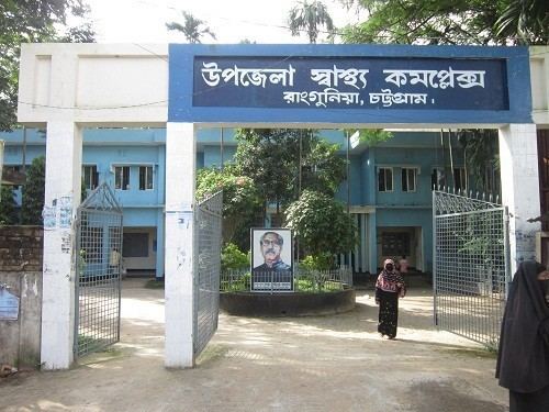
Health centres
Upazila health complex 1, family planning centre 11, satellite clinic 2.
Economics
Main sources of income are: Agriculture 39.71%, non-agricultural labourer 4.30%, industry 0.58%, commerce 16.24%, transport and communication 3.57%, service 12.31%, construction 1.03%, religious service 0.49%, rent and remittance 10.91% and others 10.86%.
Newspapers & periodicals
Religious Institutions
Mosque 359, Temple 42, Tomb 3, Pagoda 41, Sacred place 1.
Tourists spots
Betagee Grammar School
Archaeological heritage & relics
In War of Liberation
In 1971, encounters were held between the freedom fighters and the Pak army at Ranirhat, Rowajarhat and Rangunia. The Pak army conducted looting, burning, rape and mass killing in various places of the upazila.