
Postal code 4530 Area 259 km² | Time zone BST (UTC+6) Website Official Map of Kaptai | |
 | ||
Kaptai (Bengali: কাপ্তাই) is an Upazila of Rangamati District in the Division of Chittagong, Bangladesh.
Contents
Map of Kaptai, Bangladesh
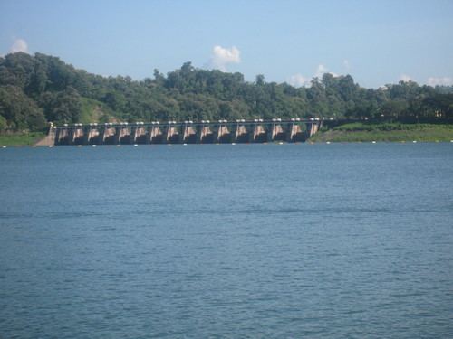
Notable landmarks are the Karnaphuli Hydroelectric Power Station, the only Hydro-electric power plant of Bangladesh. The Kaptai Dam, built for this purpose on the Karnaphuli River, created the Kaptai Lake, the largest man-made dam in Bangladesh.
Geography
Kaptai is located at 22.5000°N 92.2167°E / 22.5000; 92.2167 . It has 12992 households and total area 259 km².
Demographics
At the 2001 Bangladesh census, Kaptai had a population of 66,135. Males constituted 55.45% of the population, and females 44.55%. The population of those aged 18 and older was 32,352. The average literacy rate was 49.9% (7+ years).
Points of interest
Administration
Kaptai has 5 Unions/Wards, 10 Mauzas/Mahallas, and 144 villages.