
Country United States County Union Elevation 23 ft (7 m) Zip code 07065 Population 28,394 (2013) | Incorporated April 19, 1858 Area 10.43 km² Local time Thursday 8:44 AM | |
 | ||
Area rank 297th of 566 in state13th of 21 in county Weather -4°C, Wind NW at 10 km/h, 45% Humidity | ||
Hotel indigo rahway newark rahway new jersey
Rahway /ˈrɔːweɪ/ is a city in southern Union County, New Jersey, United States. It is part of the New York metropolitan area, being 21.6 miles (34.8 km) southwest of Manhattan and 5 miles (8.0 km) west of Staten Island. As of the 2010 United States Census, the city's population was 27,346, reflecting an increase of 846 (+3.2%) from the 26,500 counted in the 2000 Census, which had in turn increased by 1,175 (+4.6%) from the 25,325 counted in the 1990 Census.
Contents
- Hotel indigo rahway newark rahway new jersey
- Map of Rahway NJ 07065 USA
- Rahway arts district rahway new jersey
- Arts and Culture
- History
- Geography
- Climate
- Census 2010
- Census 2000
- Downtown revitalization
- East Jersey State Prison
- City parks
- County parks
- Rahway River Parkway Rahway Section
- Local government
- Federal state and county representation
- Politics
- Education
- Roads and highways
- Public transportation
- Airport
- Notable people
- References
Map of Rahway, NJ 07065, USA
Rahway arts district rahway new jersey
Arts and Culture
Rahway is home to the Union County Performing Arts Center. It is in the process of building dedicated artists' housing so that actors, musicians, dancers, comedians, poets, filmmakers, and visual artists can live in safe affordable housing.
A number of contemporary art galleries sit in the Rahway Arts District as well as three professional rehearsal and recording studios.
History
Rahway and the surrounding area were once the home of the Lenni Lenape Native Americans, and tradition states that the city was named after Rahwack, a local tribal chief.
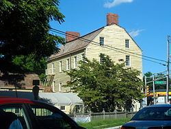
Formal European settlement began in 1664 with the purchase by the English from the Lenape of the Elizabethtown Tract, which encompassed lands from the mouth of the Raritan River and included all of present-day Union County as well as parts of Somerset, Middlesex, Morris and Essex counties. The Seventeenth Century Clark House is one of the oldest buildings in the state.
Rahway saw action during the American Revolutionary War because of its proximity to Staten Island, Elizabethtown and Perth Amboy. In January 1777, rebels were victorious against the British in the Battle of Spanktown, which resulted in the death of some 100 British troops. The battle was named this after Rahway's original name given to it by the first settlers, Spanktown, which is said to have been chosen "because an early settler publicly took his spouse across his knee and chastised her".
The Merchants' and Drovers' Tavern resides at the corner of St. Georges and Westfield Avenues. The earliest buildings at the site date to 1795 and the property remains one of Rahway's most prominent historical landmarks. George Washington visited Rahway during his travel to New York City prior to his presidential inauguration in 1789. A marker across the street from the tavern reads:
Here, on April 23, 1789, on his way to New York City, Washingtonwas received by troops from Elizabethtown and Newark. He wasentertained at the inn kept by Samuel Smith by gentlemen of the town.Following the Revolution, Rahway became the home of the first national mint to create a coin bearing the inscription E pluribus unum. A United States Post Office established in Rahway was one of only six in the entire state in 1791.
Rahway grew due to its location along the major stagecoach and railroad lines between New York City and Philadelphia, Pennsylvania. The navigable Rahway River, which flows through the city, also aided the city's commercial growth.
As immigrants from Britain, Ireland and Germany streamed into what was then Rahway Township in the 1850s, Rahway became incorporated as a city by an act of the State Legislature on April 19, 1858, from portions of Rahway Township in Union and Woodbridge Township in Middlesex County. In 1860, the portion of Rahway that had been part of Middlesex County was transferred to Union. On March 13, 1861, the remainder of Rahway Township became part of Rahway City. Clark Township was formed from portions of the city on March 23, 1864.
The first municipal elections for the mayor and council were conducted on April 19, 1858, and the council held its first meeting on May 3, 1858. The city's police department and its initial group of four constables were created at that first council meeting.
The city became home to dozens of major manufacturers, including the Regina Music Box Company, Wheatena, Mershon Bros. and, most importantly, Merck & Co., which was established in Rahway in 1903, when George Merck moved his small chemical company to Rahway from New York City. The company remained in Rahway through the presidency of George W. Merck and after.
The national decline in industry after World War II led to the closure of most of Rahway's major manufacturing facilities (except for Merck) and a general deterioration of the city's central business district. Beginning in the late 1990s, the city launched a plan to revitalize the downtown area and authorized the construction of hundreds of new market-rate housing units, a hotel, art galleries and additional retail space.
Geography
According to the United States Census Bureau, Rahway had a total area of 4.028 square miles (10.434 km2), including 3.897 square miles (10.094 km2) of land and 0.131 square miles (0.340 km2) of water (3.26%).
Rahway is bordered to the northwest by Clark, to the northeast by Linden and to the south by Woodbridge Township in Middlesex County.
The Rahway River travels through Rahway, entering from Clark at Rahway River Park. The river receives the waters of Robinsons Branch at Elizabeth Avenue between West Grand Avenue and West Main Street, and then receives the waters of the South Branch at East Hazlewood Avenue and Leesville Avenue. Finally the river leaves Rahway to enter the city limits of Linden and Carteret before flowing into the Arthur Kill.
Unincorporated communities, localities and place names located partially or completely within the city include North Rahway.
Climate
The climate in this area is characterized by hot, humid summers and generally mild to cool winters. According to the Köppen Climate Classification system, Rahway has a humid subtropical climate, abbreviated "Cfa" on climate maps.
Census 2010
The 2010 United States Census counted 27,346 people, 10,533 households, and 6,815 families residing in the city. The population density was 7,016.8 per square mile (2,709.2/km2). The city contained 11,300 housing units at an average density of 2,899.5 per square mile (1,119.5/km2). The racial makeup of the city was 52.30% (14,301) White, 30.93% (8,457) Black or African American, 0.31% (84) Native American, 4.30% (1,175) Asian, 0.02% (5) Pacific Islander, 8.37% (2,288) from other races, and 3.79% (1,036) from two or more races. Hispanics or Latinos of any race were 23.52% (6,433) of the population.
Out of a total of 10,533 households, 28.1% had children under the age of 18 living with them, 42.4% were married couples living together, 16.8% had a female householder with no husband present, and 35.3% were non-families. 29.5% of all households were made up of individuals, and 11.2% had someone living alone who was 65 years of age or older. The average household size was 2.58 and the average family size was 3.23.
In the city, 21.8% of the population were under the age of 18, 8.5% from 18 to 24, 28.6% from 25 to 44, 27.5% from 45 to 64, and 13.5% who were 65 years of age or older. The median age was 38.8 years. For every 100 females the census counted 91.1 males, but for 100 females at least 18 years old, it was 87.1 males.
The Census Bureau's 2006-2010 American Community Survey showed that (in 2010 inflation-adjusted dollars) median household income was $58,551 (with a margin of error of +/- $3,355) and the median family income was $77,268 (+/- $9,506). Males had a median income of $56,572 (+/- $3,375) versus $47,832 (+/- $3,542) for females. The per capita income for the city was $28,855 (+/- $1,981). About 5.4% of families and 8.7% of the population were below the poverty line, including 10.9% of those under age 18 and 9.4% of those age 65 or over.
Census 2000
As of the 2000 United States Census there were 26,500 people, 10,028 households, and 6,728 families residing in the city. The population density was 6,642.7 people per square mile (2,564.3/km2). There were 10,381 housing units at an average density of 2,602.2 per square mile (1,004.5/km2). The racial makeup of the city was 60.19% White, 27.07% African American, 0.16% Native American, 3.58% Asian, 0.05% Pacific Islander, 5.62% from other races, and 3.33% from two or more races. Hispanic or Latino of any race were 13.87% of the population.
There were 10,028 households out of which 30.0% had children under the age of 18 living with them, 46.7% were married couples living together, 15.6% had a female householder with no husband present, and 32.9% were non-families. 28.0% of all households were made up of individuals and 11.7% had someone living alone who was 65 years of age or older. The average household size was 2.63 and the average family size was 3.24.
In the city the population was spread out with 23.9% under the age of 18, 7.8% from 18 to 24, 32.0% from 25 to 44, 21.8% from 45 to 64, and 14.5% who were 65 years of age or older. The median age was 37 years. For every 100 females there were 91.2 males. For every 100 females age 18 and over, there were 86.5 males.
The median income for a household in the city was $50,729, and the median income for a family was $61,931. Males had a median income of $41,047 versus $32,091 for females. The per capita income for the city was $22,481. About 5.4% of families and 7.1% of the population were below the poverty line, including 9.3% of those under age 18 and 8.2% of those age 65 or over.
Downtown revitalization
Beginning in the early 1990s and continuing through the present day, the City of Rahway has rebounded as its downtown began to see the construction of new restaurants, art galleries, market-rate housing and the old Rahway Theatre reopening as the Union County Performing Arts Center. The theater underwent a $6.2-million renovation and expansion project, completed in 2007. As part of the expansion, the facility was purchased by the County of Union for $1.3 million and leased back for $1 a year.
In September 1999, remnants of Hurricane Floyd swept across New Jersey and caused severe damage. The Rahway Public Library was on a flood plain and suffered over US$1 million in flood damage. The building was demolished in October 2001 and a new library was constructed and opened on March 22, 2004, behind the city's municipal building along a less flood-prone area of the Rahway River. The area where the former Rahway Public Library was now contains tennis courts and a small playground.
East Jersey State Prison
East Jersey State Prison, formerly known as Rahway State Prison, actually is located in Woodbridge Township at the border with Rahway. The prison's mailing address is in Rahway, leading many to believe the facility was located there. The prison's official name was changed to East Jersey State Prison as of November 30, 1988, at the request of the citizens of Rahway. East Jersey State Prison is seen at the beginning of the movie, Ocean's Eleven, starring George Clooney. The 1978 documentary Scared Straight was filmed there as was the 1989 movie Lock Up, starring Sylvester Stallone and the prison was briefly mentioned in John Sayles City of Hope (1991).
City parks
The city is home to more than ten parks. The best-known park is Rahway River Park, which is maintained by Union County, and is also partially located in Clark. Parks and plazas run by the City of Rahway (and overseen by the Rahway Recreation and Parks Department) include:
County parks
Parks run by the county inside Rahway's borders (overseen by the Union County Parks and Recreation Department) include:
Rahway River Parkway - Rahway Section
The Rahway River Parkway is a greenway of parkland that hugs the Rahway River and its tributaries. It was designed in the 1920s by the Olmsted Brothers firm, who were the sons of the eminent landscape architect Frederick Law Olmsted. The Rahway section follows the banks of the meandering Rahway River as it flows south through Rahway.
Local government
The City of Rahway is governed under the Faulkner Act system of municipal government under the Mayor-Council (Plan F), implemented as of January 1, 1955, based on the recommendations of a Charter Study Commission.
Under the City of Rahway's form of government, all executive and administrative authority is vested in the office of the mayor, who appoints the Business Administrator and department directors. The Business Administrator develops an annual budget for the city, manages the city's departments and oversees its employees. This form of government gives citizens a centralized line of authority for the efficient management of the city's business. There are nine members of the Municipal Council, all elected to four-year terms of office. Six members of the council are elected from each of six wards. The other three members are elected to represent the entire city at large, and come up for election at the same time as the mayor two years after the ward seats are up for election.
As of 2016, the mayor of Rahway is Democrat Samson Steinman, who is serving a term of office ending December 31, 2018. Members of the Municipal Council are Council President Robert "Bob" C. Bresenhan Jr. (Second Ward; D, 2016), James E. Baker (At Large; D, 2018), David Brown (Fourth Ward; D, 2016), Michael W. Cox (Third Ward; D, 2016), Rodney Farrar (First Ward; D, 2016), Raymond A. Giacobbe Jr. (Sixth Ward; D, 2016 - elected to serve an unexpired term), Joanna Miles (At Large; D, 2018), Jeremy E. Mojica (At Large; D, 2018) and Jennifer Wenson-Maier (Fifth Ward; D, 2016).
Samson Steinman was appointed to the position of mayor in September 2013 following the resignation of Rick Proctor, whose term of office was to have run until December 31, 2014. In turn, the city council chose Raymond A. Giacobbe Jr., from among three candidates nominated by the Democratic municipal committee to fill Steinman's vacant Sixth Ward seat expiring in December 2016. Giacobbe served on an interim basis until the November 2014 general election, when he was elected to serve the balance of the term of office.
Federal, state and county representation
Rahway is located in the 10th Congressional District and is part of New Jersey's 22nd state legislative district.
New Jersey's Tenth Congressional District is represented by Donald Payne Jr. (D, Newark). New Jersey is represented in the United States Senate by Cory Booker (D, Newark, term ends 2021) and Bob Menendez (D, Paramus, 2019).
For the 2016–2017 session (Senate, General Assembly), the 22nd Legislative District of the New Jersey Legislature is represented in the State Senate by Nicholas Scutari (D, Linden) and in the General Assembly by Jerry Green (D, Plainfield) and James J. Kennedy (D, Rahway). The Governor of New Jersey is Chris Christie (R, Mendham Township). The Lieutenant Governor of New Jersey is Kim Guadagno (R, Monmouth Beach).
Union County is governed by a Board of Chosen Freeholders, whose nine members are elected at-large to three-year terms of office on a staggered basis with three seats coming up for election each year, with an appointed County Manager overseeing the day-to-day operations of the county. At an annual reorganization meeting held in the beginning of January, the board selects a Chairman and Vice Chairman from among its members. As of 2014, Union County's Freeholders are Chairman Christopher Hudak (D, Linden, term ends December 31, 2014), Vice Chairman Mohamed S. Jalloh (D, Roselle, 2015), Bruce Bergen (D, Springfield Township, 2015), Linda Carter (D, Plainfield, 2016), Angel G. Estrada (D, Elizabeth, 2014), Sergio Granados (D, Elizabeth, 2016) Bette Jane Kowalski (D, Cranford, 2016), Alexander Mirabella (D, Fanwood, 2015) and Vernell Wright (D, Union, 2014). Constitutional officers elected on a countywide basis are County Clerk Joanne Rajoppi (D, Union, 2015), Sheriff Ralph Froehlich (D, Union, 2016) and Surrogate James S. LaCorte (D, Springfield Township, 2014). The County Manager is Alfred Faella.
Politics
As of March 23, 2011, there were a total of 15,719 registered voters in Rahway, of which 7,159 (45.5% vs. 41.8% countywide) were registered as Democrats, 1,675 (10.7% vs. 15.3%) were registered as Republicans and 6,880 (43.8% vs. 42.9%) were registered as Unaffiliated. There were 5 voters registered to other parties. Among the city's 2010 Census population, 57.5% (vs. 53.3% in Union County) were registered to vote, including 73.5% of those ages 18 and over (vs. 70.6% countywide).
In the 2012 presidential election, Democrat Barack Obama received 8,413 votes (74.7% vs. 66.0% countywide), ahead of Republican Mitt Romney with 2,648 votes (23.5% vs. 32.3%) and other candidates with 107 votes (0.9% vs. 0.8%), among the 11,269 ballots cast by the city's 16,730 registered voters, for a turnout of 67.4% (vs. 68.8% in Union County). In the 2008 presidential election, Democrat Barack Obama received 8,340 votes (69.8% vs. 63.1% countywide), ahead of Republican John McCain with 3,410 votes (28.5% vs. 35.2%) and other candidates with 115 votes (1.0% vs. 0.9%), among the 11,944 ballots cast by the city's 16,039 registered voters, for a turnout of 74.5% (vs. 74.7% in Union County). In the 2004 presidential election, Democrat John Kerry received 6,512 votes (63.1% vs. 58.3% countywide), ahead of Republican George W. Bush with 3,668 votes (35.5% vs. 40.3%) and other candidates with 92 votes (0.9% vs. 0.7%), among the 10,326 ballots cast by the city's 14,471 registered voters, for a turnout of 71.4% (vs. 72.3% in the whole county).
In the 2013 gubernatorial election, Democrat Barbara Buono received 55.4% of the vote (3,211 cast), ahead of Republican Chris Christie with 43.0% (2,494 votes), and other candidates with 1.6% (93 votes), among the 5,934 ballots cast by the city's 16,359 registered voters (136 ballots were spoiled), for a turnout of 36.3%. In the 2009 gubernatorial election, Democrat Jon Corzine received 3,961 ballots cast (57.4% vs. 50.6% countywide), ahead of Republican Chris Christie with 2,451 votes (35.5% vs. 41.7%), Independent Chris Daggett with 366 votes (5.3% vs. 5.9%) and other candidates with 68 votes (1.0% vs. 0.8%), among the 6,895 ballots cast by the city's 15,842 registered voters, yielding a 43.5% turnout (vs. 46.5% in the county).
Education
The Rahway Public Schools serve students in pre-kindergarten through twelfth grade. As of the 2011-12 school year, the district's six schools had an enrollment of 3,858 students and 294.8 classroom teachers (on an FTE basis), for a student–teacher ratio of 13.09:1. Schools in the district (with 2011-12 enrollment data from the National Center for Education Statistics) are four PreK-6 elementary schools (which had been PreK-5 until 2011) — Grover Cleveland School (343 students), Franklin School (564), Madison School (308) and Roosevelt School (665) — Rahway 7th & 8th Grade Academy (845) for grades 7-8 and Rahway High School (1,133) for grades 9-12.
Roads and highways
The city had a total of 73.67 miles (118.56 km) of roadways, of which 59.18 miles (95.24 km) were maintained by the municipality, 10.45 miles (16.82 km) by Union County and 4.04 miles (6.50 km) by the New Jersey Department of Transportation.
Rahway is served by U.S. Route 1/9, and Route 27. The city is sandwiched between the Garden State Parkway and the New Jersey Turnpike, which are each located about two miles outside of the city limits.
Public transportation
NJ Transit 115 route provides local service and interstate service to and from the Port Authority Bus Terminal in Midtown Manhattan, with service on the 48 line to Elizabeth and Perth Amboy.
Rahway Train Station serves NJ Transit's North Jersey Coast Line and Northeast Corridor Line. The City of Rahway and NJ Transit helped fund a $16 million renovation for the station in 1999 and a public plaza in front of the station was completed in 2001, changes that have spurred cleanup and revitalization downtown. A new US$11.2 million 524-space parking deck opened across the street from the station in January 2005, helping train commuters and allowing the city to transform old parking lot space into new buildings and residences. A typical train ride to New York City's Pennsylvania Station takes 40 minutes.
Airport
Newark Liberty International Airport is located 10.2 miles (16.4 km) northeast of Rahway, approximately a 20-minute drive by car.
Notable people
People who were born in, residents of, or otherwise closely associated with Rahway include: