
Founded 1683 Website www.co.middlesex.nj.us Population 828,919 (2013) Unemployment rate 5.5% (Apr 2015) | Area 836.1 km² | |
 | ||
Colleges and Universities Rutgers University, Middlesex County College, Rutgers University–New Brunswick, Robert Wood Johnson, Edward J Bloustein School of Destinations | ||
Middlesex County is a county located in north-central New Jersey, United States. As of 2015, Middlesex County's Census-estimated population was 840,900, an increase of 3.8% from the 2010 United States Census, when its population was enumerated at 809,858, making it the second-most populous county in the state. Middlesex is part of the New York metropolitan area, and its county seat is New Brunswick. The center of population of the state of New Jersey is located in Middlesex County, in East Brunswick Township, just east of the New Jersey Turnpike. The 2000 Census showed that the county ranked 63rd in the United States among the highest-income counties by median household. The Bureau of Economic Analysis ranked the county as having the 143rd-highest per capita income of all 3,113 counties in the United States (and the 10th-highest in New Jersey) as of 2009. Middlesex County holds the nickname, "The Greatest County in the Land".
Contents
- Map of Middlesex County NJ USA
- Geography
- Adjacent counties
- Census 2010
- Census 2000
- Government
- Politics
- Transportation
- Public transportation
- Higher education
- Healthcare
- Major employers
- Municipalities
- County parks
- Climate and weather
- References
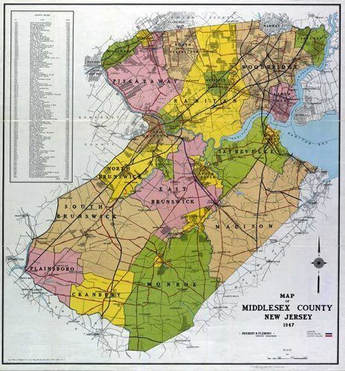
Map of Middlesex County, NJ, USA
The county was primarily settled due to its ideal location near the Raritan River and was established as of March 7, 1683, as part of the Province of East Jersey and was partitioned as of October 31, 1693, into the townships of Piscataway, Perth Amboy and Woodbridge. Somerset County was established on May 14, 1688, from portions of Middlesex County. The county's first court met in June 1683 in Piscataway, and held session at alternating sites over the next century in Perth Amboy, Piscataway and Woodbridge before relocating permanently to New Brunswick in 1778. Middlesex County hosts an extensive park system totaling more than 6,300 acres (2,500 ha).
Geography
According to the 2010 Census, the county had a total area of 322.83 square miles (836.1 km2), including 308.91 square miles (800.1 km2) of land (95.7%) and 13.91 square miles (36.0 km2) of water (4.3%). The county is named after the historic English county of Middlesex.
Bisected by the Raritan River, the county is topographically typical of Central Jersey in that it is largely flat. The elevation ranges from sea level to 300 feet (91 m) above sea level on a hill scaled by Major Road near Route 1 in South Brunswick Township.
Adjacent counties
Census 2010
The 2010 United States Census counted 809,858 people, 281,186 households, and 203,016 families residing in the county. The population density was 2,621.6 per square mile (1,012.2/km2). The county contained 294,800 housing units at an average density of 954.3 per square mile (368.5/km2). The racial makeup of the county was 58.60% (474,589) White, 9.69% (78,462) Black or African American, 0.34% (2,777) Native American, 21.40% (173,293) Asian, 0.03% (251) Pacific Islander, 6.99% (56,569) from other races, and 2.95% (23,917) from two or more races. Hispanics or Latinos of any race were 18.40% (148,975) of the population.
Out of a total of 281,186 households, 34.4% had children under the age of 18 living with them, 55.9% were married couples living together, 11.8% had a female householder with no husband present, and 27.8% were non-families. 22.5% of all households were made up of individuals, and 8.9% had someone living alone who was 65 years of age or older. The average household size was 2.8 and the average family size was 3.29.
In the county, 22.9% of the population were under the age of 18, 10.2% from 18 to 24, 28.3% from 25 to 44, 26.3% from 45 to 64, and 12.3% who were 65 years of age or older. The median age was 37.2 years. For every 100 females the census counted 96.4 males, but for 100 females at least 18 years old, it was 94 males.
As of the 2010 Census, there were 170,070 people of Asian descent in Middlesex County accounting for 21% of the county's total population. At 61.57% of the population of Asian descent, Indian Americans accounted for a majority of the county's Asian population or 12.93% (104,705 people) of the county's total population in 2010, increasing to 119,579 (14.4%) by 2015, more than that of the other sub-groups combined. Middlesex County had the largest population of Asian Indians of all counties in New Jersey; in the 2010 Census, only Santa Clara County, California (117,596) and Queens County, New York (117,550) had a larger population of Asian Indians.
Middlesex County has the largest and fastest growing population of Chinese Americans of all counties in New Jersey, in places such as East Brunswick. Edison is also developing a sprawling suburban Chinatown, with other Chinese communities spread out over the county.
Census 2000
As of the 2000 United States Census there were 750,162 people, 265,815 households, and 190,855 families residing in the county. The population density was 2,422 people per square mile (935/km²). There were 273,637 housing units at an average density of 884 per square mile (341/km²). The racial makeup of the county was 68.42% White, 9.13% Black or African American, 0.20% Native American, 13.89% Asian, 0.04% Pacific Islander, 5.71% from other races, and 2.60% from two or more races. 13.59% of the population were Hispanic or Latino of any race. Among residents listing their ancestry, 16.1% were of Italian, 13.8% Irish, 10.2% German and 9.8% Polish ancestry according to the 2000 Census.
There were 265,815 households out of which 34.20% had children under the age of 18 living with them, 57.00% were married couples living together, 10.80% had a female householder with no husband present, and 28.20% were non-families. 22.40% of all households were made up of individuals and 8.70% had someone living alone who was 65 years of age or older. The average household size was 2.74 and the average family size was 3.23.
In the county, the population was spread out with 23.70% under the age of 18, 9.50% from 18 to 24, 32.80% from 25 to 44, 21.70% from 45 to 64, and 12.30% who were 65 years of age or older. The median age was 36 years. For every 100 females there were 96.40 males. For every 100 females age 18 and over, there were 93.50 males.
The median income for a household in the county was $61,446, and the median income for a family was $70,749. Males had a median income of $49,683 versus $35,054 for females. The per capita income for the county was $26,535. About 4.2% of families and 6.6% of the population were below the poverty line, including 7.2% of those under age 18 and 6.0% of those age 65 or over.
Government
Middlesex County is governed by a Board of Chosen Freeholders, whose seven members are elected at-large on a partisan basis to serve three-year terms of office on a staggered basis, with either two or three seats coming up for election each year as part of the November general election. At an annual reorganization meeting held in January, the board selects from among its members a Freeholder Director and Deputy Director. The Freeholder Director appoints Freeholders to serve as Chairpersons and members on the various committees which oversee county departments. Middlesex County also elects three "constitutional officers" whose existence is laid out in the New Jersey Constitution. The County Clerk and Surrogate serve five year terms and the Sheriff serves a three-year term of office.
As of 2016, Middlesex County's Freeholders (with party affiliation, term-end year, residence and committee chairmanship listed in parentheses) are Freeholder Director Ronald G. Rios (D, term ends December 31, 2015, Carteret; Ex-officio on all committees), Freeholder Deputy Director Carol Barrett Bellante (D, 2017; Monmouth Junction, South Brunswick Township; County Administration), Kenneth Armwood (D, 2016, Piscataway; Business Development and Education), Charles Kenny (D, 2016, Woodbridge Township; Finance), Shanti Narra (D, 2016, North Brunswick; Public Safety and Health), Charles E. Tomaro (D, 2017, Edison; Infrastructure Management) and Blanquita B. Valenti (D, 2016, New Brunswick; Community Services).
Constitutional officers are County Clerk Elaine M. Flynn (D, Old Bridge Township), Sheriff Mildred S. Scott (D, 2016, Piscataway) and Surrogate Kevin J. Hoagland (D, 2017; New Brunswick).
Middlesex County constitutes Vicinage 8 of the New Jersey Superior Court. Vicinage 8 is seated at the Middlesex County Courthouse, at 56 Paterson Street in New Brunswick, with the Family Part housed in the Middlesex County Family Courthouse at 120 New Street, also in New Brunswick; the Assignment Judge for Vicinage 8 is the Honorable Travis L. Francis.
The 6th and 12th Congressional Districts cover the county. New Jersey's Sixth Congressional District is represented by Frank Pallone (D, Long Branch). New Jersey's Twelfth Congressional District is represented by Bonnie Watson Coleman (D, Ewing Township).
The county is part of the 12th, 14th, 16th, 17th, 18th, 19th and 22nd Districts in the New Jersey Legislature. For the 2016–2017 session (Senate, General Assembly), the 12th Legislative District of the New Jersey Legislature is represented in the State Senate by Samuel D. Thompson (R, Old Bridge Township) and in the General Assembly by Robert D. Clifton (R, Matawan) and Ronald S. Dancer (R, Plumsted Township). For the 2016–2017 session (Senate, General Assembly), the 14th Legislative District of the New Jersey Legislature is represented in the State Senate by Linda R. Greenstein (D, Plainsboro Township) and in the General Assembly by Daniel R. Benson (D, Hamilton Township, Mercer County) and Wayne DeAngelo (D, Hamilton Township). For the 2016–2017 session (Senate, General Assembly), the 16th Legislative District of the New Jersey Legislature is represented in the State Senate by Christopher Bateman (R, Branchburg) and in the General Assembly by Jack Ciattarelli (R, Hillsborough Township) and Andrew Zwicker (D, South Brunswick). For the 2016–2017 session (Senate, General Assembly), the 17th Legislative District of the New Jersey Legislature is represented in the State Senate by Bob Smith (D, Piscataway) and in the General Assembly by Joseph Danielsen (D, Franklin Township) and Joseph V. Egan (D, New Brunswick) For the 2016–2017 session (Senate, General Assembly), the 18th Legislative District of the New Jersey Legislature is represented in the State Senate by Patrick J. Diegnan (D, South Plainfield) and in the General Assembly by Robert Karabinchak (D, Edison) and Nancy Pinkin (D, East Brunswick). In May 2016, Diegnan was chosen to fill the vacant seat of Peter J. Barnes III, who left the Senate to become a judge on New Jersey Superior Court, while Karabinchak was chosen to fill Diegnan's vacant Assembly seat. For the 2016–2017 session (Senate, General Assembly), the 19th Legislative District of the New Jersey Legislature is represented in the State Senate by Joseph Vitale (D, Woodbridge Township) and in the General Assembly by Craig Coughlin (D, Woodbridge Township) and John Wisniewski (D, Sayreville). For the 2016–2017 session (Senate, General Assembly), the 22nd Legislative District of the New Jersey Legislature is represented in the State Senate by Nicholas Scutari (D, Linden) and in the General Assembly by Jerry Green (D, Plainfield) and James J. Kennedy (D, Rahway).
Politics
As of March 23, 2011, there were a total of 455,044 registered voters in Middlesex County, of which 169,718 (37.3%) were registered as Democrats, 57,711 (12.7%) were registered as Republicans and 227,355 (50.0%) were registered as Unaffiliated. There were 260 voters registered to other parties.
After being a Republican stronghold in the late 19th and early 20th centuries, Middlesex County leaned Democratic for much of the 20th century beginning with Franklin Roosevelt's victory in the county in 1932. Throughout the twentieth century, in close elections the county would always vote Democratic, sometimes by solid margins, but the county was willing to flip Republican in the midst of nationwide Republican landslides in the 1970s and 80s. However, since the 1990s, Middlesex County has become a Democratic stronghold at the national level, mirroring the state's heavy swing to the Democrats.
Democrat Bill Clinton carried the county in 1992 and it has remained reliably blue in every election since. In the nationally close 2000 election, Democrat Al Gore won the county decisively with 59.9% of the vote to Republican George W. Bush's 36.1%, a Democratic victory margin of 23.7%, while winning the state overall by a 56-40 margin. In the 2004 U.S. Presidential election, many of the suburban counties surrounding New York City, including Middlesex County, swung Republican in response to the 9/11 terrorist attacks, but Democrat John Kerry still carried the county comfortably by a 13.6% margin over George W. Bush, Kerry taking 56.3% of the vote to Bush's 42.8%, while Kerry carried the state overall by 6.7% over Bush. In 2008, Barack Obama carried Middlesex County by a much larger 21.8% margin over John McCain, Obama taking 60.2% of the vote to McCain's 38.4%, while Obama won New Jersey overall by 15.5% over McCain. In 2012, Obama won an even more commanding victory in the county, receiving 63.2% of the vote to Republican Mitt Romney's 35.6%, a Democratic victory margin of 27.6%, while carrying New Jersey overall by 17.8%. Like much of the New York City metro area, Middlesex County was one of the few parts of the country to actually swing even harder in Obama's favor in 2012 compared to 2008, even as he lost ground nationally, indicating a long-term trend toward Democratic dominance in Middlesex County.
In the 2005 Gubernatorial Election, the county went to Democrat Jon Corzine by a 56-39 margin; while in the 2009 Gubernatorial Election, Republican Chris Christie received 47% of the vote, defeating incumbent Democrat Corzine, who received around 45%.
Transportation
Middlesex County hosts various county routes, state routes, US Routes, Interstates and toll highways. As of May 2010, the county had a total of 2,584.38 miles (4,159.16 km) of roadways, of which 2,118.08 miles (3,408.72 km) were maintained by the municipality, 292.16 miles (470.19 km) by Middlesex County and 131.48 miles (211.60 km) by the New Jersey Department of Transportation and 42.66 miles (68.65 km) by the New Jersey Turnpike Authority.
County roads include County Route 501, County Route 514, County Route 516 (only in Old Bridge), County Route 520, County Route 522, County Route 527, County Route 529, County Route 531, County Route 535 and County Route 539.
The state routes are: Route 18, Route 26 (only in North Brunswick Township – entirely concurrent with Livingston Avenue), Route 27, Route 28, Route 32, Route 33 (only in Monroe Township), Route 34 (only in Old Bridge), Route 35, Route 91 (concurrent with Jersey Avenue in North Brunswick Township and entering New Brunswick), Route 171, Route 172 (only in New Brunswick), Route 184 and Route 440.
U.S. Routes include: U.S. Route 1, U.S. Route 9, U.S. Route 1/9 (only in Woodbridge Township) and U.S. Route 130.
The county also includes some limited access highways and Interstates as well. Middlesex County hosts the southern end of the Middlesex Freeway (Interstate 287) which then turns into Route 440 that connects to the Outerbridge Crossing. The Garden State Parkway passes through the eastern edge of the county, which features nine interchanges and the northern start/end of the split-roadways (Express & Local Lanes). The New Jersey Turnpike carries Interstate 95 through the center of the county. The Turnpike has five interchanges in Middlesex County: Exit 12 in Carteret, Exit 11 in Woodbridge Township, Exit 10 in Edison, Exit 9 in East Brunswick and Exit 8A in Monroe Township.
The NJDOT is upgrading the Route 18 "avenue" to a freeway between the Route 1 interchange all the way up to the new 18 Extension in Piscataway Township.
The Turnpike Authority planned to build Route 92, which was to start near the intersection of Ridge Road & Route 1 in South Brunswick Township to Interchange 8A in Monroe Township. This plan was cancelled on December 1, 2006.
The southern end of the "dual-dual" configuration (inner car lanes and outer truck lanes) used to be one mile south of Interchange 8A at the border of Cranbury Township and Monroe Township. It was relocated to Exit 6 in Mansfield Township in Burlington County after the Turnpike widening project was completed in early November 2014.
Public transportation
New Jersey Transit provides Middlesex County with frequent commuter rail service along the North Jersey Coast Line, Northeast Corridor Line and Raritan Valley Line. The North Jersey Coast Line runs through the eastern part of the county. The Northeast Corridor Line runs through the northern and central part of the county. The Raritan Valley Line serves Dunellen and is accessible to other communities along the county's northern border with Union County and Somerset County .
Intercity rail service is also provided by Amtrak. The routes that runs through Middlesex County are the Acela Express, Keystone, Northeast Regional, and Vermonter services, although only the Keystone and Northeast Regional have regular stops within Middlesex County, at either New Brunswick or Metropark. Acela also occasionally stops at Metropark.
Bus service in Middlesex County is provided by New Jersey Transit, Coach USA's Suburban Transit, the extensive Rutgers Campus bus network, the MCAT shuttle system, and DASH buses. There are bus routes that serve all townships in the county, and studies are being conducted to create the New Brunswick Bus Rapid Transit system.
Higher education
Healthcare
The county boasts capacity of more than 1,900 hospital beds among five major hospitals.
Major employers
Major non-governmental employers in Middlesex County include the following, grouped by ranges of employees:
Municipalities
Municipalities in Middlesex County (with 2010 Census data for population, housing units and area in square miles) are: Other, unincorporated communities in the county are listed next to their parent municipality. Many of these areas are census-designated places that have been defined by the United States Census Bureau for enumeration purposes within a Township and for which 2010 population data is included in parentheses.
County parks
Climate and weather
In recent years, average temperatures in the county seat of New Brunswick have ranged from a low of 22 °F (−6 °C) in January to a high of 86 °F (30 °C) in July, although a record low of −13 °F (−25 °C) was recorded in January 1984 and a record high of 103 °F (39 °C) was recorded in July 1999. Average monthly precipitation ranged from 2.98 inches (76 mm) in February to 5.08 inches (129 mm) in July.