
Founded March 15, 1739 Website www.co.morris.nj.us Population 499,397 (2013) Unemployment rate 4.5% (Apr 2015) | Area 1,247 km² | |
 | ||
Destinations Points of interest | ||
Morris county new jersey at home swim lessons
Morris County is a county located in the U.S. state of New Jersey, about 25 mi (40 km) west of New York City. According to the 2010 United States Census, the population was 492,276, up from the 470,212 at the 2000 Census, retaining its status as the tenth-most populous county in the state; since 2010, Morris County's population has increased by 1.5% to a Census-estimated 499,509 in 2015. The county is part of the New York Metropolitan Area, and its county seat is Morristown. The most populous place was Parsippany-Troy Hills Township, with 53,238 residents at the time of the 2010 Census, while Rockaway Township, covered 45.55 square miles (118.0 km2), the largest total area of any municipality.
Contents
- Morris county new jersey at home swim lessons
- Map of Morris County NJ USA
- Etymology
- Paleo Indians and Native Americans
- Geography
- Adjacent counties
- Geology
- National protected areas
- Demographics
- Census 2010
- Census 2000
- Government
- Former freeholders
- Other officers
- Politics
- Taxation
- Economy
- Business
- Education
- Municipalities
- Roads and highways
- Public transportation
- Local media
- Climate and weather
- References
Map of Morris County, NJ, USA
Morris County, as of the 2000 Census, was the sixth-wealthiest county in the United States by median household income at $77,340 (second in New Jersey behind Hunterdon County at $79,888), sixth in median family income at $89,773 (third in New Jersey behind Hunterdon County at $91,050 and Somerset County at $90,605) and ranked tenth by per capita income at $36,964 (second in New Jersey behind Somerset County at $37,970) The Bureau of Economic Analysis ranked the county as having the 16th-highest per capita income of all 3,113 counties in the United States (and the second highest in New Jersey) as of 2009. The county ranked third in the New York Metropolitan area in terms of median income.
Etymology
Morris County was named after Colonel Lewis Morris, governor of New Jersey in 1738/9, the year the county was named.
Paleo Indians and Native Americans
The Wisconsin Glacier covered the northern section of Morris County from 23,000 B.C. to 13,000 B.C.
After the Wisconsin Glacier melted around 13,000 B.C., Paleo Indians moved into the area from the south in search of big and small game as well as plants. The area was first tundra with grasses growing. Rabbits and fox moved into the area from the south.
The area of Morris County was inhabited by the Lenape Native Americans prior to the arrival of European settlers around the year 1000. They came from the Mississippi River area. They lived along the rivers and hunted game, fished, collected plants and nuts.
Henry Hudson explored the Hudson River area in 1609, which later the Dutch did surveys of the area.
From 1611 to 1614, the Dutch established the colony of New Netherland, which claimed territory between the 40th and 45th parallel north, a zone which included northern New Jersey. Dutch forts were established along the Hudson River beginning in 1613. As the years went by, more forts were established to trade with Native Americans.
The Native Americans traded furs and food with the Dutch for various goods. In return the Dutch gave the Native Americans metal pots, knives, guns, axes, and blankets. Trading with the Native Americans occurred until 1643 when a series of wars broke out between the Dutch and Native Americans.
There were hostile relations between the Dutch and Native Americans between 1643 and 1660. This prevented colonization by the Dutch of the Morris County region which was technically included in their claimed "New Netherland."
On August 27, 1664, three English ships approached Fort Amsterdam and the fort was surrendered to the English. The English now controlled New Netherland and Morris County was now under control of the colony of New York. Relations with the Native Americans improved for a while.
There was a war with the Dutch ten years later. The Dutch re-took control of New Amsterdam but after a year returned it to the English. Relations with the Native Americans and English improved for a while.
European settlements began in the early 18th century while it was known as Hunterdon County. Native Americans were still in the area at that time. Land was purchased from the Native Americans for various things such as blankets, shirts, rum, guns, knives, pots and gunpowder. The Native Americans' concept of selling land was different than that of the Europeans. Colonization occurred along the Atlantic coast and moved inland.
The first settlement in the area today known as Morris County occurred in Pompton Plains by the Dutch in 1695. From 1710 to 1730, various iron mines and forges were established. The first was in Whippany in 1710 and then in Succasunna in 1713.
By 1750, nearly all Native Americans had left New Jersey. This was due to land purchases from the Native Americans, diseases that the Native Americans contracted from Europeans, and due to starvation from the Little Ice Age, during which Native American corn crops failed and rivers froze, preventing fishing. Snow storms sent game into semi-hibernation or made them difficult to find. Nut crops such as oak, hickory, beech, walnut, chestnut and butternut failed some years due to late frosts in spring. Due to all the events that happened, Native Americans went to eastern Canada and others went to the Ohio Valley. The Walking Purchase in September 1737, prevented Native Americans from going to eastern Pennsylvania. At that time, European settlement grew swiftly as there was now land to be farmed and settled.
Morris County was originally part of Burlington County which was established in 1694. Hunterdon county separated from Burlington County.
Morris County was created on March 15, 1739, from portions of Hunterdon County. The county was named for the Governor of the Province of New Jersey, Colonel Lewis Morris. In later years Sussex County (on June 8, 1753) and, after the revolution, Warren County (on November 20, 1824, from portions of Sussex County) were carved out of what had been the original area of Morris County under English rule.
The county was the site of the winter camp of the Continental Army after the Battles of Trenton and Princeton during the winter of 1777, as well as another winter camp at Jockey Hollow during an extremely cold winter of 1779–80.
Geography
According to the 2010 Census, the county had a total area of 481.62 square miles (1,247.4 km2), including 460.18 square miles (1,191.9 km2) of land (95.5%) and 21.45 square miles (55.6 km2) of water (4.5%).
The county rises in elevation and relief from east to west, with only the more developed eastern suburbs in the Passaic River valley being relatively level. The highest point is at 1,395 feet (425 m) above sea level on a mountain south of Pine Swamp in western Jefferson Township. The second-highest point is on a mountain just north of Riker Lake at 1,358 feet (414 m). The lowest point is about 160 feet (49 m) in elevation, at Two Bridges, the confluence of the Passaic and Pompton rivers.
The county is drained by several rivers. The Rockaway River drains 125 square miles (320 km2), of the northern section of the county. The Whippany River drains 69 square miles (180 km2) of the middle of the county. The South Branch of the Raritan River and the Black River drain the western area. The Loantaka Brook Reservation is a public park with nature, biking, jogging and horse paths, to which 105 acres (42 ha) of land was added as part of a purchase in 2009.
Most of the county's borders are rivers. The Pequannock River drains the northern boundary area. The Pompton River drains the eastern section. The Passaic River also drains the eastern border area. The western border is drained by the Musconetcong River.
There are several large lakes in Morris County, among them are Lake Hopatcong, Budd Lake, Lake Parsippany, and the Jersey City Reservoir.
Adjacent counties
Geology
Around 500 million years ago, a chain of volcanic islands shaped like an arch collided with proto North America. The islands rode over top of the North American plate. This created the highlands in western Morris County and the eastern section of Morris County.
Around 400 million years ago, a small continent long and narrow collided with proto North America. This created folding and faulting, as compression occurred. Then around 350 million years ago, the African plate collided with North America creating the folding and faulting in the Appalachians. But when the African plate pulled away from North America, an aborted rift valley was created. This half graben, starts east of Boonton and goes through the middle of Parsippany, south to Morristown, to the south end of Great Swamp. From Parsippany and the Boonton area the half graben goes east to the western side of Paterson, where there was another fault by the lava flows. East of the Ramapo Fault is where there is this aborted rift valley. The Ramapo fault goes through the county on a northeast–southwest axis. The fault separates the Highlands from the Piedmont, also known as the Newark Basin. This is an active fault. The last major earthquake occurred in 1884, with a strength measured at 5.3 on the Richter scale.
Around 21,000 B.C., the Wisconsin Glacier covered about half of Morris County. The terminal moraine went from Hackettstown east to north of Budd Lake, east to Rockaway and Denville, then southeast to Morristown then south to the south end of Great Swamp. When the glacier melted around 13,000 B.C. the melt water created Glacial Lake Passaic. The lake extended from what is now Pompton Lakes through Parsippany south to the south end of Great Swamp. From Parsippany the lake went east to the lava flows of western Paterson. This lake was thirty miles long and ten miles wide (36 km by 12 km). The depth was about 200 feet (61 m). When the Wisconsin glacier cover Morris County the ice sheet was about 300 metres (980 ft) deep. Due to debris from the glacier, the lake was unable to drain through the Watchung Mountains near Short Hills. Instead, it drained through Moggy Hollow at the southwestern end of the lake. But when the glacier melted and receded to the New York State line, the lake drained though the Little Falls area, as this was lower in elevation than Moggy Hollow. And thus the Passaic river formed.
The swamps of the Great Piece Meadows, Hatfield Swamp, Troy Meadows, Lee Meadows and Great Swamp were all under the Lake Passaic until it drained, and then these areas were created.
National protected areas
Demographics
In 2009, Forbes magazine ranked the county sixth-best place in the nation to raise a family, the best of any county in the state. The ranking was mainly due to the high graduation rate of 98.4% and employment possibilities from area industry.
Census 2010
The 2010 United States Census counted 492,276 people, 180,534 households, and 129,262 families residing in the county. The population density was 1,069.8 per square mile (413.1/km2). The county contained 189,842 housing units at an average density of 412.5 per square mile (159.3/km2). The racial makeup of the county was 82.61% (406,683) White, 3.12% (15,360) Black or African American, 0.16% (805) Native American, 8.95% (44,069) Asian, 0.02% (106) Pacific Islander, 3.03% (14,910) from other races, and 2.10% (10,343) from two or more races. Hispanics or Latinos of any race were 11.47% (56,482) of the population.
Out of a total of 180,534 households, 33.9% had children under the age of 18 living with them, 59.6% were married couples living together, 8.5% had a female householder with no husband present, and 28.4% were non-families. 23.5% of all households were made up of individuals, and 9.5% had someone living alone who was 65 years of age or older. The average household size was 2.68 and the average family size was 3.19.
In the county, 23.9% of the population were under the age of 18, 7.1% from 18 to 24, 25.2% from 25 to 44, 30% from 45 to 64, and 13.8% who were 65 years of age or older. The median age was 41.3 years. For every 100 females the census counted 95.9 males, but for 100 females at least 18 years old, it was 93.2 males.
Census 2000
At the 2000 United States Census, there were 470,212 people, 169,711 households and 124,907 families residing in the county. The population density was 1,003 per square mile (387/km²). There were 174,379 housing units at an average density of 372 per square mile (144/km²). The racial makeup of the county was 87.20% White, 2.80% Black or African American, 0.12% Native American, 6.26% Asian, 0.04% Pacific Islander, 2.01% from other races, and 1.56% from two or more races. 7.79% of the population were Hispanic or Latino of any race. Among those responding for first ancestry, 22.8% were of Italian, 19.9% Irish, 16.3% German, 8.6% English and 7.5% Polish ancestry according to Census 2000.
In 2000, there were 169,711 households of which 35.40% had children under the age of 18 living with them, 62.80% were married couples living together, 7.90% had a female householder with no husband present, and 26.40% were non-families. 21.50% of all households were made up of individuals and 7.30% had someone living alone who was 65 years of age or older. The average household size was 2.72 and the average family size was 3.18.
Age distribution was 24.80% under the age of 18, 6.40% from 18 to 24, 31.90% from 25 to 44, 25.30% from 45 to 64, and 11.60% who were 65 years of age or older. The median age was 38 years. For every 100 females there were 95.80 males. For every 100 females age 18 and over, there were 92.70 males.
Hispanics constituted a majority of the population in Dover and over a quarter of the people in Morristown; over 18% of Americans in Parsippany-Troy Hills are Asian Americans. There are fairly equal numbers of Irish American and German American residents. The Jewish community is strong in specific areas, such as Randolph, Rockaway, and Morristown. Lincoln Park (26.7%), Montville (26.8%), East Hanover (41.8%), Pequannock Township (29.2%), and Riverdale (33.5%) have significant Italian American populations, along with other northern and eastern communities, while the rest of the county is more mixed with populations of Irish and German ancestries. Wharton (20.8%), Denville (25.1%), and Mine Hill (23.5%) are Irish American.
The median income for a household in the county was $77,340, and the median income for a family was $89,773. Males had a median income of $60,165 versus $40,065 for females. The per capita income for the county was $36,964. About 2.4% of families and 3.90% of the population were below the poverty line, including 3.7% of those under age 18 and 5.3% of those age 65 or over.
Government
Morris County is governed by a seven-member Board of Chosen Freeholders, who are elected to three-year terms on a staggered basis, with two or three seats up for election each year. The Freeholder Board sets policies for the operation of six super-departments, more than 30 divisions plus authorities, commissions, boards and study committees. Actual day-to-day operation of departments is supervised by County Administrator, John Bonanni.
As of 2015, Morris County's Freeholders are:
Former freeholders
Former county freeholders include:
Other officers
Constitutional officers are County Clerk Ann F. Grossi (Parsippany-Troy Hills Township, 2018), Sheriff Edward V. Rochford (Morris Plains, 2016) and Surrogate John Pecoraro (Mendham Borough, 2019). The county prosecutor is Fredric M. Knapp, who was appointed to the position in December 2012 by Governor Chris Christie.
The Morris Automated Information Network, which supplies Internet service to area libraries, turned down $10,000 per year in federal funding, starting in 2004. Acceptance of the grants would have required the network to install anti-porn content filters to comply with the Children's Internet Protection Act. As these filters excluded legitimate information—such as pages with the word "breast" in online searches regarding "breast cancer"—the network declined to accept these grants.
Another organization having the power to affect the county budget without county governmental control is the Morris County Board of Taxation, (also called the Morris County Tax Board). "[T]he freeholders, and county government in general, do not have control over tax board spending. ... [T]he tax board is an entity of state government, even though it submits expense vouchers to county government."
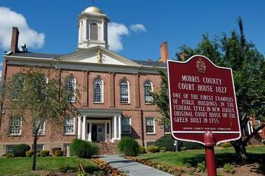
Morris County is a part of Vicinage 10 of the New Jersey Superior Court (along with Sussex County), which is seated at the Morris County Courthouse in Morristown; the Assignment Judge for Vicinage 15 is the Honorable Stuart M. Minkowitz. Law enforcement at the county level includes the Morris County Park Police and the Morris County Sheriff. The judicial organization includes the Morris County Prosecutor's Office.
The 7th and 11th Congressional Districts cover the county. New Jersey's Seventh Congressional District is represented by Leonard Lance (R, Clinton Township). New Jersey's Eleventh Congressional District is represented by Rodney Frelinghuysen (R, Harding Township).
The county is part of the 21st, 24th, 25th, 26th, 27th and 40th Districts in the New Jersey Legislature. For the 2016–2017 session (Senate, General Assembly), the 21st Legislative District of the New Jersey Legislature is represented in the State Senate by Thomas Kean Jr. (R, Westfield) and in the General Assembly by Jon Bramnick (R, Westfield) and Nancy Munoz (R, Summit). For the 2016–2017 session (Senate, General Assembly), the 24th Legislative District of the New Jersey Legislature is represented in the State Senate by Steve Oroho (R, Franklin) and in the General Assembly by Parker Space (R, Wantage Township) and Gail Phoebus (R, Andover Township). For the 2016–2017 session (Senate, General Assembly), the 25th Legislative District of the New Jersey Legislature is represented in the State Senate by Anthony Bucco (R, Boonton Town) and in the General Assembly by Tony Bucco (R, Boonton Township) and Michael Patrick Carroll (R, Morris Township). For the 2016–2017 session (Senate, General Assembly), the 26th Legislative District of the New Jersey Legislature is represented in the State Senate by Joseph Pennacchio (R, Montville) and in the General Assembly by BettyLou DeCroce (R, Parsippany-Troy Hills) and Jay Webber (R, Morris Plains). For the 2016–2017 session (Senate, General Assembly), the 27th Legislative District of the New Jersey Legislature is represented in the State Senate by Richard Codey (D, Roseland) and in the General Assembly by Mila Jasey (D, South Orange) and John F. McKeon (D, West Orange). For the 2016–2017 session (Senate, General Assembly), the 40th Legislative District of the New Jersey Legislature is represented in the State Senate by Kevin J. O'Toole (R, Cedar Grove) and in the General Assembly by David C. Russo (R, Ridgewood) and Kevin J. Rooney (R, Wyckoff). Rooney was sworn into office on December 12, 2016, to fill the seat of Scott Rumana, who had resigned from office on October 20, 2016, to become a judge of the New Jersey Superior Court.
Politics
As of October 31, 2014, there were a total of 330,014 registered voters in Morris County, of which 113,759 (34.5%) were registered as Republicans, 69,956 (21.2%) were registered as Democrats, and 145,973 (44.2%) were registered as Unaffiliated. There were 326 voters registered to other parties.
In the 2008 presidential election, Republican John McCain received 53.3% of the vote here (132,331 cast), ahead of Democrat Barack Obama with 45.2% (112,275 votes) and other candidates with 0.9% (2,310 votes), among the 248,306 ballots cast by the county's 321,254 registered voters, for a turnout of 77.3%. In the 2004 presidential election, Republican George W. Bush received 57.3% of the vote here (135,241 ballots cast), outpolling Democrat John Kerry with 41.6% (98,066 votes) and other candidates with 0.6% (1,847 votes), among the 235,920 ballots cast by the county's 313,745 registered voters, for a turnout percentage of 75.2.
In the 2009 gubernatorial election, Republican Chris Christie received 59.5% of the vote here (99,085 ballots cast), ahead of Democrat Jon Corzine with 31.0% (51,586 votes), Independent Chris Daggett with 8.0% (13,321 votes) and other candidates with 0.6% (1,031 votes), among the 166,516 ballots cast by the county's 314,232 registered voters, yielding a 53.0% turnout.
Taxation
Based on IRS data for the 2004 tax year, Morris County had the tenth-highest average federal income tax liability per return in the country. Average tax liability was $15,296, representing 16.3% of Adjusted Gross Income.
Economy
Morris County has the third-highest median household income in the USA ($77,340).
Business
There are 33 Fortune 500 businesses that have headquarters, offices or a major facility in Morris County. These include AT&T, Honeywell, Colgate-Palmolive, Pfizer, Johnson & Johnson, ExxonMobil, Novartis, BASF, Verizon, and Bayer. Major industries include finance, insurance, real estate, pharmaceuticals, health services, research and development, and technology. There are 13,000 acres (53 km2) set aside for 28 county parks. Four county golf courses and 16 public and private courses are in Morris.
Major employers in the county include:
Education
The County College of Morris is a two-year public community college serving students from Morris County, with its main campus in Randolph and was founded in 1965. Another two-year college, the private Roman Catholic women's college Assumption College for Sisters, is in Mendham.
The Florham Park–Madison–Convent Station area is also the home of three universities. The Florham Campus of Fairleigh Dickinson University, is located on the border of these three municipalities. Drew University is a small, private university in Madison. The College of Saint Elizabeth is a private Roman Catholic, four-year, liberal arts located in Convent Station that has been coeducational starting in September 2016, after being women-only since it opened in 1899.
Municipalities
Municipalities in Morris County (with 2010 Census data for population, housing units and area) are:
Roads and highways
As of 2010, the county had a total of 2,527.39 miles (4,067.44 km) of roadways, of which 2,070.57 miles (3,332.26 km) are maintained by the local municipality, 295.54 miles (475.63 km) by Morris County and 161.28 miles (259.56 km) by the New Jersey Department of Transportation.
Morris County is served by several major roadways, including Interstate 80, Interstate 287, Interstate 280, U.S. Route 206, U.S. Route 202, U.S. Route 46, Route 10, Route 24, together with a number of county and local roads.
Public transportation
NJ Transit also provides rail service with Morris County via its Morris & Essex Lines and Montclair-Boonton Line to Hoboken Terminal and to New York City via its Midtown Direct service. Rail stations are located in the county providing electrified train service seven days a week from: Chatham, Madison, Convent Station, Morristown, Morris Plains, Denville, and Dover on NJ Transit's Morris & Essex Lines; electrified train service seven days a week from Gillette, Millington and Stirling on the Gladstone Branch; and diesel train service (weekdays only) from Mount Arlington, Lake Hopatcong, Netcong, Mount Olive, Mountain Lakes, Boonton, Towaco (Montville) and Lincoln Park.
Bus transportation is also offered by several carriers including Lakeland Bus Company and NJ Transit.
Local media
Climate and weather
In recent years, average temperatures in the county seat of Morristown have ranged from a low of 18 °F (−8 °C) in January to a high of 86 °F (30 °C) in July, although a record low of −26 °F (−32 °C) was recorded in February 1934 and a record high of 104 °F (40 °C) was recorded in August 2001. Average monthly precipitation ranged from 2.91 inches (74 mm) in February to 4.89 inches (124 mm) in September.