Country United States of America Area 143.8 sq mi | ||
 | ||
Unemployment rate 9.0% (Feb 2015) | ||
Map of Port Arthur, Texas
Port Arthur is a city in Jefferson County within the Beaumont−Port Arthur Metropolitan Statistical Area of the U.S. state of Texas. A small portion extends into Orange County. It is ninety-one miles (146 km) east of Houston. It is host to the largest oil refinery in the United States (the 600,00 bpl Saudi Aramco - Motiva refinery).
Contents
- Map of Port Arthur Texas
- Studio 6 port arthur tx horrid condition
- Ego rock janis joplin live rare song about port arthur
- History
- Geography
- Communities
- Climate
- 2010 census data
- 2000 census data
- Economy
- Central business district disintegration
- Hotel Sabine
- Arts and culture
- Government
- Primary and secondary schools
- Colleges
- Public libraries
- Air
- Bus
- Hurricane Audrey
- Hurricane Rita
- Hurricane Humberto
- Tropical Storm Edouard
- Hurricane Ike
- Hurricane Harvey
- Notable people
- Port arthur restaurant owner hopes for success at his taste of the triangle debut
- References

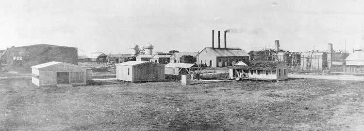
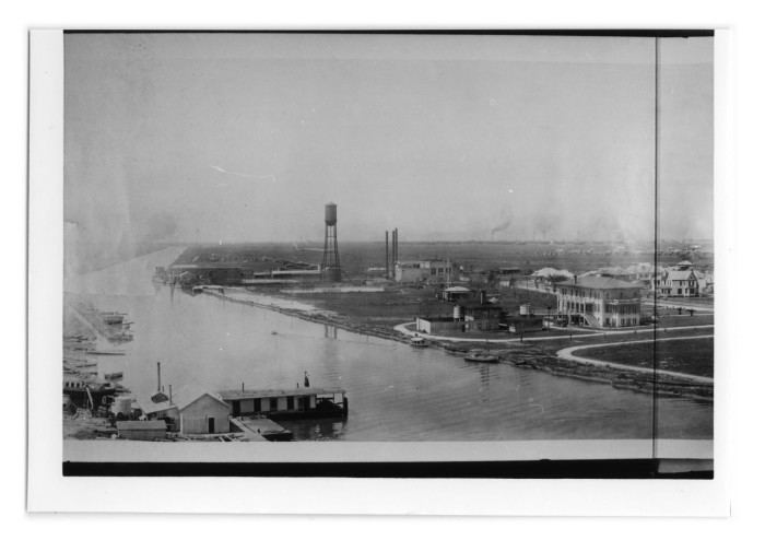
The population of Port Arthur was 53,818 at the 2010 census. Early attempts at settlements in the area had all failed. However, in 1895 Arthur Stilwell founded Port Arthur, and the town quickly grew. Port Arthur was incorporated as a city in 1898 and soon developed into a seaport. It eventually became the center of a large oil refinery network. The Rainbow Bridge across the Neches River connects Port Arthur to Bridge City.

Studio 6 port arthur tx horrid condition
Ego rock janis joplin live rare song about port arthur
History
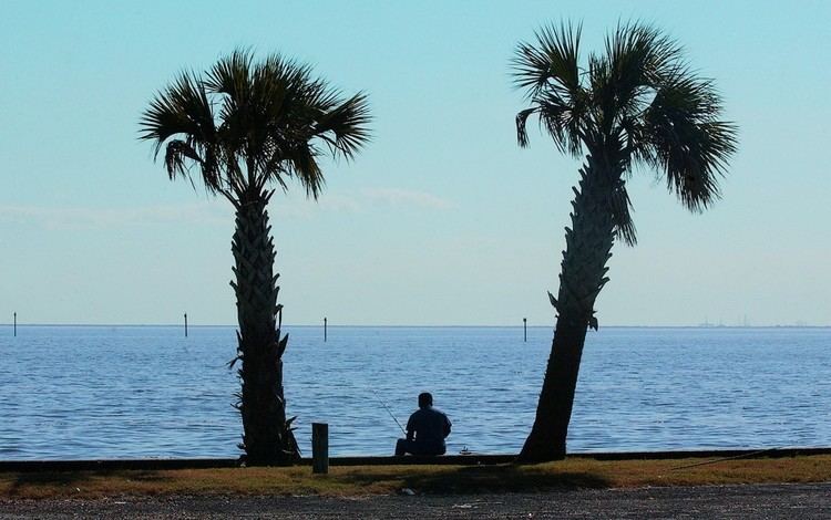
Aurora was an early settlement attempt near the mouth of Taylor Bayou on Sabine Lake, about 14 miles (23 km) long and 7 miles (11 km) wide. It is a saltwater estuary formed by the confluence of the Neches and Sabine rivers. Through its tidal outlet 5 miles (8 km) long, Sabine Pass, Sabine Lake drains some 50,000 square miles (100,000 km2) of Texas and Louisiana into the Gulf of Mexico.
The town was conceived in 1837, and in 1840 promoters led by Almanzon Huston were offering town lots for sale. Some were sold, but Huston's project failed to attract many settlers. The area next was known as Sparks, after John Sparks, who moved his family to the shores of Sabine Lake near the site of Aurora. The Eastern Texas Railroad, completed between Sabine Pass and Beaumont, Texas, passed four miles west of Sparks. However, the American Civil War soon began, and rail lines were removed. In 1886, a destructive hurricane hit the coast, causing the remaining residents to dismantle their homes and move to Beaumont. By 1895, Aurora had become a ghost town.
Arthur Stilwell led the resettling of the area as part of his planned city of Port Arthur. Pleasure Island now separates the city from the Gulf Intracoastal Waterway. The 18.5-mile (29.8 km) man-made island was created between 1899 and 1908 by the Corps of Engineers to support development of the port.
Arthur Stilwell founded the Port Arthur Channel and Dock Company to manage the port facilities. The port officially opened with the arrival of the British steamer Saint Oswald in 1899. (The ship would later sink in 1915, after colliding with the French battleship Suffren during World War I.)
When oil was discovered in the region, Port Arthur developed for a time as the center of the largest oil refinery network in the world.
Geography
Port Arthur is located at 29°53′6″N 93°56′24″W (29.884864, −93.939902) east of Houston. According to the United States Census Bureau, the city has a total area of 143.8 square miles (372.4 km2), of which, 82.9 square miles (214.7 km2) of it is land and 60.8 square miles (157.5 km2) of it (42.32%) is water.
Communities
Communities in Port Arthur include:
Climate
Port Arthur is tied with Lake Charles, Louisiana and Astoria, Oregon, as the most humid city in the contiguous United States. The average relative humidity is 90% in the morning, and 72% in the afternoon.
2010 census data
As of the 2010 census, there were 53,818 people, 20,183 households, and 13,191 families residing in the city. The population density was 654.6 people per square mile (250.5/km²). There were 23,577 housing units at an average density of 284.4 per square mile (109.8/km²). The racial makeup of the city was 41.7% African American, 37.9% White, 1.2% Native American, 6.3% Asian, 0.1% Pacific Islander, and 15.3% from other races. Hispanic or Latino of any race were 29.6% of the population.
There were 20.183 households out of which 30.2% had children under the age of 18 living with them, 39.2% were married couples living together, 19.8% had a female householder with no husband present, and 34.6% were non-families. 30.1% of all households were made up of individuals and 11.1% had someone living alone who was 65 years of age or older. The average household size was 2.63 and the average family size was 3.31.
In the city, the population had 27.0% under the age of 18, 9.7% from 18 to 24, 24.7% from 25 to 44, 25.2% from 45 to 64, and 13.3% who were 65 years of age or older. The median age was 35.3 years. For every 100 females there were 96.9 males. For every 100 females age 18 and over, there were 94.1 males.
2000 census data
As of the census of 2000, the median income for a household in the city was $26,455, and the median income for a family was $32,143. Males had a median income of $30,915 versus $21,063 for females. The per capita income for the city was $14,183. About 22.9% of families and 25.2% of the population were below the poverty line. Out of the total people living in poverty, 35.2% were under age 18 and 14.4% were age 65 or over.
Economy
After decades of stagnation and neglect in the area economy because of a decline in the oil industry, Port Arthur is reviving in the 21st century. Several large projects involving the energy infrastructure are underway or proposed, the two largest being the Golden Pass and Sabine Pass LNG terminals. These separate projects under construction in neighboring Sabine Pass have brought cumulative initial investments of $2 billion, and will employ thousands at peak construction.
Home to a large portion of United States refining capacity, Port Arthur is now seeing renewed investment in several key installations. Motiva Enterprises is undertaking a major addition to its western Port Arthur refinery, expanding capacity to 600,000 barrels per day (95,000 m3/d). This $10.0 billion project is the largest US refinery expansion to occur in 30 years. Premcor Refining (now Valero) recently completed a $775 million expansion of its petrochemical plant, and BASF/Fina commenced operations of a new $1.75 billion gasification and cogeneration unit on premises of its current installation, which had just completed its own $1 billion upgrade. These operations are supported by the Port of Port Arthur, one of Texas' leading seaports. But, Port Arthur still suffers from one of the highest unemployment rates in the state.
The city was the site of an oil spill in 2010, when an oil tanker and barge collided, causing 450,000 gallons of oil to spill into the Sabine/Neches waterway alongside the city.
Central business district disintegration
The commercial center of Port Arthur was at its peak in the early 1900s. Together with the effects of suburbanization, which drew off wealthier residents to new housing away from town, gradually taking businesses with them, from 1960 until 1974, successive waves of economic recession caused much distress in the town. The central business district has many boarded up and vacant locations.
Hotel Sabine
The Hotel Sabine opened at 600 Proctor Street in 1929 and operated as the Vaughn Hotel until the mid-1930s. At 118 feet, ten stories, and the tallest building in Port Arthur, the building is of Beaux-Arts architecture style, built with steel-reinforced concrete and brick on 640 steel-laced wooden cypress pilings driven 60-foot into the ground. It was designed to withstand the most severe coastal storms. The hotel closed down in the mid-1980s.
The Port Arthur News reported August 28, 2010, that "DWA (Digital Workforce Academy) Buys Sabine Hotel", But by November 2011, there were reports that the hotel was slated for demolition. The cost of renovations were estimated at $10– 12,000,000 dollars and demolition estimates as between $500,000 to 1.2 million.
Hurricane Rita struck a direct hit on the Proctor Street Seawall, and damaged many downtown businesses and homes. As economic activity picks up in the region, calls for downtown revitalization have been advanced. The true center of commercial activity has gravitated from downtown to other areas. The main shopping center is Central Mall, opened outside the downtown in 1982.
Arts and culture
Port Arthur's Museum of the Gulf Coast is recognized as the area's definitive collection of items and displays for figures from Port Arthur and the surrounding communities.
Government
The Mayor of Port Arthur is Derrick Ford Freeman
The county operates the Port Arthur Sub-Courthouse in Port Arthur.
The United States Postal Service operates the Port Arthur Post Office, the Port Acres Post Office, and the Sabine Pass Post Office in Sabine Pass.
Primary and secondary schools
Most of the City of Port Arthur is served by the Port Arthur Independent School District. The portion around Southeast Texas Regional Airport is served by the Nederland Independent School District. Some parts are served by Port Neches-Groves Independent School District. The Sabine Pass community is served by the Sabine Pass Independent School District.
The Bob Hope Charter School is located in Port Arthur.
Colleges
Lamar State College–Port Arthur, located in downtown Port Arthur; celebrated its 100th birthday in 2009. Offering a full variety of basic core curriculum classes which credits are transferable throughout Texas public universities, Lamar State College is recognized for associate programs in Commercial Music, Nursing, Legal Assistant and Process technology. Lamar State College also fields competitive teams in Men's Basketball and Women's Softball. The section of Port Arthur within the Sabine Pass School District is assigned to Galveston College in Galveston.
Public libraries
The Port Arthur Public Library, at 4615 9th Avenue at Texas State Highway 73, serves as the public library system for the city.
Air
The Jack Brooks Regional Airport in Port Arthur serves Beaumont and Port Arthur.
Bus
Local bus service is provided by Port Arthur Transit.
Hurricane Audrey
In June 1957, Hurricane Audrey made landfall just east of Port Arthur in Cameron Parish, Louisiana as a Category 3 hurricane. The storm caused extensive wind damage around the city and significant storm surge flooding just east in Southwest Louisiana.
Hurricane Rita
On September 24, 2005, Hurricane Rita made landfall between Sabine Pass, Texas and Johnson Bayou, Louisiana as a Category 3 hurricane. A wind gust of 116 mph (187 km/h) was recorded in Port Arthur. The storm caused widespread significant wind damage throughout the city, with power outages lasting several weeks in some locations. Some areas of the city also received flooding due to Rita.
Hurricane Humberto
On September 13, 2007, Hurricane Humberto made landfall west of Port Arthur as a Category 1 hurricane. The storm moved northeast across the Golden Triangle, causing widespread wind damage; however, most of the damage was relatively minor. An 84 mph (135 km/h) wind gust was recorded at the Southeast Texas Regional Airport just northwest of the city.
Tropical Storm Edouard
On August 5, 2008, Tropical Storm Edouard made landfall just west of Port Arthur. The effects felt in the city were light; however, wind gusts up to 55 mph (89 km/h) were recorded.
Hurricane Ike
On September 13, 2008, Hurricane Ike made landfall on Galveston Island as a Category 2 hurricane. Due to the storm's unusually large size, effects were widespread and were felt across much of Southeast Texas. Port Arthur sustained significant wind damage and much of the city's residents lost power. Fortunately, the Port Arthur seawall protected the city from the major flooding that surrounding cities experienced.
Hurricane Harvey
On August 25, 2017, Hurricane Harvey made landfall near Corpus Christi, Texas as a Category 4 hurricane. On August 29, after Harvey made a second landfall at tropical storm status, 26 inches of rain fell in a single day at the airport near Port Arthur, triggering widespread flash flooding in the city. According to the Port Arthur mayor Derrick Freeman, 20,000 homes were flooded with up to 6 feet of water. On August 30, Freeman posted on Facebook, "Our whole city is underwater right now."
