
Main source East of Colfax, Texas Length 670 km Country United States of America | River mouth Sabine Lake Source Colfax Bridges Rainbow Bridge | |
 | ||
Basin size 10,011 sq mi (25,930 km) Tributaries Left:
Flat Creek
Village Creek
Pine Island Bayou
Right:
Bayou La Nana
Ayish Bayou
Angelina River Waterbodies Rhine Lake
Lake Palestine
Steinhagen Reservoir | ||
Neches river wheelhouse food court february 25 2016
The Neches River (/ˈneɪtʃᵻz/) begins in Van Zandt County east of Rhine Lake and flows for 416 miles (669 km) through east Texas to its mouth on Sabine Lake near the Rainbow Bridge. Two major reservoirs, Lake Palestine and B. A. Steinhagen Reservoir are located on the Neches. Several cities are located along the Neches River Basin, including Tyler, Lufkin, Silsbee, Evadale, Beaumont, Vidor, Port Neches, Nederland, Groves, and Port Arthur.
Contents
- Neches river wheelhouse food court february 25 2016
- Map of Neches River Texas USA
- Canoe kayak neches river wilderness expedition 2011 view wildlife fish camping scout for hunting
- Untamed riverEdit
- Industrialized riverEdit
- Points of interestEdit
- References
Map of Neches River, Texas, USA
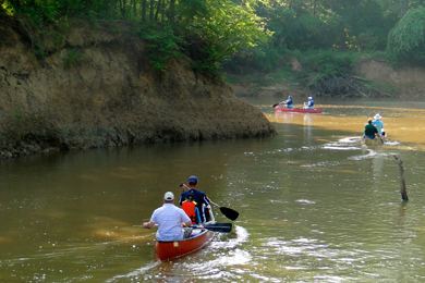
Canoe kayak neches river wilderness expedition 2011 view wildlife fish camping scout for hunting
Untamed riverEdit
With the exception of the manmade lakes, much of the river is in a natural state. For example, from Lake B.A. Steinhagen down to Beaumont, the Neches River flows through the Big Thicket National Preserve. This important ecosphere preserves the area where several ecosystems converge - an event that harkens back to the last glacial period. The Big Thicket Visitor Center is off U.S. Highway 69 several miles north of Kountze.
The Lower Neches Valley Authority is the river authority which oversees the Neches River in Tyler, Hardin, Liberty, Chambers, and Jefferson counties of Texas.
The United States Fish and Wildlife Service purchased land along the Neches River beginning in 2006 for the creation of the Neches River National Wildlife Refuge. The refuge includes land on which Dallas had proposed to build a reservoir to meet the water needs of the city and its surrounding suburbs. Tentatively named Lake Fastrill, this reservoir was not scheduled to be built until 2050. The city of Dallas and the Texas Water Development Board filed a lawsuit in 2007 against the U.S Fish and Wildlife Service, claiming the wildlife refuge was established without considering the economic and environmental impacts. However, in February 2010 the United States Supreme Court ruled in favor of the U.S. Fish and Wildlife Service, paving the way for the acquisition of lands for the wildlife refuge.
Industrialized riverEdit
The lower forty miles of the river, from the Beaumont Interstate 10 bridge to Sabine Lake, is industrialized. The river is a deep water ship channel running between the Port of Beaumont to Sabine Lake. The channel is currently 40 feet deep and 400 ft wide, but is being deepened to 48 feet. The total estimated cost of the Sabine-Neches Waterway project is $1.1 billion. Several petro-chemical plants are also located in the river's southern section. The Sabine-Neches Navigation District, formed in 1909, has management responsibilities of the portion of the river which is part of the Sabine-Neches Waterway.
Points of interestEdit
The Port of Beaumont is located on the Neches River at Beaumont, Texas. It begins near the mouth of the river and the Rainbow Bridge (Texas).
The Big Thicket National Preserve.