
Length 335 mi (539 km) Grade 8% | Use Hiking | |
 | ||
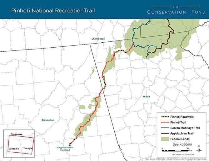
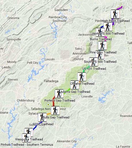
Designation National Recreation Trail (1977) 103.6 miles (166.7 km) in the Talladega National Forest Trailheads | ||
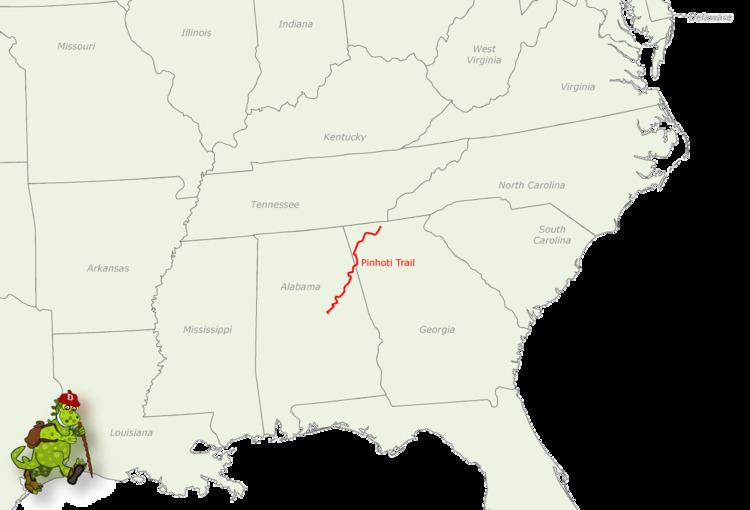
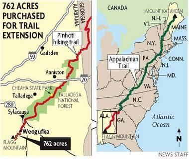
The Pinhoti Trail is a long-distance trail, 335 miles (540 km) long, located in the United States within the states of Alabama and Georgia. The trail's southern terminus is on Flagg Mountain, near Weogufka, Alabama, the southernmost peak in the state that rises over 1,000 feet (300 m). (The mountain is often called the southernmost Appalachian peak, though by most geological reckonings, the actual Appalachian range ends somewhat farther north in Alabama.) The trail's northern terminus is where it joins the Benton MacKaye Trail.
Contents
- Geographic characteristics
- History
- Appalachian Trail designation
- Trails used in the system
- Connecting trails
- Public lands traversed
- References
The Pinhoti Trail is a part of the Eastern Continental Trail and the Great Eastern Trail, both very long-distance US hiking trails connecting multiple states.

Geographic characteristics
The north terminus is approximately 70 miles (110 km) west of Springer Mountain, the southern terminus of the Appalachian Trail.
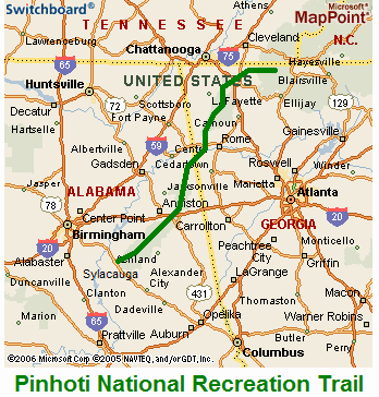
Georgia has about 164 miles (260 km) of the trail, and Alabama contains the other 171 miles (280 km) of the 335-mile-long (540 km) trail.
History
From the Georgia Pinhoti Trail Association website:
"The original plan for the Appalachian Trail was laid out in 1925 at the first Appalachian Trail Conference. This plan showed a main trail running from Cohutta Mountain in north Georgia to Mount Washington in New Hampshire. This plan also proposed a spur trail from Mt. Washington to Mount Katahdin in Maine and one from the Georgia Mountains into Northern Alabama. The spur in Maine was completed in 1940, while the spur into Alabama has yet to be blazed. However, the effort to make this Alabama spur trail a reality is underway and is the result of persistent work of many groups, individuals, agencies and organizations."
Construction of the Alabama Pinhoti Trail began in 1970 within the Talladega National Forest in east central and northeast Alabama. In 1977, the Talledega National Forest portions of the trail were designated a National Recreation Trail. By 1983, 60 miles (100 km) of trail had been constructed and Mike Leonard of the Alabama Wilderness Coalition proposed connecting the Pinhoti to the Appalachian Trail in Georgia. The U.S. Forest Service and Alabama's Forever Wild land trust aided in the acquisition of major wilderness tracts. The Pinhoti Trail currently travels through some of those acquired lands and others in which it is planned to go through.
The Pinhoti Trail was initially completed in February 2008, and officially opened to the public on March 16, 2008. Efforts continue to improve the trail, mainly involving moving road walk sections of the trail onto trails away from the road. A new southern terminus of the trail at the base of Flagg Mountain, opened in March 2015.
Appalachian Trail designation
For many years, Alabama and Georgia hiking groups have been advocating for U.S. Congress to officially designate the Pinhoti Trail as a part of the Appalachian Trail — a move that would make Flagg Mountain the southern terminus of the AT.