
 | ||
The Benton MacKaye Trail or BMT is a footpath nearly 300 miles (480 km) in length in the Appalachian Mountains in the southeastern United States and is blazed by a white diamond, 5" across by 7" tall. The hiking trail was created and is maintained by the Benton MacKaye Trail Association, and it is named for Benton MacKaye, the Massachusetts forester and regional planner who first had the idea for the Appalachian Trail in 1921.
Map of Benton MacKaye Trail, Copperhill, TN 37317, USA
The BMT runs from Springer Mountain in Georgia (sharing the southern terminus of the Appalachian Trail) to Davenport Gap in the Great Smoky Mountains National Park. The trail passes through eight United States Wilderness Areas and Wilderness Study Areas, while traversing three states (Georgia, Tennessee and North Carolina). The lowest elevation (765 ft) on the BMT occurs at the crossing of the Hiwassee River in Tennessee. The highest elevation is the 5,843-foot (1,781 m) summit of Mt. Sterling in the Great Smoky Mountains of North Carolina.
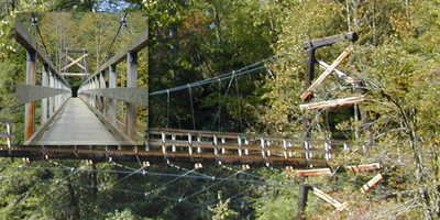
The trail crosses various trout rivers along its path including Shallowford Bridge and The Swinging Bridge over the Toccoa River in GA, the Ocoee, Hiwassee, Upper Bald and Tellico Rivers in TN and the Little Tennessee River in NC. It also crosses Eagle, Hazel, Forney, Noland and Big Creeks in the Smokies, along with Fontana Dam and the Oconaluftee River.