
Peak Phu Lang Ka Width 50 km (31 mi) NE/SW Elevation 624 m | Length 180 km (110 mi) NW/SE Age of rock Early Cretaceous | |
 | ||
State/Province Nong Bua LamphuUdon ThaniSakon NakhonNakhon PhanomKalasinRoi EtMaha SarakhamMukdahan Type of rock Sandstone and siltstone | ||
Phu phan mountains
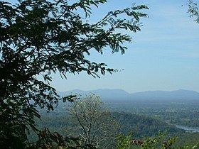
The Phu Phan mountains (Thai: ทิวเขาภูพาน, Thio Khao Phu Phan, [tʰiw kʰǎw pʰuː pʰaːn]) are a range of hills dividing the Khorat Plateau of the Isan region of Thailand into two basins: the northern Sakhon Nakhon Basin, and the southern Khorat Basin.
Contents
The silhouette of the Phu Phan Mountains appears in the provincial seal of Kalasin since they form the northern boundary of the province.
The Phu Phan mountains are among the places in Thailand more severely affected by the Illegal logging of Phayung (Siamese Rosewood) trees. Although officially a protected tree, the cutting and trading of the endangered rosewood trees has been going unabated in Thailand's mountainous forested zones, even in the protected areas. In Thailand and in China this wood is highly valued in the furniture industry.
EtymologyEdit
The name of the range is derived from the characteristic tabletop shape of its peaks, for phan is a kind of traditional tray on a pedestal.
Phu is the word for mountain in the Isan/Lao language (as opposed to khao in Central and Southern Thai and doi in Northern Thai).
GeographyEdit
The Phu Phan Mountains rise above the plateau and are not prominent. They straddle most of the provinces of northern and eastern Isan, including Khon Kaen, Nong Bua Lamphu, Udon Thani, Sakon Nakhon, Nakhon Phanom, Kalasin, Roi Et, Maha Sarakham and Mukdahan Province.
The highest elevation of the Phu Phan Range is the 641 m high summit known as Phu Lang Ka. It is located in Nakhon Phanom Province. Other important peaks are 624 m high Phu Mai Hia in Mukdahan Province and the 563 m high summit known as Phu Langka Nuea in Nakhon Phanom Province.
The hills are mostly deforested, although patches covered with mixed deciduous forest remain in zones spread across the range.
The Phu Phan Royal Palace is located within the area of the mountains, as is the Nam Un dam. Other local sights are Lake Nong Han near Sakon Nakhon and the Khmer style chedi ruins of Phu Phek, dating from 1050.
Protected areasEdit
The area of the Phu Phan mountains includes national parks and other protected areas: