
South end: WV 69 near Garrison Length 329.9 km | Constructed 1928 | |
 | ||
Counties | ||
Pennsylvania Route 18 (PA 18) is a major north–south highway in Western Pennsylvania whose southern terminus is at West Virginia Route 69 at the state line in Greene County, Pennsylvania near the village of Garrison, while the northern terminus is at PA Route 5 in Lake City, Pennsylvania. At a length of 205 miles (330 km), PA 18 is one of the few state routes in Pennsylvania — north–south or east–west — to traverse the entire state. It also has the distinction of being the longest state route in Pennsylvania.
Contents
- Map of PA 18 Pennsylvania USA
- Greene County
- Washington County
- Beaver County
- Lawrence County
- Mercer County
- Crawford County
- Erie County
- History
- PA 18 Truck Washington
- PA 18 Truck New Castle
- References
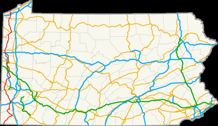
Map of PA-18, Pennsylvania, USA
Greene County
Traveling northward from West Virginia Route 69 at the West Virginia state line, Route 18 winds through rural Greene County, passing through the villages of Garrison, New Freeport, Nettle Hill, White Cottage, Woodruff, and Holbrook, before making its first junction with another state highway, PA Route 21, just west of the village of Rogersville and over 15 miles (24 km) from the state line. Here the two routes overlap for nearly 6 miles (9.7 km), winding east-northeast through Rogersville and the village of East View, crossing the South Fork of Ten Mile Creek numerous times before reaching the village of West Waynesburg. At this point, Route 18 leaves the concurrency and turns northwest, traveling 12 miles (19 km) to the county line, following along Browns Creek, and passing through the villages of Rees Mill, Sycamore, and Nineveh.
Washington County
Route 18 enters Washington County, and intersects with the eastern terminus of PA Route 231 and turns to the northeast and traveling over 5 miles (8.0 km), passing near the villages of Old Concord and Sparta. Next, the route meets PA Route 221, and the two overlap for just over a mile, heading northwest through the village of Prosperity. After the village, Route 18 leaves the concurrency and heads northward through the villages of Van Buren, Lagonda, and Gabby Heights as it approaches the city of Washington nearly 10 miles (16 km) later. In Washington, Route 18 briefly overlaps with US 40, and the routes head west, intersect with the western terminus of PA Route 136, and then turn northwest. US 40 then leaves the concurrency, and nearly a mile later, Route 18 interchanges with I-70, connecting via city streets to the entrance and exit ramps. Before departing the city, 0.4 miles (0.64 km) later, the route intersects with the eastern terminus of PA Route 844, turns northward, and passes through the village of Oak Grove. Route 18 passes through the village of Gretna 8.5 miles (13.7 km) later and then overlaps with PA Route 50 for 0.5 miles (0.80 km) a couple miles west of the village of Hickory before continuing north-northwest. The route then passes by the village of Atlasburg and through the village of Slovan before reaching the borough of Burgettstown 7.5 miles (12.1 km) later. Route 18 meets US 22 nearly 4 miles (6.4 km) north of the borough, and then passes through the village of Florence at Old US 22 before reaching the county line just over 3 miles (4.8 km) later.
Beaver County
The route enters the borough of Frankfort Springs as it enters Beaver County, and meets the southern terminus of PA Route 168 at the north end of the borough. Passing through nearly 5 miles (8.0 km) of state park land, Route 18 eventually meets US 30 in the village of Harshaville. The route then junctions with PA Route 151 at the village of Mechanicsburg about 1.5 miles (2.4 km) later, and then passes through the village of McCleary. As Route 18 approaches the Ohio River, it turns east-northeast before its first interchange with I-376 about 2 miles (3.2 km) west of the borough of Monaca. The route enters the borough, turns north-northwest, crosses the Ohio River on the Rochester-Monaca Bridge, and enters the borough of Rochester. In Rochester, Route 18 intersects with the PA Route 51/PA Route 65 overlap, and then PA Route 68 before turning northwest, west, then north-northwest. It then merges with PA Route 65 along the east bank of the Beaver River. The concurrency enters the borough of New Brighton, where Route 18 then leaves the concurrency over 2 miles (3.2 km) later, crosses the Beaver River, enters the city of Beaver Falls, and continues northward almost 2 miles (3.2 km). Route 18 briefly joins with PA Route 588, and then intersects with the southern terminus of PA Route 551 2 miles (3.2 km) later, just before leaving the city and entering the borough of Big Beaver. The route then passes through the borough of Homewood about 1.5 miles (2.4 km) later, and re-enters Big Beaver, where it interchanges with I-76 and The Pennsylvania Turnpike. Route 18 then passes through the borough of Koppel nearly 1.5 miles (2.4 km) later, where it intersects with PA Route 351, and then re-enters Big Beaver a third time before leaving Beaver County 1.3 miles (2.1 km) later.
Lawrence County
As the route enters Lawrence County, it also enters the borough of New Beaver. Route 18 then turns northwestward, and passes through the borough of Wampum 2 miles (3.2 km) later, where it intersects with the western terminus of PA Route 288. The route re-enters New Beaver, then turns northward before its second intersection with PA Route 168 over 3.5 miles (5.6 km) later, near the village of Moravia. Route 18 enters the city of New Castle nearly 4 miles (6.4 km) later as it crosses the Mahoning River, and then meets PA Route 108. The two join and turn east, then northeast through the village of Mahoningtown, situated between the Mahoning and Shenango rivers. The concurrency then passes under US 422 about 0.8 miles (1.3 km) later before turning eastward and crossing the Shenango River. The concurrency then intersects 1.3 miles (2.1 km) later with PA Route 168, and the three routes overlap for 0.9 miles (1.4 km), heading northward. Routes 108 and 168 then leave the concurrency, and Route 18 continues northward. The route is then joined with Business US 422 near downtown New Castle for nearly 0.5 miles (0.80 km). Business US 422 then leaves westward and Route 18 continues northward out of the city. Route 18 passes through the village of Walmo, and then intersects 4 miles (6.4 km) north of New Castle with Mitchell Rd., which carries traffic to I-376 parallel to and west of Route 18. Over 1.6 miles (2.6 km) later, the route intersects with the southern terminus of PA 158 south of the borough of New Wilmington, and 2.3 miles (3.7 km) later with PA 208 west of the borough just before exiting Lawrence County 0.5 miles (0.80 km) north of the intersection.
Mercer County
Upon entering Mercer County, the route winds northwesterly a few miles before turning west, where it has its second interchange with I-376 4.5 miles (7.2 km) later. Route 18 then turns northwesterly again, intersecting with the northern terminus of PA Route 551 0.4 miles (0.64 km) later, and enters the borough of West Middlesex a mile after that. Here, the route intersects with PA Route 318. Turning northward, the route then passes under I-80 and has an interchange with PA Route 760 immediately after (Route 18 traffic interchanges with I-80 via this PA Route 760 interchange). Route 18 then enters the city of Hermitage, intersects with the southern terminus of PA Route 518 a mile north of PA Route 760 at the village of Bobby’s Corners, and continues about 2 miles (3.2 km) before intersecting with US 62 and then Business US 62 less than 0.3 miles (0.48 km) later. Over 1.5 miles (2.4 km) after that, the route intersects with the northern terminus of PA Route 518 at the village of Lamont’s Corners east of the borough of Sharpsville before leaving Hermitage. The route enters the borough of Clark about 2.2 miles (3.5 km) later, where it intersects with the northern terminus of PA Route 258. Route 18 then crosses the Shenango River Reservoir, then passes near the villages of Transfer, Reynolds Heights, and Shenango before entering the borough of Greenville 8 miles (13 km) north of Clark. In Greenville, Route 18 intersects with the northern terminus of PA Route 846 just before its junction with PA Route 358. Here, the two routes overlap, heading eastward, and cross the Shenango River once again, before intersecting about 0.5 miles (0.80 km) later with PA Route 58, which joins the concurrency for about a quarter mile. Routes 18 and 58 then leave Route 358 and head northward. Less than a half mile later, Route 18 leaves the concurrency, turning northeastward, then northward, leaving Greenville. The Route continues through rural northern Mercer County about 4.5 miles (7.2 km) before passing through the village of Osgood, and leaves Mercer County less than a mile later.
Crawford County
After entering Crawford County, Route 18 then passes through the village of Adamsville about 2 miles (3.2 km) north of the county line, and, over 2.5 miles (4.0 km) later, enters the village of Hartstown, where it joins US 322, heading east-northeast. They travel over 5 miles (8.0 km) to the borough of Conneaut Lake, where they serve Conneaut Lake Park and join with US 6/PA Route 285, heading east. Route 285 leaves the concurrency one block later, and the remaining routes continue eastward out of the borough, nearly a mile later, where Route 18 then leaves the concurrency and heads northward. About 3.5 miles (5.6 km) north of the borough, Route 18 intersects with the northern terminus of PA Route 618 near Conneaut Lake Park, and then passes through the village of Harmonsburg. About 7.5 miles (12.1 km) later, the route is joined by PA Route 198, and the concurrency enters the borough of Conneautville. In the borough, Route 198 leaves the concurrency nearly 0.9 miles (1.4 km) later, and Route 18 continues northward, passing through the borough of Springboro just over 3 miles (4.8 km) north of Conneautville.
Erie County
Over 3.5 miles (5.6 km) north of Springboro, the route crosses into Erie County, and enters the borough of Albion nearly 3 miles (4.8 km) later. Here, Route 18 joins US 6N eastward about 1.5 miles (2.4 km), leaving the borough, where Route 18 turns northward. A mile later, the route passes through the borough of Cranesville, and then enters the borough of Platea about 3 miles (4.8 km) later, where it interchanges with I-90. Just over 2 miles (3.2 km) northward, Route 18 joins US 20 eastward into the borough of Girard for 1-mile (1.6 km), before leaving the concurrency and turning northward. Upon exiting Girard, the route enters the borough of Lake City, where it terminates at PA Route 5 near the shore of Lake Erie.
History
PA 18 Truck (Washington)
Pennsylvania Route 18 Truck is a truck route of PA 18 that is located near Washington, Pennsylvania.
The westbound exits and entrances of I-70 lead to a narrow street (called East Wylie Avenue) connecting to PA 18, thus making it harder for trucks to access PA 18. So, it follows I-70 west. It exits at exit 16, following Ridge Road. Then, it creates a U-Turn back onto I-70 east and exits off PA 18.
PA 18 Truck (New Castle)
Pennsylvania Route 18 Truck is a truck route around a weight-restricted bridge over the Shenango River on which trucks over 30 tons are prohibited. The route follows PA 108, I-376, US 422, and PA 168. The route was signed in 2013.