
Congressional districts 3rd, 12th Website www.co.lawrence.pa.us Founded 20 March 1849 | Area 940.2 km² Population 89,333 (2013) | |
 | ||
Colleges and Universities Westminster College, New Castle School of Trades, New Castle Beauty Academy Points of interest Living Treasures Animal P, Cascade Park, Ewing Park, Pearson Park, Arts & Education at the Hoyt Destinations | ||
Lawrence County is a county located in the U.S. state of Pennsylvania, United States. As of the 2010 census, the population was 91,108. The county seat is New Castle.
Contents
- Map of Lawrence County PA USA
- History
- Geography
- Adjacent counties
- Demographics
- Micropolitan Statistical Area
- Government and politics
- County commissioners
- Other county officials
- State Representatives
- State Senators
- US Representative
- Colleges
- Public school districts
- Tech schools
- Private schools
- Libraries
- Airports
- Public transit
- Major roads
- Parks
- State Game Lands
- Trails
- Municipalities
- City
- Census designated places
- Unincorporated communities
- Former community
- Population ranking
- References
Map of Lawrence County, PA, USA
Lawrence County makes up the entire New Castle, PA Micropolitan Statistical Area, which is also included in the larger Pittsburgh-New Castle-Weirton, PA-WV-OH Combined Statistical Area.
History
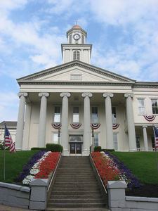
Lawrence County was created on March 20, 1849, from parts of Beaver and Mercer counties due to the rapid growth of New Castle, which was primarily in Mercer County but was rapidly expanding into Beaver County. The former borders between Beaver and Mercer Counties are still evident in Lawrence County today, as the northern borders of North Beaver Township, Shenango Township, and Slippery Rock Township with (respectively) the southern borders of Mahoning Township, Hickory Township, and Scott Township make up the former boundaries between Beaver and Mercer Counties. In addition, County Line Road in New Castle where the Lawrence County Courthouse is located also marks the former boundaries.
It was named after naval officer James Lawrence, who died during the War of 1812.
Geography
According to the U.S. Census Bureau, the county has a total area of 363 square miles (940 km2), of which 358 square miles (930 km2) is land and 4.5 square miles (12 km2) (1.3%) is water. Major waterways are the Shenango River, Neshannock Creek and the Mahoning River which form the Beaver River. Also, the Slippery Rock Creek and Connoquenessing Creak empty into the Beaver River.
Adjacent counties
Demographics
As of the 2000 United States Census there were 94,643 people, 37,091 households, and 25,889 families residing in the county. The population density was 263 people per square mile (101/km²). There were 39,635 housing units at an average density of 110 per square mile (42/km²). The racial makeup of the county was 94.98% White, 3.61% Black or African American, 0.10% Native American, 0.27% Asian, 0.01% Pacific Islander, 0.19% from other races, and 0.84% from two or more races. 0.56% of the population were Hispanic or Latino of any race. 26.1% were of Italian, 21.7% German, 9.3% Irish, 6.8% English and 6.8% Polish ancestry according to Census 2000.
There were 37,091 households out of which 28.80% had children under the age of 18 living with them, 54.50% were married couples living together, 11.50% had a female householder with no husband present, and 30.20% were non-families. 27.00% of all households were made up of individuals and 14.40% had someone living alone who was 65 years of age or older. The average household size was 2.47 and the average family size was 3.00.
In the county, the population was spread out with 23.10% under the age of 18, 8.30% from 18 to 24, 25.70% from 25 to 44, 23.60% from 45 to 64, and 19.30% who were 65 years of age or older. The median age was 40 years. For every 100 females there were 90.60 males. For every 100 females age 18 and over, there were 86.90 males.
Micropolitan Statistical Area
The United States Office of Management and Budget has designated Lawrence County as the New Castle, PA Micropolitan Statistical Area (µSA). As of the 2010 U.S. Census the micropolitan area ranked 3rd most populous in the State of Pennsylvania and the 48th most populous in the United States with a population of 91,108. Lawrence County is also a part of the Pittsburgh-New Castle-Weirton, PA-OH-WV Combined Statistical Area (CSA), which combines the population of Lawrence, as well as the Allegheny, Armstrong, Beaver, Butler, Fayette, Indiana, Washington and Westmoreland county areas in Pennsylvania. In West Virginia the counties included are Brooke and Hancock. And in Ohio, Jefferson County. The Combined Statistical Area ranked 4th in the State of Pennsylvania and 20th most populous in the United States with a population of 2,660,727.
Government and politics
As of November 2008, there are 62,505 registered voters in Lawrence County.
County commissioners
Other county officials
State Representatives
State Senators
US Representative
Colleges
Public school districts
Tech schools
Private schools
Per data provided at Pennsylvania EdNA
Libraries
Airports
Public transit
Major roads
Parks
State Game Lands
Trails
Municipalities
Under Pennsylvania law, there are four types of incorporated municipalities: cities, boroughs, townships, and, in at most two cases, towns. The following cities, boroughs and townships are located in Lawrence County:
City
Census-designated places
Census-designated places are geographical areas designated by the U.S. Census Bureau for the purposes of compiling demographic data. They are not actual jurisdictions under Pennsylvania law. Other unincorporated communities, such as villages, may be listed here as well.
Unincorporated communities
Various unincorporated communities that lie within and are part of official municipalities.
Former community
Population ranking
The population ranking of the following table is based on the 2010 census of Lawrence County.
† county seat