
Founded March 12, 1800 Population 87,376 (2013) | Congressional district 3rd Area 2,688 km² Unemployment rate 4.5% (Apr 2015) | |
 | ||
Website www.crawfordcountypa.net Colleges and Universities Allegheny College, University of Pittsburg, Precision Manufacturing Institute Points of interest Conneaut Lake Park, Drake Well Museum, Woodcock Lake Park, PennDOT Road Sign Sculpture, Lago Winery | ||
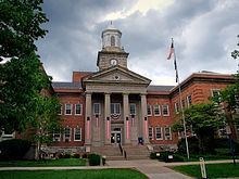
Crawford County is a county located in the U.S. state of Pennsylvania. As of the 2010 census, the population was 88,765. Its county seat is Meadville. The county was created on March 12, 1800, from part of Allegheny County and named for Colonel William Crawford.
Contents
- Map of Crawford County PA USA
- Geography
- Adjacent Counties
- National protected area
- State protected area
- Demographics
- Micropolitan Statistical Area
- County Commissioners
- Other county officials
- Colleges and universities
- Community junior and technical colleges
- Public school districts
- Communities
- Cities
- Census designated places
- Unincorporated communities
- Population ranking
- References
Map of Crawford County, PA, USA
Crawford County comprises the Meadville, PA Micropolitan Statistical Area, which is also included in the Erie-Meadville, PA Combined Statistical Area.
Geography
According to the U.S. Census Bureau, the county has a total area of 1,038 square miles (2,690 km2), of which 1,012 square miles (2,620 km2) is land and 25 square miles (65 km2) (2.4%) is water.
Adjacent Counties
National protected area
State protected area
Pymatuning State Park is on Pymatuning Reservoir.
Demographics
As of the census of 2000, there were 90,366 people, 34,678 households, and 23,858 families residing in the county. The population density was 89 people per square mile (34/km²). There were 42,416 housing units at an average density of 42 per square mile (16/km²). The racial makeup of the county was 97.00% White, 1.59% Black or African American, 0.20% Native American, 0.28% Asian, 0.03% Pacific Islander, 0.13% from other races, and 0.77% from two or more races. 0.59% of the population were Hispanic or Latino of any race. 26.7% were of German, 11.7% American, 11.3% Irish, 10.8% English, 7.6% Italian and 5.4% Polish ancestry according to Census 2000.
There were 34,678 households out of which 30.40% had children under the age of 18 living with them, 55.60% were married couples living together, 9.20% had a female householder with no husband present, and 31.20% were non-families. 26.20% of all households were made up of individuals and 11.60% had someone living alone who was 65 years of age or older. The average household size was 2.50 and the average family size was 3.01.
In the county, the population was spread out with 24.70% under the age of 18, 9.20% from 18 to 24, 26.60% from 25 to 44, 23.90% from 45 to 64, and 15.60% who were 65 years of age or older. The median age was 38 years. For every 100 females there were 94.80 males. For every 100 females age 18 and over, there were 90.80 males.
Micropolitan Statistical Area
The United States Office of Management and Budget has designated Crawford County as the Meadville, PA Micropolitan Statistical Area (µSA). As of the 2010 U.S. Census the micropolitan area ranked 5th most populous in the State of Pennsylvania and the 52nd most populous in the United States with a population of 88,765. Crawford County is also a part of the Erie-Meadville, PA Combined Statistical Area (CSA), which combines the population of both Crawford County and the Erie County areas. The Combined Statistical Area ranked 7th in the State of Pennsylvania and 102nd most populous in the United States with a population of 369,331.
County Commissioners
Other county officials
Colleges and universities
Community, junior and technical colleges
Laurel Technical Institute (LTI)
Public school districts
Communities
Under Pennsylvania law, there are four types of incorporated municipalities: cities, boroughs, townships, and, in at most two cases, towns. The following cities, boroughs and townships are located in Crawford County:
Cities
Census-designated places
Census-designated places are geographical areas designated by the U.S. Census Bureau for the purposes of compiling demographic data. They are not actual jurisdictions under Pennsylvania law.
Unincorporated communities
Population ranking
The population ranking of the following table is based on the 2010 census of Crawford County.
† county seat