
Vehicle registration GJ | Time zone IST (UTC+5:30) Website gujaratindia.com | |
 | ||
Points of interest | ||
Girls hostel in panchmahal district gujarat
Panchmahal, also Panch Mahals, is a district in the eastern portion of Gujarat State western India. Panch-mahal means "five tehsils/talukas" (5 sub-divisions), and refers to the five sub-divisions that were transferred by the Maharaja Jivajirao Scindia of Gwalior State to the British: Godhra, Dahod, Halol, Kalol and Jhalod. The district had a population of 2,025,277 of which 12.51% were urban as of 2001. Headquarters: Godhra.
Contents
- Girls hostel in panchmahal district gujarat
- Map of Panchmahal Gujarat
- History
- Economy
- Talukas
- Demographics
- References
Map of Panchmahal, Gujarat
The district is located on eastern end of the state. It is bordered by Dahod District to the north-east & east, Vadodara District to the south (southeast and southwest also), Kheda District to the west and Sabarkantha District to the northwest. Banswara District of Rajasthan State also borders the district in the northeast.
History
The history of Panchmahals district revolves around the city of Champaner. Panch mahal is a Hindi or Gujarati word derived from Panch ("five") and Mahal ("palace"). It was established in the 7th century (647) in the territory of King Vanraj Chavda of Chavda dynasty. In the 13th century, Chauhans acquired the city from Muslim rulers under Alauddin Khilji. Their rule continued until 1484, when Sultan Mahmud Begada of Gujarat captured the city. Thereafter Godhra became center of the district under the Mughal Empire (1575 to 1727).
The Panchmahal were conquered from the Mughal Empire by the Maratha general Sindhia in the 18th century. In the course of time, Sindhia dynasty became Maharajas of Gwalior State and, after 1818, were forced to recognize British sovereignty. The Panch Mahals were transferred in 1861 by the Sindhias to British India, where they became a district in the Gujarat Division of Bombay Province. The British district consisted of two parts, the "western mahals" and the "eastern mahals," which were divided by the territories of Baria (Devgadh) and Sanjeli states. The western portion was for the most part a level plain of rich soil; while the eastern portion, although it comprised few fertile valleys, was generally rugged, undulating and barren, with little cultivation. The area of the British district was 1606 sq. mi., and the population was 261,020 in 1901. The administrative headquarters were at Godhra with a population (1901) of 20,915. The ruins of Champaner, the former capital of a Hindu kingdom and later of the Sultans of Gujarat, was included in the district. It was the only district of Bombay presidency that is administered on the non-regulation system, the colonial Collector being also the agent to the Governor General of India (Political Agent) for Rewa Kantha Agency.
The mineral products comprised sandstone, granite and other kinds of building stone. Mining for manganese on a large scale was begun by a European firm. The principal crops were maize, millets, rice, pulse and oilseeds; there were manufactures of lac bracelets and lacquered toys; the chief export was timber. Both portions of the district were crossed by the branch of the Baroda, Bombay & Central India Railways (B.B.&C.I.R) from Anand, through Godhra and Dahod, to Ratlam; a chord line was opened in 1904 from Godhra to Baroda city. The district suffered very severely from the famine of 1899-1900, and its population decreased 17% from 1891 to 1901 owing to the famine. In 1960, Gujarat State was created and Panchmhals became one of the districts in the state, with district headquarters at Godhra. In 1997, District Panchmahals was divided into two districts Panchmahals (with district headquarters at Godhra) and a new district of Dahod was created.
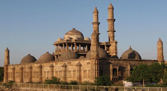
Champaner is a World Heritage Site. Pavagarh hosts a temple of Kalika mata, whose holy shrine attracts about two million pilgrims per annum.
Economy
In 2006 the Ministry of Panchayati Raj named Panchmahal one of the country's 250 most backward districts (out of a total of 640). It is one of the six districts in Gujarat currently receiving funds from the Backward Regions Grant Fund Programme (BRGF).
Talukas
Panchmahal district is further divided in 11 Talukas for administrative purposes. Following is the list of Talukas of Panchmahal district :
Demographics
According to the 2011 census Panchmahal district has a population of 2,388,267, roughly equal to the nation of Latvia or the US state of New Mexico. This gives it a ranking of 187th in India (out of a total of 640). The district has a population density of 458 inhabitants per square kilometre (1,190/sq mi) . Its population growth rate over the decade 2001-2011 was 17.92%. PanchMahal has a sex ratio of 945 females for every 1000 males, and a literacy rate of 72.32%.