
Elevation 921 m | Prominence 555 m | |
 | ||
Similar Chilhowee Mountain, Big Frog Mountain, Blue Ridge Mountains, Bald River Falls | ||
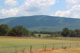
Oswald Dome (elevation 3,022 ft, 921 m) is a mountain located in the Cherokee National Forest in Polk County, Tennessee.
Contents
Map of Oswald Dome, Tennessee 37307, USA
DescriptionEdit
Oswald Dome is located at approximately 3.2 miles west of Reliance, 5.5 miles northeast of Benton, and 2.9 miles south-southeast of Delano. The Hiwassee River flows along the north base. The mountain is accessible by Oswald Dome Road, a forest service road which connects to U.S. 64, and two trails. The Lowry Cove Trail begins on top of the mountain and heads north. Several radio/television transmitters are located on atop the mountain. A fire tower was moved from the mountain to the Ocoee Whitewater Center in 2006.
TowersEdit
References
Oswald Dome Wikipedia(Text) CC BY-SA