
- elevation 682 ft (208 m) Length 237 km Source Rocky Mountain | - elevation 3,640 ft (1,109 m) Basin area 6,993 km² Basin area 2,590 km² | |
 | ||
- average 2,431 cu ft/s (69 m/s) (mean for water years 1942-1979) - max 47,100 cu ft/s (1,334 m/s) May 1973 Cities Chattanooga, Charleston, Calhoun | ||
6 fishing the hiwassee river tn fishing the top 100 trout streams in america
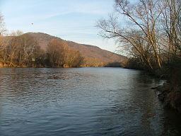
The Hiwassee River has its headwaters on the north slope of Rocky Mountain in Towns County in northern Georgia and flows northward into North Carolina before turning westward into Tennessee, flowing into the Tennessee River a few miles west of State Route 58 in Meigs County, Tennessee. The river is 147 miles (237 km) long.
Contents
- 6 fishing the hiwassee river tn fishing the top 100 trout streams in america
- Map of Hiwassee River Tennessee USA
- Crappie fishing hiwassee river tennessee
- HydrographyEdit
- EtymologyEdit
- HistoryEdit
- Early Spanish contactEdit
- British colonial influencesEdit
- 18th century Cherokee homelandEdit
- American Revolutionary War effectsEdit
- NotabilityEdit
- References
Map of Hiwassee River, Tennessee, USA
Crappie fishing hiwassee river tennessee
HydrographyEdit
The river is dammed by the Tennessee Valley Authority (TVA) in four locations, all in western North Carolina. Chatuge Dam, Mission Dam, Hiwassee Dam, and Apalachia Dam. Water is diverted from the stream bed at Apalachia Dam and sent through a pipeline which is tunneled through the mountains for eight miles (13 km), then gravity-fed through the Apalachia Powerhouse to generate electricity. The stretch of the river that flows between Apalachia Dam and Apalachia Powerhouse features reduced flow and is shadowed by the John Muir Trail in Tennessee's Cherokee National Forest.
The 23-mile (37 km) stretch of river that flows from the North Carolina/Tennessee state line to U.S. Highway 411 near Delano is designated a State Scenic River (Class III Partially Developed River) and for recreational purposes is managed by the state Resource Management Division, in cooperation with TVA.
The river features Class I through Class III rapids, depending on water levels.
After exiting the mountains through a gorge, the Hiwassee flows under US-411 and broadens, meandering through rural Polk and Bradley counties. The river crosses under U.S. Route 11 at Calhoun and Charleston, Tennessee, where local industries such as Bowater Newsprint Mill and Arch/Olin Chemical use river water in their operations. At this point the river interfaces with the impoundment of Chickamauga Dam (located in Chattanooga, Tennessee), and many marshes and wetlands surround the main channel, providing areas for hunting and fishing. The Hiwassee passes under Interstate 75 on the border of McMinn and Bradley counties. The Hiwassee continues westward to pass under TN-58's historic, and narrow, bridge (this bridge has been replaced with a wide and modern bridge) on its way to the confluence with the Tennessee River. This area of the river is enjoyed by boaters, fishermen, and water skiers.
Major tributaries include Valley River, Nottely River, Coker Creek, Big Lost Creek, Spring Creek, Conasauga Creek, and Toccoa/Ocoee River.
EtymologyEdit
The Hiwassee River has been known by many variant spellings. The best-known of these is Hiawassee, which is also the name of the Georgia town through which the river flows. Other alternate spellings include Heia Wassea and Highwassee, and some less obvious related names include Eufasee, Eufassee, Euphasee and Quannessee. Some Cherokee say the name came from the Cherokee word Ayuhwasi, which means a meadow or savanna. The Muskogee (Creek) say the river's name is the Koasati and Hitchiti, Creek language words for the copperhead snake. The river is known for its many copperheads, even today.
HistoryEdit
Various Muskogean ethnic groups occupied the region for many centuries before the arrival of the Cherokee. Some historians originally thought that because the Europeans had encountered the Cherokee in the Hiwassee Valley in the 18th century, they had occupied the territory for a much longer period, but this is not the case.
Early Spanish contactEdit
Spanish explorers visited the region in the 16th century. Hernando de Soto probably crossed the Hiwassee River near its confluence with the Tennessee River at Hiwassee Island, in the spring of 1541 AD. Juan Pardo probably followed a trail that paralleled the river in 1567 AD. All town names and indigenous words that were recorded by de Soto's chroniclers in present-day Georgia, North Carolina and Tennessee, can be easily translated by contemporary Muskogean dictionaries. Most of the words are of the Koasati and Hitchiti languages, but a few are Muskogean and Alabama words. None of the words are Cherokee.
The earliest European maps from the 17th century vaguely show the Hiwassee River Basin occupied by a mountain branch of the Apalachee and the Kusa. The Kusa (or Coosa in English) were one of the ancestral branches of the "Upper Creek" (or Muscogee). The Tama-tli of the Altamaha River Basin in southeastern Georgia are known to have had a colony in the valley between Andrews, North Carolina and the Hiwassee River at Murphy, North Carolina.
British colonial influencesEdit
The initial contacts by English explorers and traders in the 1690s found most of the river valley occupied by Muskogean and Yuchi towns. Cherokee villages were east and north of the river at this time. In 1714, two traders in South Carolina supplied the Cherokee with firearms and directed them to attack the Yuchi villages on the Hiwassee River. Most of the men in one Yuchi town were gone when the Cherokee attacked. Without firearms, the remaining Yuchi were massacred.
In 1715, the Cherokee invited the leaders of the many Muskogean provinces that would eventually comprise the Creek Confederacy to a diplomatic conference at Tugaloo at the headwaters of the Savannah River. They murdered the Muskogean leaders in their sleep. This precipitated a 40-year-long war between the Creek and the Cherokee. Due to disunity among the Creek, the Cherokee were able to occupy the northeastern tip of what is now Georgia, but then was part of South Carolina. They also drove the Muskogee and Yuchi from most of North Carolina west and south of the Hiwassee. Most of the branches of the Creek lost interest in this war after a few years.
18th century Cherokee homelandEdit
The Hiwassee River and its tributaries were part of Cherokee territory in the early 18th century. A town known as "Hiwassee" (Ayuhwasi) was located near the mouth of Peachtree Creek near Murphy, North Carolina. The Valley River contained many Cherokee towns, sometimes collectively called the "Valley Towns", from today's Andrews, North Carolina, near the headwaters of Valley River to its mouth at Murphy. The Cherokee town known as Great Hiwassee (Ayuhwasi Egwahi) was located in today's Polk County, Tennessee, where the Hiwassee River emerges from the mountains.
The Indians had several "highways" which passed through the area. The Great Trading Path, the Overhill Trading Path, and the Unicoi Turnpike ran along much of the Hiwassee River. Another old path known as the Warrior Path ran from southern lands to Great Hiwassee and then up the Conasauga Creek to the Cherokee town known as Great Tellico.
The Kowita Creek (Muscogee), whose homeland was in the North Carolina mountains (east of present-day Franklin and south of Asheville), continued to fight the Cherokee by themselves. By the 1750s, the Kowita had developed such a powerful military machine that they could consistently defeat any branch of the Cherokee that they encountered. By 1755, they had destroyed all of the Cherokee towns in Georgia and in the Hiwassee Valley. The Kowita Taskimikko, or general, bragged to some English traders that he sent women and children in the front line against the Cherokee town of Quanesee, and that its people ran from the village without fighting. The archives of colonial Georgia, where this boast is recorded, hold a 1755 map created by John Mitchell and commissioned by the Colony of North Carolina. Over the entire southern half of western North Carolina and all of northeastern Georgia are the words, "Deserted Cherokee Towns."
In 1763, the Cherokee lost all of their lands in present-day North Carolina east of the 80th longitude line, which runs through Murphy and crosses the Hiwassee River there. This was punishment by the British for the Cherokee support of the French during the French and Indian War (known worldwide as the Seven Years' War). The line runs roughly 45 miles west of Cherokee, North Carolina.
The Creek agreed to give up their recently reconquered lands in North Carolina and Georgia in return for most of Alabama, which the French ceded to Great Britain after the war. The Cherokee were given lands in northwestern Georgia, which had been occupied by the Apalachicola, allies of the French.
American Revolutionary War effectsEdit
Some Cherokee families continued to live east of the Appalachians after 1763. But, at any time an Anglo-European settler could arrive on a Cherokee farmstead, and evict the Cherokee. In 1776 during the American Revolution, the Cherokee became allies of the British and massacred residents of frontier farmsteads across a broad swath of the Carolinas.
The counterattack by the Euro-American patriot militia left most of the remaining Cherokee towns in North Carolina, South Carolina and Georgia in ruins. The survivors initially fled into the Tennessee River valley in the vicinity of Chickamauga Creek in southeast Tennessee (present-day Chattanooga), and settled upriver of an old Muskogee/Kusa town, Citico on Chickamauga Creek, but within a decade had also settled in northwestern Georgia and northeastern Alabama. Some Chickamauga Cherokee returned to the Hiwassee Valley after the Revolution, but the center of the Cherokee culture by then had moved further south and west.
Later the Cherokee were divided over the government's proposal for removal to Indian Territory, with most opposing it. Following passage of the Indian Removal Act of 1830, US soldiers forced the Cherokee west on the Trail of Tears. They built internment camps along the Hiwassee River as government forces rounded up the people. One of the largest such camps was Fort Cass near present-day Charleston, Tennessee, on the south bank of the Hiwassee River.
NotabilityEdit
The river passes through downtown Murphy, North Carolina, where it flows past a site famous in Cherokee Indian mythology. The legend tells of a house-sized leech that could command the waters and use them to sweep hapless people to the bottom of the river and consume them. It was known as Tlanusi-yi, "The Leech Place."
The river is popular for whitewater rafting, whitewater canoeing, and whitewater kayaking. Trout fishing is very popular with many outfitters located near the river.
The Hiwassee River flows under the Interstate 75 overpass between McMinn and Bradley counties in Tennessee, which was the site of a fatal 99-vehicle accident in December 1990.