
Country United States Incorporated 1915 Elevation 226 m Local time Friday 7:20 AM | Founded 1840 Zip code 37307 Population 1,329 (2013) | |
 | ||
Weather -1°C, Wind SE at 0 km/h, 87% Humidity | ||
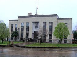
Tour de south 1st update chattanooga benton tennessee
Benton is a town in Polk County, Tennessee, United States. The population was 1,385 at the 2010 census. It is the county seat of Polk County.
Contents
- Tour de south 1st update chattanooga benton tennessee
- Map of Benton TN 37307 USA
- History
- Geography
- Demographics
- References
Map of Benton, TN 37307, USA
Benton is included in the Cleveland Metropolitan Statistical Area.
History
Benton was founded in 1840 as a county seat for Polk County, which had been established the previous year. The town, originally a trading post known as McKamy's stock stand, was named in honor of Thomas Hart Benton.
The Benton fireworks disaster was an industrial disaster which occurred on May 27, 1983 on a farm southeast of Benton. An explosion at a secret illegal fireworks operation killed eleven, injured one, caused damage within a radius of several miles, and revealed the operation. The operation was by far the largest and most successful known illegal fireworks operation and the blast, having been heard over 20 miles away, was arguably the largest and most powerful explosion involving firework explosives.
Geography
Benton is located at 35°10′23″N 84°39′0″W (35.173185, -84.650000). The town is situated just southeast of the confluence of the Ocoee River and the Hiwassee River, roughly 34 miles (55 km) upstream from the latter's mouth along the Chickamauga Lake impoundment of the Tennessee River. The Unicoi Mountains rise prominently to the east of Benton.
Benton is centered on the junction of U.S. Route 411, which connects the town to Etowah to the north and Tennga, Georgia to the south, and Tennessee State Route 314, which connects Benton to Parksville and the Ocoee Dam area to the southeast. Benton is located approximately 20 miles (32 km) east of Interstate 75.
According to the United States Census Bureau, the town has a total area of 2.3 square miles (6.0 km2), all land.
One of the scenic areas around Benton is Lake McCamy, where a hiking trail leads to the Benton Falls.
Demographics
As of the census of 2000, there were 1,138 people, 468 households, and 301 families residing in the town. The population density was 502.1 people per square mile (193.6/km2). There were 513 housing units at an average density of 226.3 per square mile (87.3/km2). The racial makeup of the town was 98.86% White, 0.09% African American, 0.18% Native American, 0.09% Pacific Islander, 0.09% from other races, and 0.70% from two or more races. Hispanic or Latino of any race were 0.53% of the population.
There were 468 households out of which 26.5% had children under the age of 18 living with them, 47.6% were married couples living together, 12.8% had a female householder with no husband present, and 35.5% were non-families. 31.8% of all households were made up of individuals and 14.5% had someone living alone who was 65 years of age or older. The average household size was 2.34 and the average family size was 2.95.
In the town, the population was spread out with 22.7% under the age of 18, 11.1% from 18 to 24, 29.4% from 25 to 44, 22.6% from 45 to 64, and 14.2% who were 65 years of age or older. The median age was 37 years. For every 100 females there were 91.6 males. For every 100 females age 18 and over, there were 92.6 males.
The median income for a household in the town was $22,667, and the median income for a family was $31,146. Males had a median income of $24,667 versus $23,295 for females. The per capita income for the town was $12,580. About 15.1% of families and 20.4% of the population were below the poverty line, including 34.5% of those under age 18 and 20.9% of those age 65 or over.