
Country United States Incorporated 1909 Area 7.2 km² Local time Wednesday 11:22 AM Area code 423 | Founded 1906 Elevation 246 m Zip code 37331 Population 3,496 (2013) | |
 | ||
Named for Muskogean word for "town" Weather 14°C, Wind NW at 8 km/h, 39% Humidity | ||
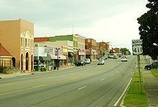
Etowah is a city in McMinn County, Tennessee, United States. The population was 3,490 at the 2010 census.
Contents
- Map of Etowah TN 37331 USA
- History
- Geography
- Demographics
- Government
- City Council
- City Administration
- City Services
- Education
- Landmarks
- Industry
- Notable people
- References
Map of Etowah, TN 37331, USA
History
Etowah was founded in 1906, primarily as a location for a depot on the Louisville & Nashville Railroad (L&N) line as part of a more direct route between Atlanta and Cincinnati. The etymology of the town name is unclear, but local folklore states that a train crew brought a sign reading "Etowah" from the Etowah River, and the name stuck. The word Etowah comes from the Muskogee/Creek word italwa meaning "town."
In 1902, the Louisville and Nashville Railroad announced its plan to build a more direct line from Atlanta to Cincinnati in order to avoid the rugged mountains of North Georgia and East Tennessee bypassing the Great Hiwassee Loop. A point midway between these cities was needed to service cars and change crews, and at the end of 1904, land had been purchased in McMinn County to serve as this site and the city of Etowah was planned. The L & N purchased 1,454 acres (5.88 km2) for the main terminus (depot), maintenance and repair facilities (shops), railroad yards and proposed township to support the railroad workforce. This land was purchased at $10 to $20 per acre and the L&N set about building a major rail center and the town of Etowah.
Out of what was referred to then as a wet swampland, a boomtown sprung up in 1906 with the L & N Depot serving as the hub of the new town's business and social activities. Since then, the City of Etowah has ridden the waves of economic downturns and successes, such as the closing of the L & N shops in the 1930s and the recruitment of new industries, to evolve into the city that it is today. Etowah has seen positive growth in industry and retail over the past decade.
In 1974, Etowah residents Doug, Carol and Michael Tullock started the Bargain Barn grocery store, which has since grown into a chain that includes 35 stores in 5 states.
On April 3, 1974, an F3 tornado struck southern Etowah, destroying 23 homes and killing 3 people. The tornado was one of many in the 1974 Super Outbreak.
Geography
Etowah is located at 35°19′46″N 84°31′42″W (35.329579, -84.528196).
According to the United States Census Bureau, the city has a total area of 2.8 square miles (7.2 km²), all of it land.
Demographics
As of the census of 2000, there were 3,663 people, 1,545 households, and 979 families residing in the city. The population density was 1,321.8 people per square mile (510.6/km²). There were 1,769 housing units at an average density of 638.4 per square mile (246.6/km²). The racial makeup of the city was 93.42% White, 3.25% African American, 0.38% Native American, 0.11% Asian, 0.08% Pacific Islander, 1.09% from other races, and 1.67% from two or more races. Hispanic or Latino of any race were 2.13% of the population.
There were 1,545 households out of which 26.6% had children under the age of 18 living with them, 47.5% were married couples living together, 12.5% had a female householder with no husband present, and 36.6% were non-families. 32.8% of all households were made up of individuals and 17.2% had someone living alone who was 65 years of age or older. The average household size was 2.25 and the average family size was 2.86.
In the city, the population was spread out with 21.4% under the age of 18, 7.4% from 18 to 24, 25.6% from 25 to 44, 22.4% from 45 to 64, and 23.2% who were 65 years of age or older. The median age was 42 years. For every 100 females there were 85.1 males. For every 100 females age 18 and over, there were 80.5 males.
The median income for a household in the city was $28,117, and the median income for a family was $33,034. Males had a median income of $27,824 versus $18,882 for females. The per capita income for the city was $15,298. About 7.4% of families and 15.9% of the population were below the poverty line, including 27.6% of those under age 18 and 13.7% of those age 65 or over.
Government
The City of Etowah has a council-manager government. The Mayor sits as a Council member-at-large and presides over City Council meetings. In the event that the Mayor cannot preside over a City Council meeting, the Vice-Mayor is the presiding officer of the meeting until such time as the Mayor returns to his/her seat. The City Manager is responsible for the administration and the day-to-day operation of all of the municipal services and city departments. The City Manager also maintains intergovernmental relationships with federal, state, county and other local governments.
The primary law enforcement agency in the city is the City of Etowah Police Department. The city and the rest of the un-incorporated Etowah area are also under the jurisdiction of the McMinn County Sheriff's Office.
City Council
City Administration
City Services
Education
The city includes two K-8 elementary schools located within blocks of each other, which now also include a Headstart and Pre-K. Mountain View Elementary is part of the McMinn County School System. The other, Etowah City School, is administered by the city of Etowah. The Etowah area high school students are able to attend McMinn Central High School.
Landmarks
The Historic L&N Depot museum in downtown Etowah is considered by many to be the main attraction in this small town. The historically African-American "Parkstown" neighborhood on the south side of Etowah has also seen renewed interest from tourists in recent years. An obvious presence in Etowah is the Gem Theater. Located in a building originally built in 1927 and purchased by the city of Etowah in 1993 and now is the location of local plays, concerts, movies and other events.
Industry
The newest plant (Plant number 6) of the Waupaca Foundry, Inc. is located in Etowah. The plant makes quality grey and ductile steel components that are used in the automotive and farming markets. The foundry makes parts (such as control arms, differential covers and cases, and brake calipers) for the new Ford F-series heavy duty trucks, Dodge Caravan, Hummer H2, GMC Envoy, Chrysler 300C/Dodge Charger, and the Toyota Camry. Etowah also claims two other plants, Johns Manville and Huber, even though neither are actually located in the city limits.