
Peak Unmarked point Elevation 586 m | Country Canada | |
 | ||
The Opeongo Hills (sometimes called the Opeongo Mountains or Madawaska Highlands, particularly for the eastern-most hills) are a range of hills in Southern Ontario, near Algonquin Provincial Park. The hills stretch from Opeongo Lake in Algonquin Park in the west, along the Madawaska and Opeongo Rivers, towards the Opeongo Colonization Road, and extending towards the Deacon Escarpment (north of Killaloe, Ontario in Renfrew County), Bonnechere, Ontario, and Dacre in the east. To the east of the Opeongo Hills lie the Madawaska River valley, the Mississippi River Valley, and the Ottawa-Bonnechere Graben along the Ottawa River. The hills continue into Quebec across the Ottawa River as the Laurentian Highlands and the Laurentian Mountains. Its tallest peak is roughly 7 km northeast of Highway 60. At roughly 586 meters, it is the tallest point in Southern Ontario. The community of Foymount (along former Highway 512, the Opeongo Line) is the highest settlement in Southern Ontario.
Contents
- Municipalities located in the Opeongo HillsEdit
- Frontenac CountyEdit
- Haliburton CountyEdit
- Hastings CountyEdit
- Lanark CountyEdit
- Lennox and Addington CountyEdit
- Nipissing DistrictEdit
- Renfrew CountyEdit
- Lakes and riversEdit
- ParksEdit
- RoadsEdit
- Notable attractionsEdit
- References
The Opeongo Hills are a continuation of the Laurentian Highlands, which extend into Eastern Ontario, towards Gananoque, and across the Ottawa River Valley into Quebec, and the Laurentian Mountains, which continue parallel to the St. Lawrence River, north of Montreal, Trois-Rivières and Quebec City.
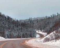
The geography in this area of Central Ontario is dotted with rolling hills and forests with streams, lakes, and small waterfalls, typical of a place in the Canadian Shield.
The first explorer to visit the region is Samuel de Champlain, in 1615, while exploring the area with the Huron natives. When settlers first started arriving in the area in the late 1790s and early 19th century, land areas were given to settlers by the Canadian Land and Emigration Company for settlement and farming. The soils of the area were not perfectly suited for farming, but small-scale agriculture was able to be conducted on the land. Today, the Opeongo Hills are crossed by many provincial highways, many of which still follow the original Historic Colonization Roads.
Municipalities located in the Opeongo HillsEdit
Below is a list of communities and municipalities located in the Opeongo Hills, from west to east
Frontenac CountyEdit
Haliburton CountyEdit
Hastings CountyEdit
Lanark CountyEdit
Lennox and Addington CountyEdit
Nipissing DistrictEdit
Renfrew CountyEdit
Lakes and riversEdit
ParksEdit
Below is a list of Conservation areas, Provincial and National parks located in the Opeongo Hills
RoadsEdit
Roads that cross the Opeongo Hills include: