
Surface elevation 403 m Province Ontario | Area 5.8 km² | |
 | ||
Opeongo Lake is a lake in the Ottawa River drainage basin in the geographic townships of Bower, Dickson, Preston and Sproule in the Unorganized South Part of Nipissing District in Northeastern Ontario, Canada. It is the largest lake in Algonquin Provincial Park and the source of the Opeongo River.
Contents
Map of Opeongo Lake, Nipissing, Unorganized, South Part, ON, Canada
It has three arms, North, East and South, joined by narrows into a Y shape. The total area is 58 km2 (22.4 sq mi), the average depth 14.6 m (48 ft) and the maximum depth 49.4 m (162 ft). The primary outflow is the Opeongo River at the southeast tip of Annie Bay on the East Arm, controlled by the Opeongo Lake Dam, which flows via the Madawaska River to the Ottawa River.
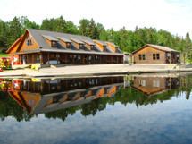
A store with camping supplies and dock, Algonquin access point 11 and the Harkness Laboratory of Fisheries Research are located on Sproule Bay at south end of South Arm and are all accessible from Ontario Highway 60. Consequently, the lake is a popular starting point for canoe trips into the interior of the park.
Opeongo lake was to have been the endpoint of the Opeongo Line, one of a series of settlement roads built to open up this section of the province.
The lake's name comes from the Algonquian word opeauwingauk meaning "sandy narrows".
TributariesEdit
clockwise from Sproule Bay on the South Arm