Country Canada Time zone Eastern (EST) (UTC-5) Website opasatika.net Local time Saturday 5:55 AM Area code 705 | Postal code P0L 1Z0 Population 214 (2011) | |
 | ||
Weather -18°C, Wind NE at 5 km/h, 91% Humidity | ||
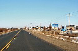
Opasatika is a township in the Canadian province of Ontario, located in the Cochrane District on the Opasatika River, a tributary of the Missinaibi River. Its name is of First Nation origin, meaning "river lined with poplars".
Contents
Map of Opasatika, ON, Canada
The main communities in the township are Opasatika and Lowther, both located along Highway 11 between Mattice and Harty. The ghost town of Reesor Siding, site of the 1963 Reesor Siding incident, is at the western edge of the township. The former Canadian Forces Station Lowther was located in the municipality.
Demographics
Population:
Mother tongue:
References
Opasatika Wikipedia(Text) CC BY-SA
