
Existed: 1927 – present Length 29.9 km | Constructed 1927 | |
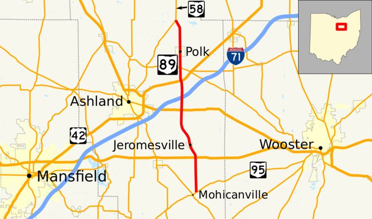 | ||
State Route 89 (SR 89) is a north–south state highway in the northern part of the U.S. state of Ohio. State Route 89 travels from its southern terminus at a T-intersection with State Route 95 approximately 5 miles (8 km) southeast of Hayesville to its northern terminus at a Y-intersection with State Route 58 nearly 3 miles (4.8 km) north of Polk.
Contents
Map of OH-89, Ohio, USA
Route description
All of State Route 89 is located within the eastern half of Ashland County. No segment of this highway is included within the National Highway System, a network of routes deemed most important for the economy, mobility and defense of the country.
History
The State Route 89 designation was assigned in 1927. Originally, State Route 89 included a brief stretch of what is now State Route 95 between State Route 179 southeast of Hayesville and State Route 89's current southern terminus, along with the entirety of the current routing of State Route 89. Five years after its inception, State Route 89 was extended to the southwest along the present routing of State Route 95 from State Route 179 to a new southern terminus at State Route 39 in Perrysville.
In 1939, State Route 95 was extended northeasterly from its prior eastern terminus in Butler to the Wooster vicinity. Consequently, State Route 89 was scaled back to its present southern terminus, as all of the former State Route 89 southwest of that point became a part of the newly extended State Route 95. State Route 89 has maintained its present routing since that time.
Major intersections
The entire route is in Ashland County.