
Existed: 1923 – present Length 24.98 km | Constructed 1923 | |
 | ||
Counties | ||
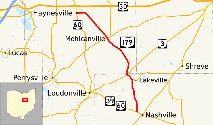
State Route 179 (SR 179) is a 15.52-mile (24.98 km) long north–south state highway in the central portion of the U.S. state of Ohio. SR 179 runs from its southern terminus at the duplex of SR 39 and SR 60 nearly 0.50 miles (0.80 km) northwest of the limits of the village of Nashville to its northern terminus at a signalized intersection with SR 60 in Hayesville.
Contents
Map of OH-179, Ohio, USA
Route description
SR 179 traverses the northwestern portion of Holmes County and the southeastern quadrant of Ashland County. No part of this state highway is included within the National Highway System (NHS). The NHS is a system of routes that are identified as being most important for the economy, mobility and defense of the country.
History
SR 179 was assigned in 1923. This highway has maintained the same routing between SR 39 near Nashville and SR 60 in Hayesville for its entire lifetime.