
Existed: 1924 – present Constructed 1924 | Length 248.3 km | |
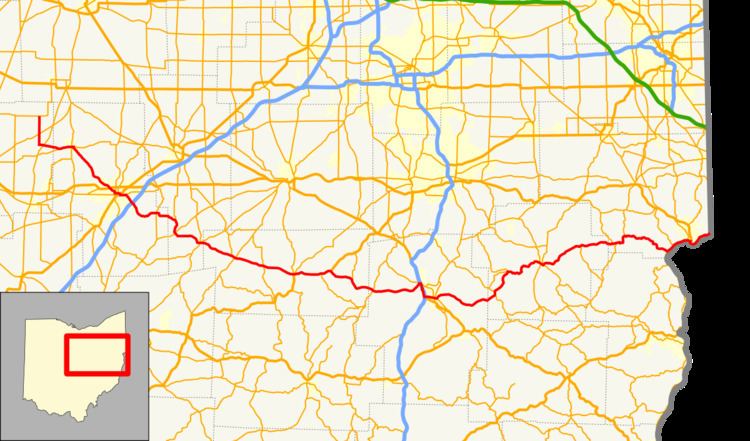 | ||
State Route 39 (SR 39) is a primarily east–west running state highway in north-central and northeastern portion of the U.S. state of Ohio. The route runs through seven counties on its approximately 155-mile (249 km) trip through the region. Its northern terminus is at State Route 103 near New Washington, and its eastern terminus is at PA 68 near East Liverpool.
Contents
Map of OH-39, Ohio, USA
Route 39 is unique in that its directional signage changes in the middle of its route. It is signed north–south between New Washington and Mansfield, and east–west from Mansfield to the Pennsylvania border. Thus, Route 39 has a northern and eastern terminus.
History
SR 39 was commissioned in 1923, originally routed from Shelby to Dover. In 1927 the highway was extended to the current eastern terminus at the Pennsylvania state line, along mostly the former route of SR 20. The route was extended to its current northern terminus at SR 103, in 1939. Between 1969 and 1971 the road between Shelby and Mansfield became a four-lane highway. In 1974, the route between Wellsville and East Liverpool was upgraded to a four-lane highway.