
Existed: 1923 – present Constructed 1923 | Length 45.48 km | |
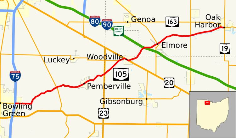 | ||
State Route 105 (SR 105) is an east–west state highway in the northwestern portion of the U.S. state of Ohio. Its western terminus is at an interchange with Interstate 75 in Bowling Green that doubles as the southern terminus of State Route 64, and its eastern terminus is at State Route 19 in Oak Harbor. For its final 0.4 miles (0.64 km), the route overlaps State Route 163 which continues east.
Contents
Map of OH-105, Ohio, USA
History
SR 105 was commissioned in 1923, routed from 4 miles (6.4 km) east of Bowling Green to Oak Harbor along its current alignment. Its western terminus was at then SR 34, later became U.S. Route 6 (US 6). The entire route was paved by 1934. Between 1967 and 1969, extended west to current western terminus, along former US 6 alignment.
References
Ohio State Route 105 Wikipedia(Text) CC BY-SA