
Existed: 1923 – present Constructed 1923 | Length 74.42 km | |
 | ||
Counties | ||
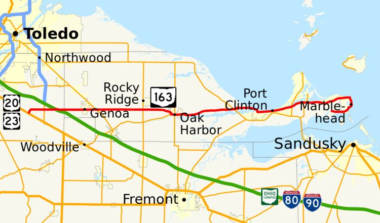
State Route 163 (SR 163) is a 46.24-mile (74.42 km) long east–west state highway in the northwestern portion of the U.S. state of Ohio. The western terminus of SR 163 is at a T-intersection with the duplex of U.S. Route 20 (US 20) and US 23 approximately 6 miles (9.7 km) southeast of the city limits of Perrysburg. Its eastern terminus is at its intersection with Hartshorn Road nearly 2 miles (3.2 km) west of the village limits of Marblehead, on the peninsula formed by Lake Erie and Sandusky Bay.
Contents
Map of W State Rte 163, Ohio, USA
Route description
The path of SR 163 takes it through the northeastern portion of Wood County and the entire width of Ottawa County. No segment of this state route is included within the National Highway System.
History
The SR 163 designation was applied in 1923. Originally, the highway ran along its present routing from its intersection with SR 51, at the time a part of SR 2 and later designated as the now-defunct SR 102, on the outskirts of Genoa, and its eastern terminus near Marblehead. SR 163 was extended west into Wood County along a previously un-numbered road from Genoa to its present western terminus at US 20 southeast of Perrysburg.