
- elevation 5,133 ft (1,565 m) - average 3,371 cu ft/s (95 m/s) Length 148 km | - elevation 217 ft (66 m) Discharge 95.46 m³/s Basin area 1,984 km² | |
 | ||
- max 76,600 cu ft/s (2,169 m/s) | ||
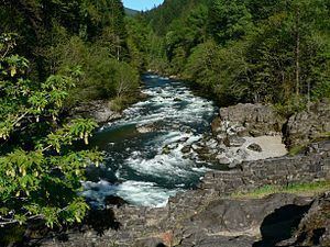
Opal creek little north santiam river oregon whitewater kayaking
The North Santiam River is a 92-mile (148 km) tributary of the Santiam River in western Oregon in the United States. It drains 766 square miles (1,980 km2) of the Cascade Range on the eastern side of the Willamette Valley east of Salem.
Contents
- Opal creek little north santiam river oregon whitewater kayaking
- Map of North Santiam River Oregon USA
- Waterfalls of oregon north santiam river
- FaunaEdit
- WatershedEdit
- References
Map of North Santiam River, Oregon, USA
It rises in the high Cascades in eastern Linn county, northwest of Three Fingered Jack in the Willamette National Forest. It flows north through the mountains past Marion Forks, receiving the drainage from the western slope of Mount Jefferson. Near Mount Jefferson it turns sharply west, descending through a canyon past Idanha and Detroit to Niagara County Park where the valley begins to widen and some agriculture use begins. Continuing west, the river flows past Gates, Mill City and Mehama. It emerges through the foothills into the Willamette Valley near Stayton, then flows 15 miles (24 km) southwest through the valley where it joins the South Santiam River to form the Santiam River. The confluence is approximately 10 miles (16 km) east of the confluence of the Santiam and the Willamette River.
It is impounded by Detroit Dam in the mountains west of Detroit to form Detroit Lake for flood control. Detroit Lake State Park is along the northern shore of the lake.
In the 19th century, the canyon of the North Santiam River provided a formidable obstacle to settlers. The construction of a railroad in 1887 opened up the canyon to settlement and logging of the surrounding mountains.
Waterfalls of oregon north santiam river
FaunaEdit
Blocked by Big Cliff Dam near Mill City, the lower North Santiam River supports spring chinook salmon and summer steelhead. In the reaches upstream of the dam, the river is managed mainly as a stocked-trout fishery. Near the stream's source at Santiam Lake in the Mount Jefferson Wilderness, native cutthroat trout, rainbow trout, and brook trout are also found.
The headwaters of Marion Creek, a tributary of the North Santiam River, originate at Marion Lake, which is a location of many wildlife species. This headwaters area is a breeding location for amphibians including the rough-skinned newt.
WatershedEdit
Ten cities draw their drinking water from the North Santiam watershed: Detroit, Gates, Idanha, Jefferson, Lyons, Mehama, Mill City, Salem, Stayton, and Turner.