
Country United States Time zone Pacific (UTC-8) Elevation 288 m Zip code 97346 Local time Friday 6:04 PM | Incorporated 1950 Area 168 ha Population 474 (2013) Number of airports 1 | |
 | ||
Weather 14°C, Wind SE at 6 km/h, 54% Humidity | ||
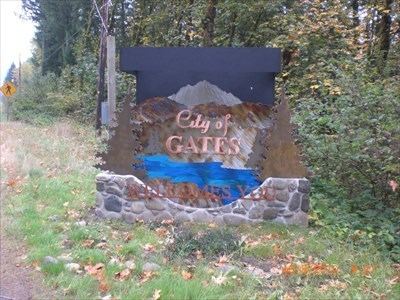
Gates is a city on the border of Linn and Marion counties in Oregon, United States. The population was 471 at the 2010 census. The greater part of Gates' population is in Marion County and the city is primarily under Marion County's jurisdiction.
Contents
Map of Gates, OR, USA
The Marion County portion of Gates is part of the Salem Metropolitan Statistical Area, while the Linn County portion is part of the Albany–Lebanon Micropolitan Statistical Area.
History
Gates' first post office was established in 1882 on the south side of the Santiam River as Henness, named for the first postmaster, Jane Henness. The post office later moved to the north side of the river as Gatesville but the post office was established with the name Gates on February 12, 1892. The name honored one of the oldest settlers in the area, Mary Gates. The city was incorporated in 1950.
Geography
According to the United States Census Bureau, the city has a total area of 0.65 square miles (1.68 km2), all land.
Climate
This region experiences warm (but not hot) and dry summers, with no average monthly temperatures above 71.6 °F (22.0 °C). According to the Köppen Climate Classification system, Gates has a warm-summer Mediterranean climate, abbreviated "Csb" on climate maps.
2010 census
As of the census of 2010, there were 471 people, 222 households, and 129 families residing in the city. The population density was 724.6 inhabitants per square mile (279.8/km2). There were 249 housing units at an average density of 383.1 per square mile (147.9/km2). The racial makeup of the city was 92.4% White, 0.2% African American, 1.7% Native American, 0.8% Asian, 0.4% from other races, and 4.5% from two or more races. Hispanic or Latino of any race were 4.5% of the population.
There were 222 households of which 22.1% had children under the age of 18 living with them, 44.6% were married couples living together, 5.9% had a female householder with no husband present, 7.7% had a male householder with no wife present, and 41.9% were non-families. 36.9% of all households were made up of individuals and 12.7% had someone living alone who was 65 years of age or older. The average household size was 2.12 and the average family size was 2.70.
The median age in the city was 47.9 years. 19.1% of residents were under the age of 18; 5.2% were between the ages of 18 and 24; 21.2% were from 25 to 44; 32.4% were from 45 to 64; and 21.9% were 65 years of age or older. The gender makeup of the city was 53.9% male and 46.1% female.
2000 census
As of the census of 2000, there were 471 people, 208 households, and 136 families residing in the city. The population density was 773.5 people per square mile (298.1/km²). There were 261 housing units at an average density of 428.7 per square mile (165.2/km²). The racial makeup of the city was 87.47% White, 2.97% Native American, 0.21% Asian, 4.03% from other races, and 5.31% from two or more races. Hispanic or Latino of any race were 6.37% of the population.
There were 208 households out of which 21.6% had children under the age of 18 living with them, 55.3% were married couples living together, 4.8% had a female householder with no husband present, and 34.6% were non-families. 29.3% of all households were made up of individuals and 15.4% had someone living alone who was 65 years of age or older. The average household size was 2.26 and the average family size was 2.79.
In the city, the population was spread out with 20.2% under the age of 18, 5.7% from 18 to 24, 22.1% from 25 to 44, 31.2% from 45 to 64, and 20.8% who were 65 years of age or older. The median age was 47 years. For every 100 females there were 104.8 males. For every 100 females age 18 and over, there were 102.2 males.
The median income for a household in the city was $32,344, and the median income for a family was $37,143. Males had a median income of $35,714 versus $31,250 for females. The per capita income for the city was $17,065. About 15.9% of families and 17.9% of the population were below the poverty line, including 23.1% of those under age 18 and 11.0% of those age 65 or over.
Education
Gates is served by the Santiam Canyon School District. Area students attend Santiam Elementary Schools, Mill City Middle School, and Santiam High School in Mill City. The former elementary school in Gates closed in 2012 and in 2014 was sold to Upward Bound Camp for Persons with Special Needs, Inc. Upward Bound Camp has opened a year-round training facility there for children and adults with special needs.