
Country United States Type of dam Concrete gravity Opened 1953 | Status Operational Height 141 m Catchment area 1,132 km² Construction began 1949 | |
 | ||
Purpose Flood control, power, irrigation Opening date 1953; 64 years ago (1953) Similar Big Cliff Dam, Cascade Range, Foster Dam, Cougar Dam, Detroit Lake State Recreatio | ||
Santiam highway salem to detroit dam oregon highway 22 time lapse drive
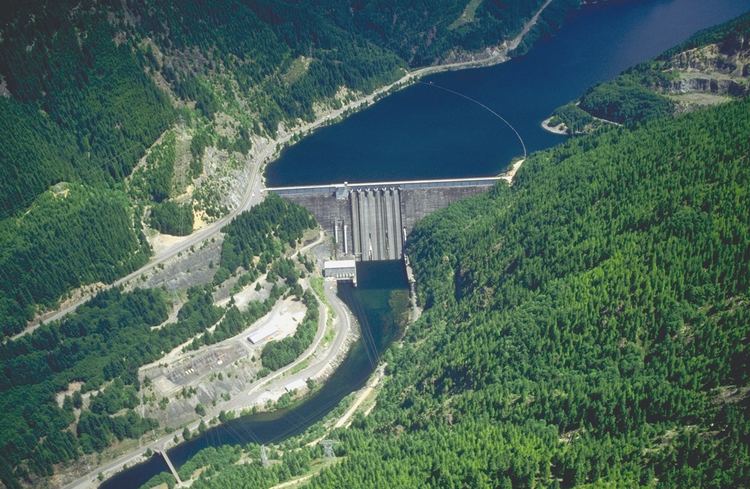
Detroit Dam is a gravity dam on the North Santiam River between Linn County and Marion County, Oregon. It is located in the Cascades, about 5 mi (8.0 km) west of the city of Detroit. It was constructed between 1949 and 1953 by the United States Army Corps of Engineers. The dam created 400-foot (120 m) deep Detroit Lake, more than 9 miles (14 km) long with 32 miles (51 km) of shoreline.
Contents
- Santiam highway salem to detroit dam oregon highway 22 time lapse drive
- Map of Detroit Dam Detroit OR 97342 USA
- References
Map of Detroit Dam, Detroit, OR 97342, USA
The dam, dedicated on June 10, 1953, was authorized for the purposes of flood control, power generation, navigation, and irrigation. Other uses are fishery, water quality, and recreation. It was built in concert with the Big Cliff Dam downstream.
References
Detroit Dam Wikipedia(Text) CC BY-SA