Trisha Shetty (Editor)

North Hertfordshire

Updated on
Edit
Like
Comment
Share on FacebookTweet on TwitterShare on LinkedInShare on Reddit
Sovereign state
  
United Kingdom

Region
  
East of England

Admin HQ
  
Letchworth

Team
  
Hitchin Town F.C.

Constituent country
  
England

Non-metropolitan county
  
Hertfordshire

Area
  
375.4 kmĀ²

North Hertfordshire

Status
  
Non-metropolitan district

Government body
  
North Hertfordshire District Council

Points of interest
  
Knebworth House, Royston Cave, Therfield Heath, River Cam, Howard Park

Destinations
  
Stevenage, Letchworth, Hitchin, Royston, Baldock

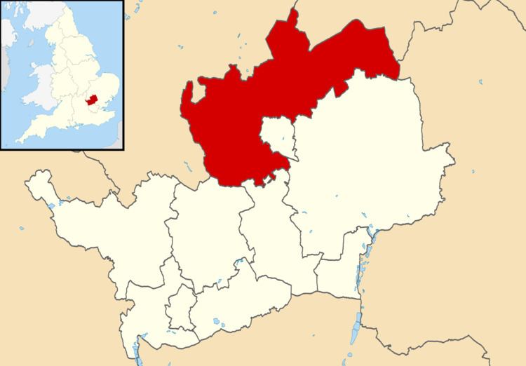
North Hertfordshire is a local government district in Hertfordshire, England. Its council is based in Letchworth.

Contents

Map of North Hertfordshire District, UK

The district was formed on 1 April 1974 by the amalgamation of the urban districts of Baldock, Hitchin, Letchworth, and Royston and the Hitchin Rural District.

From eastward clockwise, it borders the districts of East Hertfordshire, Stevenage, Welwyn Hatfield, St Albans in Hertfordshire, Central Bedfordshire, Luton, Central Bedfordshire again, and South Cambridgeshire.

Towns

  • Baldock
  • Hitchin
  • Letchworth
  • Royston
  • Most of the Great Ashby development north east of Stevenage falls within North Hertfordshire.
  • Villages

  • Ashwell
  • Barley
  • Barkway
  • Bygrave
  • Caldecote
  • Clothall
  • Codicote
  • Graveley
  • Great Offley
  • Great Wymondley
  • Holwell
  • Kings Walden
  • Kimpton
  • Knebworth
  • Hexton
  • Hinxworth
  • Langley
  • Lilley
  • Little Wymondley
  • Ickleford
  • Kelshall
  • Newnham
  • Norton
  • Nuthampstead
  • Old Letchworth
  • Offley
  • Pirton
  • Preston
  • Radwell
  • Reed
  • Rushden
  • St Ippollitts
  • St Paul's Walden
  • Therfield
  • Wallington
  • Walsworth
  • Weston
  • Willian
  • Whitwell
  • References

    North Hertfordshire Wikipedia