
Population 310 (2011 Census) Sovereign state United Kingdom Local time Sunday 6:58 PM | OS grid reference TL364360 Post town ROYSTON Dialling code 01763 | |
 | ||
Weather 10°C, Wind E at 19 km/h, 67% Humidity | ||
Fallowfield christmas lights 2013 reed hertfordshire
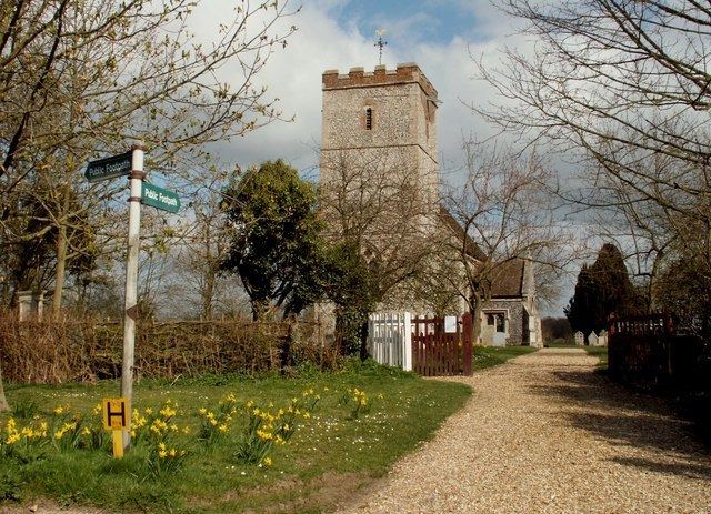
Reed is a small village and civil parish in North Hertfordshire. It is situated on a chalk ridge at almost the highest point in the county, approximately 3 miles south of the market town of Royston. The Prime Meridian passes just to the east of the village, between Reed and Barkway. The modern A10 road (here following the course of the Roman Ermine Street) passes just to the west of the village.
Contents
Map of Reed, UK
Reed includes a first school, recently assessed as 'Outstanding' in a 2009 Ofsted report1. There is also a village hall, the Saxon parish church of St. Mary, a small chapel, a cricket club and a village pub and restaurant set in a 16th-century coaching inn. A converted windmill also stands in the village. There were 273 residents recorded as living in 119 households in Reed in the United Kingdom Census 2001.
There has reportedly been a settlement at Reed for 2,000 years, and the community was mentioned in the Domesday Book of 1086 (as Retth). A number of houses in the village boast the remnants of ancient moats, and the village includes a number of ancient woods on its outskirts. Reed was awarded protected status as a conservation area in 1974.