
- elevation 501 m (1,644 ft) - elevation 144 m (472 ft) Basin area 27,676 km² | Basin area 27,690 km² | |
 | ||
Mouths | ||
Fishing in the nogoa river ep1
Fishing nogoa river
Course and features
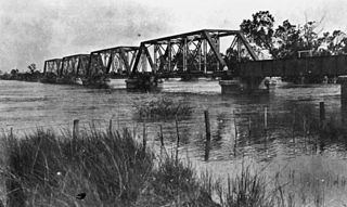
The river rises on the Carnarvon Range, part of the Great Dividing Range, in the Carnarvon National Park and flows in a generally north easterly direction towards Emerald. From source to mouth, the Nogoa River is joined by 29 minor tributaries. North of Comet the river forms confluence with the Comet River to form the Mackenzie River. The Nogoa descends 361 metres (1,184 ft) over its 569-kilometre (354 mi) course. The river is crossed by the Gregory and Capricorn Highways at Emerald.
The river has a catchment area of 27,690 square kilometres (10,690 sq mi) draining parts of the Minerva Hills, Peak Range, Snake Range national parks. Of this area, 271 kilometres (168 mi) is riverine wetlands.
The reservoir created by Queensland's second largest dam, Lake Maraboon was formed when the Fairbairn Dam was built on the river in 1972. The dam and a network of channels along the Nogoa River supplies water for the Emerald Irrigation Area.
Sir Thomas Mitchell was the first European explorer to discover the river on 19 July 1846.
Major flooding events
In January 2008, the Nogoa River reached record flood levels. During the flood, water levels in the Fairbairn Dam rapidly exceeded 100%. Within a week inundations had caused severe disruptions to graziers, crops growers and to residents of Emerald when waters broke its banks. The Nogoa peaked at 15.4 m (51 ft) in Emerald on the night of January 22 2008, causing more than 2500 people to be evacuated. The unprecedented floods washed through the Ensham coal mine, temporarily halting operations in two out of six coal pits, reducing output to less than 50% and rendering a huge dragline defunct after it had been submerged.
In December 2010 - January 2011 the river was impacted by major flooding at Emerald and in the Nogoa's upper catchment.