
Type Highway | Length 912 km | |
 | ||
Route number(s) State Route 63(Kennedy Developmental Road - Charters Towers) State Highway A7(Charters Towers - Springsure) Formerroute number National Route 55(Charters Towers - Springsure) | ||
The Gregory Highway is a state highway in Queensland that serves the major coal-mining centres of Central Queensland. The highway was named after Augustus Gregory, an early explorer.
Contents
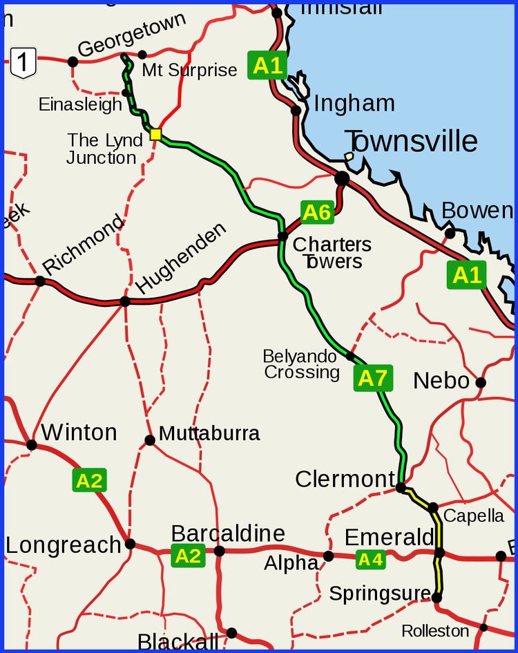
- Map of Gregory Hwy Queensland Australia
- Route description
- List of towns along the Gregory Developmental RoadHighway
- References
Map of Gregory Hwy, Queensland, Australia
Route description
The highway runs southward from Quartz Blow Creek, a point 31 kilometres west of Mount Surprise on the Gulf Developmental Road, via Charters Towers, to Springsure, over 900 kilometres away. The northern section of 756 kilometres is designated by the state government as the Gregory Developmental Road. The shorter southern section between Clermont and Springsure (174 kilometres) is designated the Gregory Highway. As of 2015, the first 120 kilometres between the Gulf Developmental Road via Einasleigh to the Lynd Junction are unsealed and may be corrugated. The next section to Charters Towers has been upgraded from single lane to mostly dual-laned bitumen. The road is used by many road trains.