
Basin size 187 sq mi (480 km) | Length 39 km | |
 | ||
River mouth Sandy Creek in Tuscarawas County, Ohio938 ft (286 m) | ||
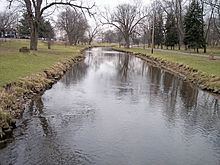
Nimishillen Creek is a tributary of Sandy Creek, 24.5 miles (39.4 km) long, in northeastern Ohio in the United States. Via Sandy Creek and the Tuscarawas, Muskingum and Ohio Rivers, it is part of the watershed of the Mississippi River, draining an area of 187 square miles (484 km²), including the city of Canton.
Contents
Map of Nimishillen Creek, Ohio, USA
Nimishillen Creek flows on both glaciated (in the north) and unglaciated (in the south) portions of the Allegheny Plateau, in Stark and Tuscarawas Counties. It is formed in Canton by the confluence of the East Branch Nimishillen Creek and the Middle Branch Nimishillen Creek. The East Branch is 10.4 miles (16.7 km) long and flows through Louisville; the Middle Branch is 16.6 miles (26.6 km) long. Shortly downstream of this confluence, the stream collects the West Branch Nimishillen Creek, which is nine miles (14.5 km) long and flows through North Canton and Canton. From Canton, Nimishillen Creek flows generally southwardly, past East Sparta, into northern Tuscarawas County, where it flows into Sandy Creek from the north.
Variant names
According to the Geographic Names Information System, Nimishillen Creek has also been known historically as: