
Existed: 1936 – present Counties: Cass Constructed 1936 | Length 22.47 km | |
 | ||
North end: US 6 southwest of Ashland | ||
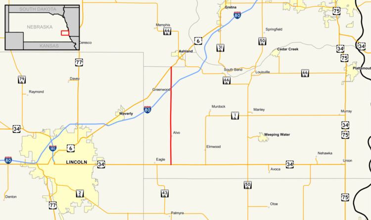
Nebraska Highway 63 is a highway in eastern Nebraska. It is a north–south highway with a length of 13.93 miles (22.42 km). Its southern terminus is at U.S. Highway 34 east of Eagle. Its northern terminus is at U.S. Highway 6 southwest of Ashland.
Contents
Route description
Nebraska Highway 63 begins at U.S. 34 east of Eagle. It goes north into farmland through Alvo before intersecting Interstate 80. It goes north towards Ashland before ending at U.S. 6. Nebraska Highway 63 currently lies entirely in Cass County. Exit signage on Interstate 80 indicates the Nebraska Highway 63 exit as the exit for Ashland and Greenwood.
History
Prior to October 24, 2005, Nebraska Highway 63 extended north from its present terminus on a concurrency with U.S. Highway 6 to Ashland. At Ashland, it turned north, and followed a highway which went north and west near the villages of Memphis and Ithaca, eventually terminating at U.S. Highway 77 south of Wahoo. On that day, that part of the highway was renumbered as Nebraska Highway 66.
Major intersections
The entire route is in Cass County.