
Country United States Time zone Central (CST) (UTC-6) Zip code 68066 | Elevation 1,211 ft (369 m) Area code(s) 402 Population 4,512 (2013) | |
 | ||
Weather 13°C, Wind N at 14 km/h, 29% Humidity | ||
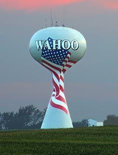
Wahoo (Dakota: wǧhu; "arrow wood") is a city and county seat of Saunders County, Nebraska, United States. The population was 4,508 at the 2010 census.
Contents
Map of Wahoo, NE 68066, USA
History
Wahoo was founded in 1870. The town's name comes from the eastern wahoo (Euonymus atropurpureus), a shrub found on the banks of Wahoo Creek. The town was founded by predominantly Czech, German, and Scandinavian settlers.
Geography
Wahoo is located at 41°13′N 96°37′W (41.21, -96.62). According to the United States Census Bureau, the city has a total area of 2.65 square miles (6.86 km2), all land.
2010 census
As of the census of 2010, there were 4,508 people, 1,801 households, and 1,131 families residing in the city. The population density was 1,701.1 inhabitants per square mile (656.8/km2). There were 1,962 housing units at an average density of 740.4 per square mile (285.9/km2). The racial makeup of the city was 94.5% White, 0.8% African American, 0.3% Native American, 1.0% Asian, 1.4% from other races, and 1.9% from two or more races. Hispanic or Latino of any race were 3.5% of the population.
There were 1,801 households of which 31.8% had children under the age of 18 living with them, 50.8% were married couples living together, 8.7% had a female householder with no husband present, 3.3% had a male householder with no wife present, and 37.2% were non-families. 33.3% of all households were made up of individuals and 16.2% had someone living alone who was 65 years of age or older. The average household size was 2.40 and the average family size was 3.08.
The median age in the city was 38.7 years. 26.5% of residents were under the age of 18; 6.7% were between the ages of 18 and 24; 24.4% were from 25 to 44; 25.3% were from 45 to 64; and 17.2% were 65 years of age or older. The gender makeup of the city was 49.5% male and 50.5% female.
2000 census
As of the census of 2000, there were 3,942 people, 1,583 households, and 992 families residing in the city. The population density was 1,841.1 people per square mile (711.2/km²). There were 1,669 housing units at an average density of 779.5 per square mile (301.1/km²). The racial makeup of the city was 98.40% White, 0.15% African American, 0.30% Native American, 0.36% Asian, 0.30% from other races, and 0.48% from two or more races. Hispanic or Latino of any race were 0.84% of the population.
There were 1,583 households, out of which 31.8% had children under the age of 18 living with them, 51.6% were married couples living together, 8.6% had a female householder with no husband present, and 37.3% were non-families. 33.2% of all households were made up of individuals, and 19.3% had someone living alone who was 65 years of age or older. The average household size was 2.39, and the average family size was 3.08.
In the city, the population was spread out, with 26.3% under the age of 18, 6.5% from 18 to 24, 26.4% from 25 to 44, 19.5% from 45 to 64, and 21.4% who were 65 years of age or older. The median age was 39 years. For every 100 females, there were 90.1 males. For every 100 females age 18 and over, there were 84.5 males.
As of 2000 the median income for a household in the city was $35,104, and the median income for a family was $46,094. Males had a median income of $31,729 versus $22,138 for females. The per capita income for the city was $16,765. About 7.5% of families and 8.3% of the population were below the poverty line, including 7.5% of those under age 18 and 9.3% of those age 65 or over.