
 | ||
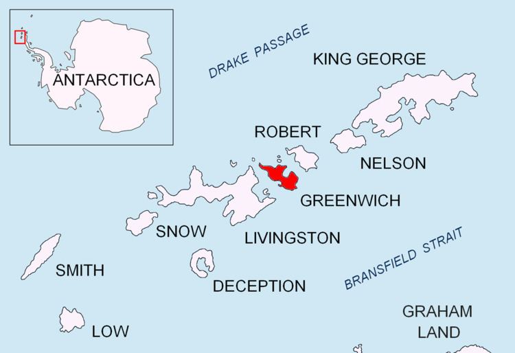
Musala Glacier (Lednik Musala \'led-nik mu-sa-'la) on Greenwich Island in the South Shetland Islands, Antarctica is situated northeast of Targovishte Glacier, east-northeast of Zheravna Glacier and southeast of Fuerza Aérea Glacier. It is bounded by St. Kiprian Peak to the south, Vratsa Peak to the southwest, central Breznik Heights to the west, and Ilarion Ridge bordering Hardy Cove to the northeast, extends 3.7 km in east-west direction and 2.2 km in north-south direction, and drains eastwards into Bransfield Strait north of Fort Point.
Contents
Map of Musala Glacier, Antarctica
The glacier is named after Musala Peak in the Rila Mountain, the summit of Bulgaria and the Balkan Peninsula.
Location
Musala Glacier is centred at 62°31′57″S 59°36′49″W. Bulgarian mapping in 2005 and 2009.
Maps
References
Musala Glacier Wikipedia(Text) CC BY-SA