
Mountains Viskyar Ridge | ||
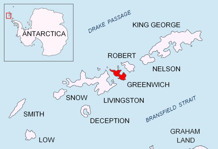 | ||
Breznik Heights (Breznishki Vazvisheniya \'brez-nish-ki v&-zvi-'she-ni-ya) rises to over 600 m in the southeast part of Greenwich Island. They extend 12 km between Santa Cruz Point in the northeast and the base of the moraine spit of Provadiya Hook at the mouth of Yankee Harbour in the southwest. The heights are ice covered except for limited precipitous areas such as those at Oborishte Ridge, Ephraim Bluff, Viskyar Ridge and Bogdan Ridge.
Contents
Map of Breznik Heights, Antarctica
The heights are named after the town of Breznik in Western Bulgaria.
Location
Breznik Heights are centred at 62°31′30″S 59°39′50″W.
Maps
References
Breznik Heights Wikipedia(Text) CC BY-SA