
- elevation 149 m (489 ft) Basin area 14,812 km² | - elevation 347 m (1,138 ft) - average 6 m/s (212 cu ft/s) Mouth Barwon River | |
 | ||
- location near Mogi Mogi, New South Wales | ||
Moonie river crossing
The Moonie River, a perennial river of the Barwon catchment within the Murray–Darling basin, is located in the Southern Downs district of Queensland and Orana district of New South Wales, Australia.
Contents
Moonie river crossing 2
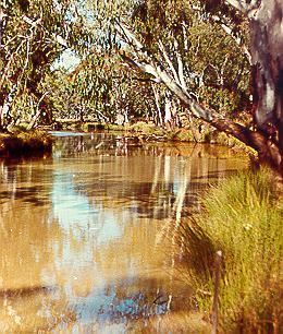
Course and features
The rivers rises south west of Dalby, near Braemar State Forest, south-east of Tara in Queensland, and flows generally to the south-west, joined by thirteen minor tributaries, before reaching its confluence with the Barwon River, near the village of Mogi Mogi in New South Wales; descending 198 metres (650 ft) over its 542-kilometre (337 mi) course. The catchment area has no major towns and is extremely flat. The Moonie River is impounded by Thallon Weir, with a capacity of 185 megalitres (6.5×10^6 cu ft).
The river flows through the towns of the Nindigully, Flinton and just to the west of Thallon. Both the Moonie Highway and Carnarvon Highway cross the river.