
Country United States County Essex Population 38,977 (2000) | Local time Friday 7:02 PM | |
 | ||
Area rank 250th of 566 in state6th of 22 in county Weather 6°C, Wind W at 13 km/h, 29% Humidity Points of interest Montclair Art Museum, Crane House and Museum, Van Vleck House and Gardens, Brookdale Park, Grover Cleveland Park | ||
Jessica keefe presents montclair new jersey
Montclair (/mɒntˈklɛər/ or /mɒŋˈklɛər/) is a township in Essex County, New Jersey, United States. As of the 2010 United States Census, the township's population was 37,669, reflecting a decline of 1,308 (-3.4%) from the 38,977 counted in the 2000 Census, which had in turn increased by 1,248 (+3.3%) from the 37,729 counted in the 1990 Census. As of 2010, it was the 60th-most-populous municipality in New Jersey.
Contents
- Jessica keefe presents montclair new jersey
- Map of Montclair NJ USA
- Geography
- Climate
- Demographics
- 2015 Census
- 2010 Census
- 2000 Census
- Economy
- Arts and culture
- Sports
- Parks and recreation
- Local government
- Federal state and county representation
- Politics
- Transportation
- Roads and highways
- Bus
- Rail
- Air
- Housing
- Education
- Media
- Sister cities
- Points of interest
- Historic sites
- In popular culture
- References
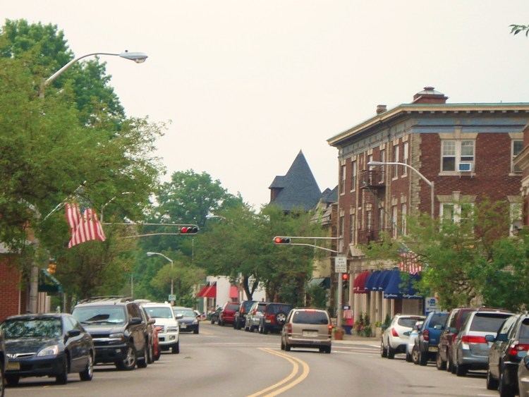
Map of Montclair, NJ, USA
Montclair was first formed as a township on April 15, 1868, from portions of Bloomfield Township, so that a second railroad could be built to Montclair. After a referendum held on February 21, 1894, Montclair was reincorporated as a town, effective February 24, 1894. It derives its name from the French mont clair, meaning "clear mountain" or "bright mountain."
In 1980, after multiple protests filed by Montclair officials regarding the inequities built into the federal revenue sharing system, Montclair passed a referendum changing its name to the "Township of Montclair," becoming the third of more than a dozen Essex County municipalities to reclassify themselves as townships to take advantage of federal revenue sharing policies that allocated townships a greater share of government aid to municipalities on a per capita basis.
Geography
According to the United States Census Bureau, the township has a total area of 6.315 square miles (16.357 km2), including 6.308 square miles (16.339 km2) of land and 0.007 square mile (0.018 km2) of water (0.11%).
Montclair is on the east side of the First Mountain of the Watchung Mountains. Some higher locations in the township provide excellent views of the surrounding area and of the New York City skyline about 12 miles (19 km) away.
Named localities in the township include Frog Hollow, Montclair Heights, South End, Upper Montclair and Watchung Plaza.
Montclair citizens use two main ZIP codes. The central and southern parts of the township are designated 07042. Upper Montclair lies north of Watchung Avenue and has a separate ZIP code, 07043. Because the ZIP codes do not exactly match municipal boundaries, a few homes near the borders with neighboring towns fall into the ZIP codes for those communities. A few homes in some adjoining municipalities use one of the two ZIP codes assigned to Montclair, as does HackensackUMC Mountainside (07042, formerly known as Mountainside Hospital), whose campus straddles the border with Glen Ridge. Small areas in the southeast of the township fall into the Glen Ridge ZIP code 07028.
Several streams flow eastward through Montclair: Toney's Brook in the center, Nishuane Brook in the southeast, the Wigwam Brook in the southwest, Pearl Brook in the northwest, and Yantacaw Brook in the northeast - all in the Passaic River watershed. Yantacaw and Toney's brooks are dammed in parks to create ponds. Wigwam, Nishuane, and Toney's brooks flow into the Second River, and the others flow into the Third River. Montclair lies just north of the northernmost extent of the Rahway River watershed.
The southern border of Montclair is a straight line between Eagle Rock, on the ridge of the First Watchung Mountain, and the point where Orange Road crosses Nishuane Brook. The eastern border is roughly a straight line between that point and a point just southwest of where Broad Street crosses the Third River. The western border runs roughly along the ridge of the First Watchung Mountain between Eagle Rock and the Essex County/Passaic County border. The northern border is the border between those two counties.
Climate
Montclair has a temperate climate, with warm-to-hot, humid summers and cool to cold winters, as is characteristic of the Köppen climate classification humid continental climate. January tends to be the coldest month, with average high temperatures in the upper 30s Fahrenheit and lows averaging 21. July, the warmest month, features high temperatures in the mid-80s and lows in the 70s, with an average high of 86 degrees. From April to June and from September to early November, Montclair experiences temperatures from the lower 60s to the lower 70s.
Montclair gets approximately 50 inches (1,270 mm) of rain per year, above the United States average of 39 inches (990 mm) (weather.com, weatherdb.com). Snowfall is common from December to early March, and totals about 30 inches (760 mm) annually. The number of days each year in Montclair with any measurable precipitation is 90; the area has an average of 202 sunny days.
Montclair is one or two degrees warmer than the neighboring towns of Verona and Cedar Grove because of the mountain between them, which sometimes blocks winds and clouds, including warmer air from the ocean to the east.
Demographics
Montclair has long highlighted its diversity, a feature that has attracted many to the community. The African American population has been stable at around 30% for decades, although it fell from 32% in 2000 to 27% in 2010 (U.S. Census).
As of 2012, 32.6% of the population were Catholic, 8.4% were Jewish and 2.4% were Muslim, with a small percentage of other denominations. Proportionally, Montclair has more Muslims, Jews, and Catholics than the national average.
Montclair has attracted many who work for major media organizations in New York City, including The New York Times and Newsweek. A March 11, 2007, posting in the blog Gawker.com listed some of those who work in the media and live in Montclair. In it also live many commuters to New York City and the Metro Area.
2015 Census
According to the 2015 American Community Survey the census showed Montclair had a total population of 38,021. There was a median age of 40.6 years old with 20.6% of the population being under 18, 62% being between 18 and 64, and 13% being 65 and over. The town population was 54% female and 46% male. The racial percentages were 59% White, 23% Black, 9% Hispanic, 4% Asian, 4% two or more races, and 1% other.
The income per capita was $62,832 and the median household income was $99,105. The income split was 27% of the population under $50k, 24% between $50k and $100k, 25% between $100k and $200k, and 24% over $200k. With poverty, 6.7% of the population was below the poverty line. In terms of households, there were 14,517 total households and 2.6 households per person.
2010 Census
The 2010 United States Census counted 37,669 people, 15,089 households, and 9,446 families residing in the township. The population density was 5,971.2 per square mile (2,305.5/km2). The township contained 15,911 housing units at an average density of 2,522.2 per square mile (973.8/km2). The racial makeup of the township was 62.16% (23,416) White, 27.16% (10,230) Black or African American, 0.16% (59) Native American, 3.81% (1,434) Asian, 0.02% (9) Pacific Islander, 2.19% (826) from other races, and 4.50% (1,695) from two or more races. Hispanics or Latinos of any race were 7.46% (2,810) of the population.
Out of a total of 15,089 households, 33.9% had children under the age of 18 living with them, 46.1% were married couples living together, 13.2% had a female householder with no husband present, and 37.4% were non-families. 30.9% of all households were made up of individuals, and 8.9% had someone living alone who was 65 years of age or older. The average household size was 2.47 and the average family size was 3.15.
In the township, 25.5% of the population were under the age of 18, 6.2% from 18 to 24, 26.7% from 25 to 44, 30.3% from 45 to 64, and 11.3% who were 65 years of age or older. The median age was 39.9 years. For every 100 females the census counted 87.2 males, but for 100 females at least 18 years old, it was 82.2 males.
The Census Bureau's 2006-2010 American Community Survey showed that (in 2010 inflation-adjusted dollars) median household income was $95,696 (with a margin of error of +/- $5,396) and the median family income was $126,983 (+/- $8,950). Males had a median income of $83,589 (+/- $5,955) versus $66,063 (+/- $3,616) for females. The per capita income for the township was $53,572 (+/- $2,671). About 4.6% of families and 2.7% of the population were below the poverty line, including 7.0% of those under age 18 and 4.6% of those age 65 or over.
2000 Census
As of the 2000 United States Census, 38,977 people, 15,020 households, and 9,687 families resided in the township. The population density was 6,184 people per square mile (2,389/km2). There were 15,531 housing units at an average density of 2,464 per square mile (951.8/km2). The racial makeup of the CDP was 59.77% White, 32.06% African American, 3.15% Asian, 0.19% Native American, 0.04% Pacific Islander, 1.77% from other races, and 3.03% from two or more races. Hispanic or Latino of any race were 5.12% of the population.
Of the 15,020 households in Montclair, 34.3% included children under the age of 18, 47.2% were married couples living together, 14.1% had a female householder with no husband present, and 35.5% were non-families. Individuals living alone accounted for 29.3% of all households, and in 8.6% of households, that individual was 65 years of age or older. The average household size was 2.53 and the average family size was 3.16.
Like most stable, mature communities, Montclair had many people in each age group, with 25.6% under the age of 18, 6.6% from 18 to 24, 31.9% from 25 to 44, 24.1% from 45 to 64, and 12.0% who were 65 years of age or older. The median age was 38 years. For every 100 females there were 86.3 males. For every 100 females age 18 and over, there were 80.7 males.
The median income for a household in the township was $74,894, and the median income for a family was $96,252. Males had a median income of $64,151 versus $43,520 for females. The per capita income for the township was $44,870. About 3.9% of families and 5.6% of the population were below the poverty line, including 5.4% of those under age 18 and 7.2% of those age 65 or over.
Economy
Montclair has six distinct commercial zones:
Arts and culture
Montclair hosts many art institutions and theaters, and despite its relatively small size, has many art venues. It has its own art museum, the Montclair Art Museum, and several small galleries.
Montclair also hosts two theaters that showcase movies and films. Both were originally live theaters, but are now operated by Clearview Cinemas. While the Bellevue Cinema in Upper Montclair mostly shows mainstream Hollywood films, the Clairidge Cinema on Bloomfield Avenue shows different types of movies from documentaries to small scale indie films. The township hosted its first annual film festival in 2012 to provide a platform for filmmakers from New Jersey, the US and the world.
Live theaters include The Montclair Operetta Company, the Wellmont Theatre, Montclair State University's Kasser Theater, Montclair State University's theater in Life Hall, and the Studio Playhouse. On Bloomfield Avenue there is a public stage used for concerts and other events. Dotted around Montclair there are also many art galleries, though most are centered in the Bloomfield Avenue Downtown Area. Concerts are held at the Wellmont Theatre and at several churches and auditoriums sponsored by Outpost in the Burbs, a community-based organization. In 2017, The Montclair Orchestra was formed as a semi-professional orchestra.
Montclair was the setting for some of the stories in the HBO television series The Sopranos, and many Montclair streets, locations and businesses were featured in the show, such as Bloomfield Avenue.
Sports
Parks and recreation
Montclair is home to many parks and nature reserves.
Montclair's parks include Edgemont Memorial Park, Essex Park, Glenfield Park, Nishuane Park, Erie Park, Tuers Park, Rand Park, Graz Park, Canterbury Park, Watchung Park, Eagle Rock Reservation, Brookdale Park, Anderson Park, Yantacaw Brook Park, the Bonsal Nature Reserve, Mountainside Park, the Presby Memorial Iris Gardens, and the Mills Reservation. The parks include many sports fields, and additional parks are school-owned, such as the Essex Park fields or Montclair State University's Sprague Field. In total Montclair has 153.9 acres (0.623 km2) of township park land spread around 18 parks and 123.8 acres (0.501 km2) of county park land consisting of five parks.
The township has 18 public tennis courts, four skating rinks (two of which are indoor), and three public swimming pools: the Mountainside pool, the Nishuane pool, and the Essex pool.
In 2007, township residents advocated for construction of a public skatepark. Community members revitalized the effort in 2010 and lobbied the Parks and Recreation Committee for support. The township council passed a resolution expressing approval of the project, but allocated no funds for it.
Local government
Since July 1, 1988, Montclair has been governed under the council-manager plan 13 form of municipal government under the Faulkner Act, whose originator was a former mayor of Montclair. The government consists of a mayor and a six-member Township Council. The mayor and council are all elected to four-year terms in concurrent nonpartisan elections. The mayor and two council seats are elected at-large, with four council seats elected from each of four wards. A deputy mayor is selected by the six council members from their members, and this position is largely ceremonial.
Though the Mayor has no executive powers, the Mayor presides over council meetings and has both a voice and vote in its proceedings. The Mayor appoints members to many local governing groups, most notably the board of education.
As of 2016, the Mayor of Montclair is Robert D. Jackson. Members of the Montclair Township Council are Deputy Mayor William L. Hurlock (First Ward), Dr. Renée E. Baskerville (Fourth Ward), Rich McMahon (At-Large), Robert J. Russo (At-Large), Robin Schlager (Second Ward) and Sean Spiller (Third Ward), all of whom serve terms of office that end on June 30, 2020.
In elections held on May 8, 2012, Robert D. Jackson won election as mayor, defeating Karen Turner and Harvey Susswein. Almost all of Jackson's Montclair 2012 slate also won office, with Rich McMahon and former Mayor Robert Russo winning the two at-large seats, Robin Schlager winning the Second Ward and Sean Spiller taking the Third Ward. For Montclair's Bill Hurlock won the First Ward seat and incumbent councilwoman Dr. Renée Baskerville, who ran as an independent, won the Fourth Ward seat. The new council took office on July 1, 2012. Russo was chosen by the council to be deputy mayor, succeeding Kathryn Weller-Demming.
Federal, state and county representation
Montclair is split between the 10th and 11th Congressional Districts and is part of New Jersey's 34th state legislative district. Prior to the 2010 Census, Montclair had been part of the 8th Congressional District and the 10th Congressional District, a change made by the New Jersey Redistricting Commission that took effect in January 2013, based on the results of the November 2012 general elections. The split that took effect in 2013 placed 26,730 residents living in the township's southern section in the 10th District, while 11,299 residents in the northern portions of the township were placed in the 11th District.
New Jersey's Tenth Congressional District is represented by Donald Payne Jr. (D, Newark). New Jersey's Eleventh Congressional District is represented by Rodney Frelinghuysen (R, Harding Township). New Jersey is represented in the United States Senate by Cory Booker (D, Newark, term ends 2021) and Bob Menendez (D, Paramus, 2019).
For the 2016–2017 session (Senate, General Assembly), the 34th Legislative District of the New Jersey Legislature is represented in the State Senate by Nia Gill (D, Montclair) and in the General Assembly by Thomas P. Giblin (D, Montclair) and Sheila Oliver (D, East Orange). The Governor of New Jersey is Chris Christie (R, Mendham Township). The Lieutenant Governor of New Jersey is Kim Guadagno (R, Monmouth Beach).
Essex County is governed by a directly-elected County Executive, with legislative functions performed by the Board of Chosen Freeholders. As of 2016, the County Executive is Joseph N. DiVincenzo, Jr. The county's Board of Chosen Freeholders consists of nine members, four elected on an at-large basis and one from each of five wards, who serve three-year terms of office on a concurrent basis, all of which end December 31, 2018. Essex County's Freeholders are Freeholder President Britnee N. Timberlake (District 3 - East Orange, Newark's West and Central Wards, Orange and South Orange; East Orange) Freeholder Vice President Brendan W. Gill (at large; Montclair), Rufus I. Johnson (at large; Newark), Lebby C. Jones (at large; Irvington), Patricia Sebold (at large; Livingston), Rolando Bobadilla (District 1 - Newark's North and East Wards, parts of Central and West Wards; Newark), Wayne L. Richardson (District 2 - Irvington, Maplewood and Newark's South Ward and parts of West Ward; Newark), Leonard M. Luciano (District 4 - Caldwell, Cedar Grove, Essex Fells, Fairfield, Livingston, Millburn, North Caldwell, Roseland, Verona, West Caldwell and West Orange; West Caldwell), and Cynthia D. Toro (District 5 - Belleville, Bloomfield, Glen Ridge, Montclair and Nutley; Bloomfield). Constitutional elected countywide are County Clerk Christopher J. Durkin (West Caldwell, 2020), Sheriff Armando B. Fontoura (Fairfield, 2018) and Surrogate Theodore N. Stephens II (2016).
Politics
As of March 23, 2011, there were a total of 27,289 registered voters in Montclair, of which 14,782 (54.2%) were registered as Democrats, 2,581 (9.5%) were registered as Republicans and 9,903 (36.3%) were registered as Unaffiliated. There were 23 voters registered to other parties.
In the 2012 presidential election, Democrat Barack Obama received 83.0% of the vote (15,811 cast), ahead of Republican Mitt Romney with 15.9% (3,034 votes), and other candidates with 1.1% (201 votes), among the 19,576 ballots cast by the township's 29,463 registered voters (530 ballots were spoiled), for a turnout of 66.4%. In the 2008 presidential election, Democrat Barack Obama received 83.0% of the vote (17,396 cast), ahead of Republican John McCain with 15.7% (3,294 votes) and other candidates with 0.6% (132 votes), among the 20,951 ballots cast by the township's 27,476 registered voters, for a turnout of 76.3%. In the 2004 presidential election, Democrat John Kerry received 78.8% of the vote (15,597 ballots cast), outpolling Republican George W. Bush with 20.2% (3,995 votes) and other candidates with 0.6% (157 votes), among the 19,804 ballots cast by the township's 25,762 registered voters, for a turnout percentage of 76.9.
In the 2013 gubernatorial election, Democrat Barbara Buono received 70.5% of the vote (7,613 cast), ahead of Republican Chris Christie with 28.3% (3,057 votes), and other candidates with 1.2% (131 votes), among the 10,941 ballots cast by the township's 29,768 registered voters (140 ballots were spoiled), for a turnout of 36.8%. In the 2009 gubernatorial election, Democrat Jon Corzine received 73.9% of the vote (10,139 ballots cast), ahead of Republican Chris Christie with 18.7% (2,573 votes), Independent Chris Daggett with 5.8% (801 votes) and other candidates with 0.8% (104 votes), among the 13,723 ballots cast by the township's 26,843 registered voters, yielding a 51.1% turnout.
Transportation
Montclair is considered a commuter suburb of New York City. NJ Transit and DeCamp Bus Lines are the providers of public transportation. The average Montclair commute is 38 minutes each way. Twenty-four percent of commuters take mass transit, while 59% drive alone. Twelve times more Montclair commuters take mass transit than the national average.
Roads and highways
As of May 2010, the township had a total of 100.62 miles (161.93 km) of roadways, of which 86.68 miles (139.50 km) were maintained by the municipality and 13.94 miles (22.43 km) by Essex County.
Major roads in the township include CR 506 (Bloomfield Avenue).
There is a taxi stand off of Bloomfield Avenue in eastern Montclair, in front of Lackawanna Plaza, formerly the Montclair train station.
Bus
NJ Transit buses 11, 28, 29, 34, 97, 191 and 705 run through Montclair, most going along the main street, Bloomfield Avenue. The NJ transit bus routes are:
All of these routes except #97, #191, and #705 were trolley lines originally, operated by the Public Service Railway. A trolley garage existed on Bloomfield Avenue. In the 1930s and 1950s the trolleys were destroyed and replaced with buses.
DeCamp Bus Lines routes 33 and 66 run through Montclair to the Port Authority Bus Terminal in New York City, carrying primarily commuters.
Montclair State University has shuttle buses going around its campus.
The township of Montclair operates a jitney in the evening from the Bay Street train station to the southern end of Montclair.
Rail
Running through Montclair is the Montclair-Boonton Line, serving New York Penn Station via Hoboken Terminal to the east, and Hackettstown to the west. Seven NJ Transit Rail stations serve Montclair: Bay Street, Walnut Street, Watchung Avenue, Upper Montclair, Mountain Avenue, and Montclair Heights in Montclair, and Montclair State University Station in the Great Notch area of Little Falls, New Jersey. Of these seven stations, only Bay Street station has weekend train service.
Montclair has a long history of railroads. The first railroad to Montclair was built in 1856 by the Newark and Bloomfield Railroad. It terminated at a station in Downtown Montclair. First the Morris and Essex Railroad, then the Delaware, Lackawanna and Western Railroad leased the line.
In 1868, the Montclair Railway built another line through Montclair, which caused disputes leading to Montclair's separation from Bloomfield. Shortly afterward it was taken over by the New York and Greenwood Lake Railway, a subsidiary of the Erie Railroad. A third railroad to Morristown was planned in 1860 and construction began, but the Panic of 1873 ended the project. In 1912 the Lackawanna Railroad built a large terminal at the end of their line. The Erie and Lackawanna Railroads later merged, forming the Erie-Lackawanna Railroad, which operated both lines for many decades. They were next operated by Conrail for approximately one year, after which NJ Transit took over passenger operations and Conrail continued freight operations. Meanwhile, the 1912 terminal was closed in 1981 and converted into shops. This station was replaced by the Bay Street station. In 2002, the two railway lines were connected with the construction of the Montclair Connection.
Air
Montclair is 13 miles (21 km) from Newark Liberty International Airport, 42 miles (68 km) from JFK Airport and 31 miles (50 km) from LaGuardia Airport. The Garden State Parkway to the east, U.S. Route 46 and New Jersey Route 3 to the north, and New Jersey Route 23 to the west are slightly past the town's borders. The main road through Montclair is Bloomfield Avenue.
Housing
Montclair is noted for its historic architecture. It is home to six historic districts listed on the Register of Historic Places of both the state and country as a whole, 92 individually listed landmarks, and two locally designated commercial districts. Works by significant architects include designs by Van Vleck and Goldsmith, Charles Follen McKim, McKim, Mead, and White, Henry Hudson Holly, Charles A. Platt, Alexander Jackson Davis, Dudley Van Antwerp, Effingham R. North, Montrose Morris, and Frances Nelson, among others.
Montclair has also housed many hotels, such as the defunct Hotel Montclair. In 2013, plans were announced to bring a new hotel to Montclair, featuring 100 rooms and a liquor license.
Education
The Montclair Public Schools serve students in kindergarten through twelfth grade. As of the 2011-12 school year, the district's 11 schools had an enrollment of 6,625 students. Schools in the district (with 2011-12 enrollment data from the National Center for Education Statistics) are seven elementary schools (K-5, except as noted, with enrollment and magnet program listed in parentheses) — Bradford School (456 students, Magnet Theme: The University Magnet), Charles H. Bullock School (432, Environmental Science), Edgemont Montessori School (304, Montessori), Hillside School (3-5; 626, Gifted and Talented), Nishuane School (K-2; 430, Gifted and Talented), Northeast School (457, Global Studies) and Watchung School (456, Science and Technology) — Glenfield Middle School (717, Visual and Performing Arts), Buzz Aldrin Middle School (548, Science, Technology, Engineering & Math) and Renaissance at Rand (253, Liberal Arts) for grades 6-8, along with Montclair High School (1,946) for grades 9-12.
Montclair is home to Montclair State University, which was founded in 1908 as the New Jersey State Normal School at Montclair.
The Roman Catholic Archdiocese of Newark supervises the operation of Immaculate Conception High School (coed) and Lacordaire Academy (for girls)at the high school level and Lacordaire Academy Lower Division and St. Cassian School for grades PreK-8. In 2016, St. Cassian School was one of ten schools in New Jersey, and one of four private schools in the state, recognized as a National Blue Ribbon School by the United States Department of Education, a recognition celebrating excellence in academics.
Montclair is also home to a host of private and parochial schools, including Montclair Kimberley Academy, Montclair Community Pre-K, Virginia Harkness Sawtelle Learning, Maria Montessori Early Learning, Montclair Cooperative School, Trinity Academy and Deron School II.
Media
Montclair has two local newspapers, the Montclair Dispatch and the Montclair Times. In addition, there is a radio station at 90.3 FM on the campus of Montclair State University, WMSC. Montclair State University is also the major broadcasting site for NJTV in Northern New Jersey. Locals also subscribe to The Star-Ledger of Newark, New Jersey, and The New York Times. The township has a municipal public service television channel, Channel 34, where township council and school board meetings are broadcast. Montclair High School has its own paper the Mountaineer, and Montclair State University has its own student-run paper, the Montclarion.
Sister cities
Montclair has four sister cities, as listed by Sister Cities International:
Points of interest
Historic sites
Montclair is home to the following locations on the National Register of Historic Places:
In popular culture
In the 1948 biographical novel Cheaper by the Dozen, the principal characters Frank Bunker Gilbreth Sr. and Lillian Moller Gilbreth live in Montclair, as the authors did in real life.