
Country United States County Essex Zip code 07052 Population 44,943 (2000) | Elevation 156 m Local time Friday 10:07 PM | |
 | ||
Area rank 190th of 566 in state3rd of 22 in county Weather 2°C, Wind NE at 19 km/h, 98% Humidity | ||
Welcome to west orange new jersey
West Orange is a suburban township in central Essex County, New Jersey, United States. As of the 2010 United States Census, the township's population was 46,207, reflecting an increase of 1,264 (+2.8%) from the 44,943 counted in the 2000 Census, which had in turn increased by 5,840 (+14.9%) from the 39,103 counted in the 1990 Census.
Contents
- Welcome to west orange new jersey
- Map of West Orange NJ 07052 USA
- The wilshire grand hotel west orange new jersey the best by far for your event
- History
- Geography
- Neighborhoods
- Census 2010
- Census 2000
- Economy
- Sports
- Parks and recreation
- Local government
- Municipal court
- Politics
- Federal state and county representation
- Roads and highways
- Public transportation
- Mass media and telecommunications
- Notable people
- References
Map of West Orange, NJ 07052, USA
The wilshire grand hotel west orange new jersey the best by far for your event
History
West Orange was initially a part of Newark township, and remained so until November 27, 1806, when the territory now encompassing all of The Oranges was detached to form Orange Township. On April 13, 1807, the first government was elected. On January 31, 1860, Orange was incorporated as a town, and on April 3, 1872, it was reincorporated as a city. Almost immediately, Orange began fragmenting into smaller communities, primarily because of local disputes about the costs of establishing paid police, fire and street departments. South Orange was organized on April 1, 1861, Fairmount (an independent municipality for less than one year that was later to become part of West Orange) on March 11, 1862, and East Orange on March 4, 1863. West Orange (including what had been the briefly independent municipality of Fairmount) was incorporated as a township on April 10, 1863, and was reformed as a town on February 28, 1900. In 1980, West Orange again became a township to take advantage of federal revenue sharing policies that allocated a greater share of government aid to municipalities classified as townships.
The township derives its name from the city of Orange, which in turn is derived from William III of England or William IV, Prince of Orange.
Llewellyn Park, the first planned community in America, is located within West Orange, and was designed by entrepreneur Llewellyn Haskell and architect Alexander Jackson Davis in 1857. Llewellyn Park is considered among the best examples of the "Romantic Landscape" movement of that period. Thomas Edison was one of the many residents.
Geography
According to the United States Census Bureau, the township had a total area of 12.171 square miles (31.522 km2), including 12.046 square miles (31.198 km2) of land and 0.125 square miles (0.324 km2) of water (1.03%). It is located approximately 5 miles (8.0 km) west of downtown Newark and 13 miles (21 km) west of New York City.
The West Branch of the Rahway River originates at Crystal Lake and passes through the township in South Mountain Reservation.
West Orange borders the Essex County communities of Essex Fells, Livingston, Millburn, Maplewood, Montclair, Orange, Roseland, Verona and South Orange.
Neighborhoods
Unincorporated communities, localities and place names located partially or completely within the township include Crestmont, Crystal Lake, Llewellyn Park, Pleasantdale and Saint Cloud.
The township is marked by an eclectic mix of neighborhoods and housing types, which roughly correspond to the township's geographic features. Generally, the township has four distinct neighborhoods:
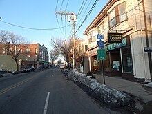
The oldest and most densely populated part of the township is Downtown West Orange, which lies in the low basin along the township's eastern border with the city of Orange and Montclair. Main Street, in this section, is home to the Thomas Edison National Historical Park, as well as the municipal building, police headquarters, and a branch post office. The West Orange Public Library is located on Mount Pleasant Avenue in this section, just west of Main Street. Downtown West Orange is laid out in the pattern of a traditional town, and is formed around the western termini of two major east-west arteries of the Newark street grid: Central Avenue and Park Avenue. Downtown West Orange has the most urban character of the township's neighborhoods, while the Valley is home to a growing arts district and a significant African American community.
West of Downtown, the neighborhoods of West Orange become increasingly suburban as one ascends the steep hill of the First Watchung Mountain along Northfield, Mount Pleasant, or Eagle Rock Avenue. The housing stock in the neighborhoods of Hutton Park and Gregory is a mixture of Victorian, Jazz Age, and Tudor-style houses; large estates; garden apartments; and post-World War II modern houses. The Victorian enclave of Llewellyn Park, one of America's first planned residential communities, is also located on the First Mountain, having been created in 1853 as a site for country homes for the wealthy from New York City. Many blocks on the First Mountain have sweeping views of the Newark and New York City skylines.
Beyond the high ridge traced by Prospect Avenue, West Orange becomes a patchwork of post-World War II suburban neighborhoods, interspersed with pockets of older Victorian homes, as well as golf courses, professional campuses, and shopping centers. Pleasantdale, a walkable business district in this part of the township, includes a number of restaurants, office buildings, and houses of worship. Pleasantdale is also home to a significant Orthodox Jewish community.
Finally, the westernmost section of West Orange lies along the eastern face of the Second Watchung Mountain, and includes large portions of the South Mountain Reservation. The housing stock in this neighborhood resembles that of Pleasantdale, as well as those of the adjacent suburban townships of Millburn and Livingston.
Census 2010
The 2010 United States Census counted 46,207 people, 16,790 households, and 11,753 families residing in the township. The population density was 3,836.0 per square mile (1,481.1/km2). The township contained 17,612 housing units at an average density of 1,462.1 per square mile (564.5/km2). The racial makeup of the township was 57.15% (26,406) White, 26.58% (12,284) Black or African American, 0.38% (174) Native American, 7.96% (3,680) Asian, 0.02% (10) Pacific Islander, 4.82% (2,227) from other races, and 3.09% (1,426) from two or more races. Hispanics or Latinos of any race were 16.20% (7,487) of the population.
Out of a total of 16,790 households, 33.4% had children under the age of 18 living with them, 53.1% were married couples living together, 12.7% had a female householder with no husband present, and 30.0% were non-families. 25.5% of all households were made up of individuals, and 12.6% had someone living alone who was 65 years of age or older. The average household size was 2.70 and the average family size was 3.28.
In the township, 23.7% of the population were under the age of 18, 7.1% from 18 to 24, 25.7% from 25 to 44, 27.6% from 45 to 64, and 15.9% who were 65 years of age or older. The median age was 40.6 years. For every 100 females the census counted 88.3 males, but for 100 females at least 18 years old, it was 83.2 males.
The Census Bureau's 2006-2010 American Community Survey showed that (in 2010 inflation-adjusted dollars) median household income was $88,917 (with a margin of error of +/- $4,480) and the median family income was $106,742 (+/- $5,256). Males had a median income of $65,854 (+/- $4,548) versus $43,223 (+/- $2,769) for females. The per capita income for the township was $43,368 (+/- $2,021). About 4.9% of families and 7.1% of the population were below the poverty line, including 8.5% of those under age 18 and 7.5% of those age 65 or over.
Census 2000
As of the 2000 United States Census there were 44,943 people, 16,480 households, and 11,684 families residing in the township. The population density was 3,708.7 people per square mile (1,431.7/km2). There were 16,901 housing units at an average density of 1,394.7 per square mile (538.4/km2). The racial makeup of the township was 67.6% White, 17.5% African American, 0.14% Native American, 8.09% Asian, 0.04% Pacific Islander, 3.52% from other races, and 3.20% from two or more races. Hispanic or Latino of any race were 10.04% of the population.
There were 16,480 households out of which 32.2% had children under the age of 18 living with them, 56.0% were married couples living together, 11.2% had a female householder with no husband present, and 29.1% were non-families. 24.6% of all households were made up of individuals and 11.6% had someone living alone who was 65 years of age or older. The average household size was 2.66 and the average family size was 3.19. In the township the population was spread out with 23.3% under the age of 18, 6.2% from 18 to 24, 29.7% from 25 to 44, 23.4% from 45 to 64, and 17.4% who were 65 years of age or older. The median age was 39 years. For every 100 females there were 88.6 males. For every 100 females age 18 and over, there were 84.0 males.
The median income for a household in the town was $69,254, and the median income for a family was $83,375. Males had a median income of $52,029 versus $39,484 for females. The per capita income for the township was $34,412. About 4.6% of families and 5.6% of the population were below the poverty line, including 6.0% of those under age 18 and 7.8% of those age 65 or over.
Economy
Essex Green Shopping Center is an outdoor mall with stores, restaurants and an AMC Theatres Fork and Screen dine-in movie theater. The 350,000-square-foot (33,000 m2) mall, the largest of its type in Essex County, was purchased in 2016 by Clarion Partners.
Sports
The Jersey Rockhoppers hockey team of the Eastern Professional Hockey League, formed for the 2008-09 season, played home games at the Richard J. Codey Arena. The arena also used to be the practice facility for the New Jersey Devils from 1986-2007. The New Jersey Daredevils, a special needs hockey team formed in 2002 that plays in the SHI (Special Hockey International League), uses the arena for home games and practices. Annually in October, the Daredevils host a Halloween themed tournament for Special Hockey International teams (including the Daredevils themselves) called Frankenfest. Frankenfest has been going on every October since 2009. The New Jersey Devils Youth Hockey team also plays here as well.
Parks and recreation
The township is set off by two large parks: the South Mountain Reservation along its southwestern borders with Maplewood, Millburn and South Orange, and the Eagle Rock Reservation along its northeastern borders with Montclair and Verona. The township straddles the transition between the low-lying Newark Bay basin and the high terrain of the Watchung Mountains.
Fishing and kayaking is available on the Rahway River.
Local government
West Orange is governed by Plan B of the Mayor-Council system of municipal government pursuant to the Faulkner Act, as implemented on July 1, 1962, by direct petition. Each member of the Council is elected to a four-year term of on a staggered basis, with either three council seats or two seats and the mayoral seat up for election every even-numbered year. Township elections are nonpartisan, with all seats chosen on an at-large basis. In December 2013, the Township Council approved an ordinance that shifted municipal elections from May to the November general election, citing savings from the combined elections estimated as much as $100,000 per cycle.
As of 2016, the Mayor of West Orange is Robert Parisi, whose term of office ends December 31, 2018. Members of the Township Council are Michelle Casalino (2016; appointed to serve an unexpired term), Victor Cirilo (2018), Jerry Guarino (2016), Joe Krakoviak (2016) and Susan McCartney (2018).
In September 2015, the Township Council selected Michelle Casalino to fill the seat expiring in December 2016 that had been held by Patty Spango until her resignation from office.
Municipal court
Officers of the municipal court are:
Politics
As of March 23, 2011, there were a total of 30,561 registered voters in West Orange, of which 14,166 (46.4%) were registered as Democrats, 3,273 (10.7%) were registered as Republicans and 13,108 (42.9%) were registered as Unaffiliated. There were no voters registered to other parties.
In the 2012 presidential election, Democrat Barack Obama received 71.3% of the vote (15,214 cast), ahead of Republican Mitt Romney with 27.9% (5,950 votes), and other candidates with 0.8% (177 votes), among the 21,491 ballots cast by the township's 32,061 registered voters (150 ballots were spoiled), for a turnout of 67.0%. In the 2008 presidential election, Democrat Barack Obama received 67.8% of the vote (15,423 cast), ahead of Republican John McCain with 29.3% (6,667 votes) and other candidates with 0.7% (154 votes), among the 22,740 ballots cast by the township's 30,260 registered voters, for a turnout of 75.1%. In the 2004 presidential election, Democrat John Kerry received 64.7% of the vote (13,535 ballots cast), outpolling Republican George W. Bush with 34.0% (7,118 votes) and other candidates with 0.7% (186 votes), among the 20,933 ballots cast by the township's 28,418 registered voters, for a turnout percentage of 73.7.
In the 2013 gubernatorial election, Democrat Barbara Buono received 56.0% of the vote (6,350 cast), ahead of Republican Chris Christie with 42.9% (4,863 votes), and other candidates with 1.1% (125 votes), among the 11,580 ballots cast by the township's 32,390 registered voters (242 ballots were spoiled), for a turnout of 35.8%. In the 2009 gubernatorial election, Democrat Jon Corzine received 59.3% of the vote (8,168 ballots cast), ahead of Republican Chris Christie with 32.9% (4,530 votes), Independent Chris Daggett with 6.2% (858 votes) and other candidates with 0.7% (100 votes), among the 13,773 ballots cast by the township's 29,898 registered voters, yielding a 46.1% turnout.
Federal, state and county representation
West Orange is split between the 10th and 11th Congressional Districts and is part of New Jersey's 27th state legislative district. Prior to the 2010 Census, West Orange had been split between the 8th Congressional District and the 10th Congressional District, a change made by the New Jersey Redistricting Commission that took effect in January 2013, based on the results of the November 2012 general elections. In the redistricting that took effect in 2013, 18,122 residents in the eastern third of the township were placed in the 10th district, while 28,085 residents in the western portion of the township were placed in the 11th District.
New Jersey's Tenth Congressional District is represented by Donald Payne Jr. (D, Newark). New Jersey's Eleventh Congressional District is represented by Rodney Frelinghuysen (R, Harding Township). New Jersey is represented in the United States Senate by Cory Booker (D, Newark, term ends 2021) and Bob Menendez (D, Paramus, 2019).
For the 2016–2017 session (Senate, General Assembly), the 27th Legislative District of the New Jersey Legislature is represented in the State Senate by Richard Codey (D, Roseland) and in the General Assembly by Mila Jasey (D, South Orange) and John F. McKeon (D, West Orange). The Governor of New Jersey is Chris Christie (R, Mendham Township). The Lieutenant Governor of New Jersey is Kim Guadagno (R, Monmouth Beach).
Essex County is governed by a directly-elected County Executive, with legislative functions performed by the Board of Chosen Freeholders. As of 2016, the County Executive is Joseph N. DiVincenzo, Jr. The county's Board of Chosen Freeholders consists of nine members, four elected on an at-large basis and one from each of five wards, who serve three-year terms of office on a concurrent basis, all of which end December 31, 2018. Essex County's Freeholders are Freeholder President Britnee N. Timberlake (District 3 - East Orange, Newark's West and Central Wards, Orange and South Orange; East Orange) Freeholder Vice President Brendan W. Gill (at large; Montclair), Rufus I. Johnson (at large; Newark), Lebby C. Jones (at large; Irvington), Patricia Sebold (at large; Livingston), Rolando Bobadilla (District 1 - Newark's North and East Wards, parts of Central and West Wards; Newark), Wayne L. Richardson (District 2 - Irvington, Maplewood and Newark's South Ward and parts of West Ward; Newark), Leonard M. Luciano (District 4 - Caldwell, Cedar Grove, Essex Fells, Fairfield, Livingston, Millburn, North Caldwell, Roseland, Verona, West Caldwell and West Orange; West Caldwell), and Cynthia D. Toro (District 5 - Belleville, Bloomfield, Glen Ridge, Montclair and Nutley; Bloomfield). Constitutional elected countywide are County Clerk Christopher J. Durkin (West Caldwell, 2020), Sheriff Armando B. Fontoura (Fairfield, 2018) and Surrogate Theodore N. Stephens II (2016).
The West Orange Public Schools serves students in pre-kindergarten through twelfth grade. As of the 2011-12 school year, the district's 11 schools had an enrollment of 6,792 students and 573.6 classroom teachers (on an FTE basis), for a student–teacher ratio of 11.84:1. Schools in the district (with 2011-12 enrollment data from the National Center for Education Statistics) seven elementary schools — Gregory Elementary School (590 students; in grades K-5), Hazel Avenue Elementary School (368; K-5), Kelly Elementary School (424; PreK-5), Mount Pleasant Elementary School (416; K-5), Redwood Elementary School (576; K-5), St. Cloud Elementary School (386; K-5) and Washington Elementary School (403; K-5) — three middle schools — Thomas A. Edison Central Six School (6; 475), Liberty Middle School (7&8; 551) and Roosevelt Middle School (7&8; 464) — and West Orange High School (2,141) for grades 9-12.
Pleasantdale School was renamed Kelly School in May 2016 in honor of Mark and Scott Kelly, identical twins who attended the school starting in second grade before becoming NASA astronauts.
Roads and highways
As of May 2010, the township had a total of 114.54 miles (184.33 km) of roadways, of which 89.63 miles (144.25 km) were maintained by the municipality, 19.45 miles (31.30 km) by Essex County and 5.46 miles (8.79 km) by the New Jersey Department of Transportation.
Public transportation
NJ Transit offers bus service in the township to Newark on the 21, 29, 71, 73 and 79 routes, with local service on the 97 route. In September 2012, as part of budget cuts, NJ Transit suspended service to Newark on the 75 line.
DeCamp Bus Lines offers scheduled service between the township and the Port Authority Bus Terminal in Midtown Manhattan on the 66 route. Coach USA / Community Coach serves the Port Authority Bus Terminal on route 77.
The township offers a jitney service that operates on weekdays, offering service to the Orange and South Orange train stations.
Mass media and telecommunications
For many decades West Orange has been a hotbed for the mass-media and telecommunication industries. Thomas Edison's Black Maria, the first movie studio ever, was located on Main Street and Lakeside Avenue. Several radio and television broadcast antennas are located in the town. From the late 1960s/early-1970s until the early 1990s UHF Channel 68 TV maintained their offices, studios and transmitter at 416 Eagle Rock Avenue. After Channel 68 moved to West Market Street in Newark and their transmitter to the Empire State Building in Manhattan, NBC owned and operated stations WNBC-TV Channel 4 and WPXN-TV Channel 31 (NBC later sold its interest in WPXN's parent Paxson Communications) moved into the Eagle Rock Avenue complex operating backup transmitter facilities in case of a catastrophic event such as the destruction of their main transmitters at the World Trade Center which occurred on September 11, 2001. The original Channel 68 building was later demolished and a new building was erected in its place. Two religious radio stations and one independent television station all owned by Family Stations, Inc. WFME (AM) on 1560kHz and licensed to New York City, WFME-FM on 106.3mHz and licensed to Mount Kisco, New York and ethnic television station WNYJ-TV Channel 66 licensed to West Milford, New Jersey maintains their studios and offices on Mount Pleasant Avenue. WFME's former 94.7mHz frequency which was acquired by Cumulus Media in 2012 and renamed WNSH along with the former Upsala College radio station WFMU (now owned by Auricle Communications} have their transmitter towers on Marcella Avenue, WNSH's next to WFME/WNYJ and WFMU's in a fenced shack.
Verizon Communications, going as far back as the mid to late 1950s and early 1960s when it was New Jersey Bell, operated an analog central office and later fiber optics facilities on Prospect Avenue near the Essex Green Shopping Center and a fiber optics and satellite transmitter facility which was originally owned and operated by MCI Inc. until it was acquired by Verizon in 2006. Additionally Sprint Corporation, T-Mobile and Verizon Wireless all own or lease cell phone towers throughout the town.
Notable people
People who were born in, residents of, or otherwise closely associated with West Orange include: