
- elevation 1,165 ft (355 m) | - elevation 2,330 ft (710 m) - average 147 cu ft/s (4 m/s) | |
 | ||
- max 9,660 cu ft/s (274 m/s) | ||
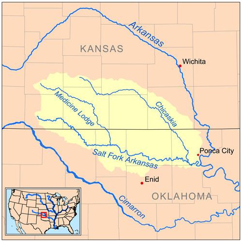
The Medicine Lodge River is a 130-mile-long (210 km) tributary of the Salt Fork of the Arkansas River in southern Kansas and northern Oklahoma in the United States. Via the Salt Fork and Arkansas rivers, it is part of the watershed of the Mississippi River.
Contents
Map of Medicine Lodge River, United States
NameEdit
The Medicine Lodge River got its name from a large hut built by the Kiowa Indians, who believed the water from the river had healing properties if ingested or inhaled in a sauna type room.
The United States Board on Geographic Names settled on "Medicine Lodge River" as the stream's name in 1968. According to the Geographic Names Information System, it has also been known historically as "A-ya-dalda-pa River," "Medicine Lodge Creek" and "Medicine River."
GeographyEdit
The river rises in Kiowa County, Kansas and flows generally southeastwardly through Barber County in Kansas and Alfalfa County in Oklahoma, past the Kansas towns of Belvidere, Sun City and Medicine Lodge.
It joins the Salt Fork of the Arkansas River in Oklahoma, about 5 miles (8 km) north-northeast of Cherokee.