
Website KiowaCountyKS.org Founded 26 February 1867 Population 2,523 (2013) | Area 1,873 km² | |
 | ||
Rivers Medicine Lodge River, Middle Kiowa Creek | ||
Kiowa County (standard abbreviation: KW) is a county located in the U.S. state of Kansas. As of the 2010 census, the county population was 2,553. The largest city and county seat is Greensburg.
Contents
- Map of Kiowa County KS USA
- History
- 21st century
- Geography
- Adjacent counties
- Demographics
- Law and government
- Unified school districts
- Colleges
- Incorporated cities
- Unincorporated communities
- Townships
- References
Map of Kiowa County, KS, USA
History
In 1854, the Kansas Territory was organized, then in 1861 Kansas became the 34th U.S. state. In 1867, Kiowa County was established and named after the Kiowa tribe.
21st century
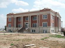
On May 4, 2007, Greensburg was devastated by an EF5 tornado during the May 2007 tornado outbreak.
Geography
According to the U.S. Census Bureau, the county has a total area of 723 square miles (1,870 km2), of which 723 square miles (1,870 km2) is land and 0.2 square miles (0.52 km2) (0.03%) is water.
Kiowa County has a large number of iron-rich meteorites in its soil due to the Brenham meteor fall over 10 thousand years ago.
Adjacent counties
Demographics
As of the census of 2000, there were 3,278 people, 1,365 households, and 924 families residing in the county. The population density was 4 people per square mile (2/km²). There were 1,643 housing units at an average density of 2 per square mile (1/km²). The racial makeup of the county was 97.19% White, 0.21% Black or African American, 0.61% Native American, 0.27% Asian, 0.98% from other races, and 0.73% from two or more races. 2.04% of the population were Hispanic or Latino of any race.
There were 1,365 households out of which 27.70% had children under the age of 18 living with them, 59.60% were married couples living together, 5.30% had a female householder with no husband present, and 32.30% were non-families. 30.50% of all households were made up of individuals and 15.50% had someone living alone who was 65 years of age or older. The average household size was 2.32 and the average family size was 2.89.
In the county, the population was spread out with 24.00% under the age of 18, 8.20% from 18 to 24, 21.80% from 25 to 44, 24.60% from 45 to 64, and 21.30% who were 65 years of age or older. The median age was 42 years. For every 100 females there were 96.30 males. For every 100 females age 18 and over, there were 95.10 males.
The median income for a household in the county was $31,576, and the median income for a family was $40,950. Males had a median income of $29,063 versus $20,764 for females. The per capita income for the county was $17,207. About 7.40% of families and 10.80% of the population were below the poverty line, including 13.50% of those under age 18 and 8.70% of those age 65 or over.
Law and government
Although the Kansas Constitution was amended in 1986 to allow the sale of alcoholic liquor by the individual drink with the approval of voters, Kiowa County has remained a prohibition, or "dry", county.
Unified school districts
Colleges
Incorporated cities
Unincorporated communities
Townships
Kiowa County has only one township, and none of the cities within the county are considered governmentally independent; all figures for the township include those of the cities.