
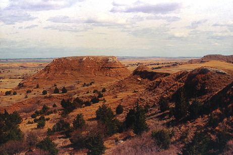
Named for Thomas W. Barber Website barber.ks.gov Founded 26 February 1867 | Area 2,942 km² Population 4,947 (2013) Unemployment rate 4.4% (Apr 2015) | |
 | ||
Rivers Medicine Lodge River, Salt Fork Arkansas River | ||
April 12th 2015 barber county kansas tornado warning
Barber County (county code BA) is a county located in the south-central portion of the U.S. state of Kansas. As of the 2010 census, the county population was 4,861. Its county seat and most populous city is Medicine Lodge. It was named for Thomas Barber, an abolitionist who was killed in Douglas County in 1855 during the Wakarusa War.
Contents
- April 12th 2015 barber county kansas tornado warning
- Map of Barber County KS USA
- Geography
- Adjacent counties
- Major highways
- Demographics
- Law and government
- Economy
- Unified school districts
- Cities
- Ghost towns
- Townships
- References
Map of Barber County, KS, USA
Geography
According to the U.S. Census Bureau, the county has a total area of 1,136 square miles (2,940 km2), of which 1,134 square miles (2,940 km2) is land and 2.1 square miles (5.4 km2) (0.2%) is water.
Adjacent counties
Major highways
Sources: National Atlas, U.S. Census Bureau
Demographics
As of the U.S. Census in 2000, there were 5,307 people, 2,235 households, and 1,510 families residing in the county. The population density was 5 people per square mile (2/km²). There were 2,740 housing units at an average density of 2 per square mile (1/km²). The racial makeup of the county was 97.06% White, 0.38% Black or African American, 0.58% Native American, 0.09% Asian, 0.89% from other races, and 1.00% from two or more races. Hispanic or Latino of any race were 2.02% of the population.
There were 2,235 households out of which 28.70% had children under the age of 18 living with them, 58.70% were married couples living together, 6.50% had a female householder with no husband present, and 32.40% were non-families. 29.90% of all households were made up of individuals and 17.00% had someone living alone who was 65 years of age or older. The average household size was 2.35 and the average family size was 2.91.
In the county, the population was spread out with 25.00% under the age of 18, 5.80% from 18 to 24, 23.20% from 25 to 44, 24.50% from 45 to 64, and 21.50% who were 65 years of age or older. The median age was 43 years. For every 100 females there were 92.40 males. For every 100 females age 18 and over, there were 89.40 males.
The median income for a household in the county was $33,407, and the median income for a family was $40,234. Males had a median income of $29,806 versus $20,046 for females. The per capita income for the county was $16,627. About 7.50% of families and 10.10% of the population were below the poverty line, including 12.60% of those under age 18 and 4.90% of those age 65 or over.
Law and government
Although the Kansas Constitution was amended in 1986 to allow the sale of alcoholic liquor by the individual drink with the approval of voters, Barber County has remained a prohibition, or "dry", county.
Economy
Unified school districts
Cities
Ghost towns
Townships
Barber County is divided into eighteen townships. None of the cities within the county are considered governmentally independent, and all figures for the townships include those of the cities. In the following table, the population center is the largest city (or cities) included in that township's population total, if it is of a significant size.