
- elevation 732 ft (223 m) Length 164 km | - elevation 1,105 ft (337 m) - average 1,051 cu ft/s (30 m/s) | |
 | ||
- max 33,800 cu ft/s (957 m/s) | ||
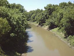
The Marmaton River (MAR-muh-tuhn) is a 102-mile-long (164 km) tributary of the Little Osage River in southeastern Kansas and western Missouri in the United States. Via the Little Osage, Osage and Missouri rivers, it is part of the watershed of the Mississippi River.
Contents
Map of Marmaton River, United States
CourseEdit
The Marmaton River rises in Kansas northeast of Moran in eastern Allen County and flows generally eastward through Bourbon County in Kansas and Vernon County in Missouri, past the towns of Uniontown, Redfield and Fort Scott in Kansas and Deerfield in Missouri. It joins the Little Osage River from the south, 7 miles (11 km) south-southeast of Rich Hill, Missouri.
NameEdit
Marmaton is a corruption of Marmiton, a French name given by fur traders meaning "scullion".
References
Marmaton River Wikipedia(Text) CC BY-SA